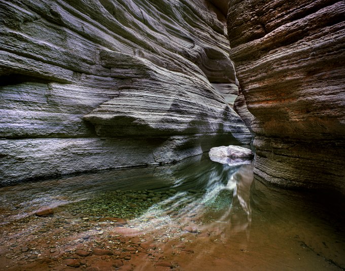
Wading through a pool shaded by National Canyon’s deep recesses near its confluence with the Colorado River, I hoisted myself and helped my hiking companions up over the chockstone shown in this photograph. We scrambled past it only to find deeper water and more chockstones in a narrow passage between the steep limestone walls. It was useless; this was as far as we could travel without climbing gear, which we did not bring along – or imagine using – on our river rafting trip through northern Arizona's Grand Canyon.
If we had climbed higher, we would have discovered ancient habitation sites, abandoned granaries that once stored corn, and metates – flat sandstone rocks with shallow indentions formed by grinding maize with granite river stones. The lower canyon lies within the Hualapai Reservation on the southern side of the Grand Canyon's western extension. They, along with the closely related Havasupai tribe that lives just to their east, have inhabited this high desert for the past 1500 years. Historically, the tribal members moved with the seasons, gathering plants and returning to their villages to tend gardens and hunt game.
National Canyon has a wide catch basin, and intense monsoon showers periodically scour its channel. A massive flood in 2013 ripped out trees and carried away boulders, eliminating the flats at the canyon's mouth where we had camped on this trip years before. However, on this morning, everything was calm. The sounds of May’s runoff trickling as it meandered through the ravine blended with the melancholy notes of a lone canyon wren whose song echoes within the wild heart of the Grand Canyon.
Location research and commentary by James Baker.

