
Weekly Insights
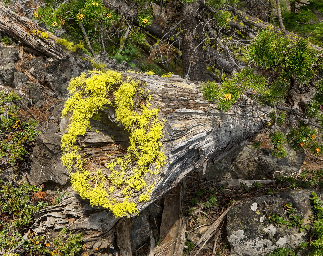
Wolf Lichen, Cut Timber, Paulina Lake, Oregon
Wolf Lichen is common in the Pacific Northwest, especially along the shores of Paulina Lake in central Oregon’s Newberry Crater caldera, where it forms thick patches. Moist lake air and ample sunlight help it thrive in the parts of the Ponderosa and lodgepole forests facing the lake.
Wolf Lichen is beautiful but poisonous, earning its name because it was used to poison food left out for wolves and foxes, who were killed after ingesting it. It has virtues; native peoples used the lichen to weave mats, dye fabrics, and as a natural insect repellent. In small doses, it was also used to make medicines to relieve bruises, swelling, and boils.
The fallen log on which this lichen grows was cut to clear the trail that circles the lake. As the tree died, its heartwood decayed, and its hollowed-out trunk became an attractive surface for the lichen to attach to as it fed on airborne nutrients, water, and sunlight. I often wandered by this spot while photographing along the lake, without noticing this lichen cluster. It took a midsummer thunderstorm followed by sparkling sunlight to catch my attention. After the added moisture of an intense rain shower, the lichen swelled, its color intensified, and it shifted from gray-green to a rich chartreuse. It had quickly bloomed and, almost as quickly, shriveled back to its smaller, less vibrant self in the drying high-desert air.
more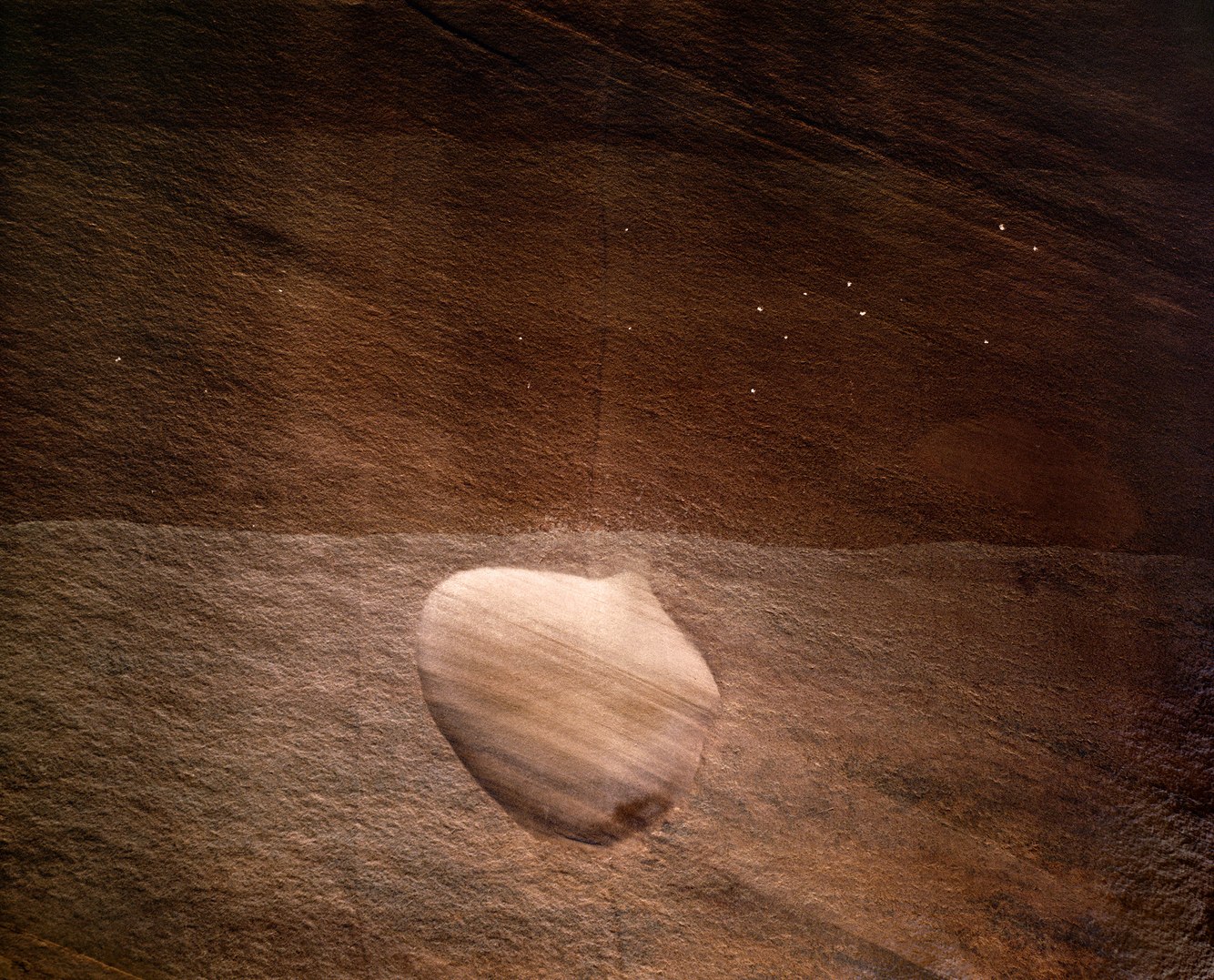
Scoured Pocket, Buckskin Gulch Narrows, Arizona
Meandering along the Utah/Arizona border, Buckskin Wash is an ephemeral stream that flows through a broad valley before draining into a long, constricted canyon. In some places, the gulch is so narrow that I could stretch my arms out and touch both sides of its nearly vertical walls.
Ancient dunes, compacted by weight and cemented by minerals once dissolved in groundwater, lithified into a thick layer of sedimentary rock that was uplifted into a plateau that covers much of Utah and portions of adjoining states, and has since eroded into "slot canyons" such as Buckskin Gulch.
This deep ravine has been scraped and polished into an exotic (if claustrophobic) wonderland, offering the chance to discover unusual details in nature. This scoured pocket in a sandstone wall is a perfect example. The midday light leaked through an opening in the canyon rim, briefly illuminating the contours of an oval feature.
At first, I couldn't tell whether it bulged inward or outward. Just above the line of mudded sediment from the last flash flood, I wondered, had previous erosion sanded this concave pocket out of weakly cemented sandstone? Or was it a soft, rounded imprint left by a concretion of hardened sandstone that was swept away by a flood? Either way, the canyon's subtle lighting lent this mysterious feature a radiant glow.
more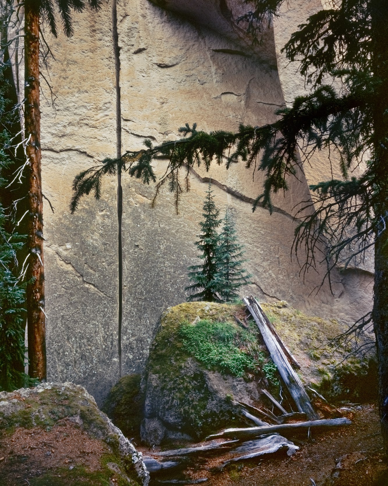
Tuff Formation, Engelmann Spruce, Wheeler Geologic Area, Colorado
Hidden in the recessed alcoves of dun-toned canyons near the treeline in southern Colorado’s La Garita Range are tableaus of rocks, trees, and moss. Shaped by erosion and lit by the fading light of late afternoon as it settled on rotting trunks and eroding canyon walls, they suggest the remains of ancient ruins, resembling a castle of worn turrets and eroding firmaments.
The cracks, ripples, and shearing of these walls result from fracturing caused by rain, snow, and ice, as water cycles between its liquid and solid states, entering and then wedging rocks apart, eventually causing them to tumble and erode further.
In the distant past, a volcanic explosion, one of the largest worldwide, deposited a hot flow of ash that compressed and cooled into a layer of tuff thousands of feet thick, soft enough to erode easily, capped by harder volcanic breccia, which helps preserve these narrow, cavernous ravines and clusters of spires.
In 1908, recognizing its unique geology, Theodore Roosevelt designated the Wheeler Geologic Area a national monument, and it became, for a time, a popular, if remote, tourist destination. After the Second World War, visitation dropped dramatically, and it was reclassified as a “geologic area” by the Forest Service. Today, it is accessible either by a very rough four-wheel-drive road or by hiking several miles through the high country. Within the confines of its square-mile reserve at 11,000 feet, this naturally sculpted landscape remains, with sheltered spruce groves, a clear stream, and sites to pitch a tent, as my wife and I did when we camped and I took this photograph decades ago.
more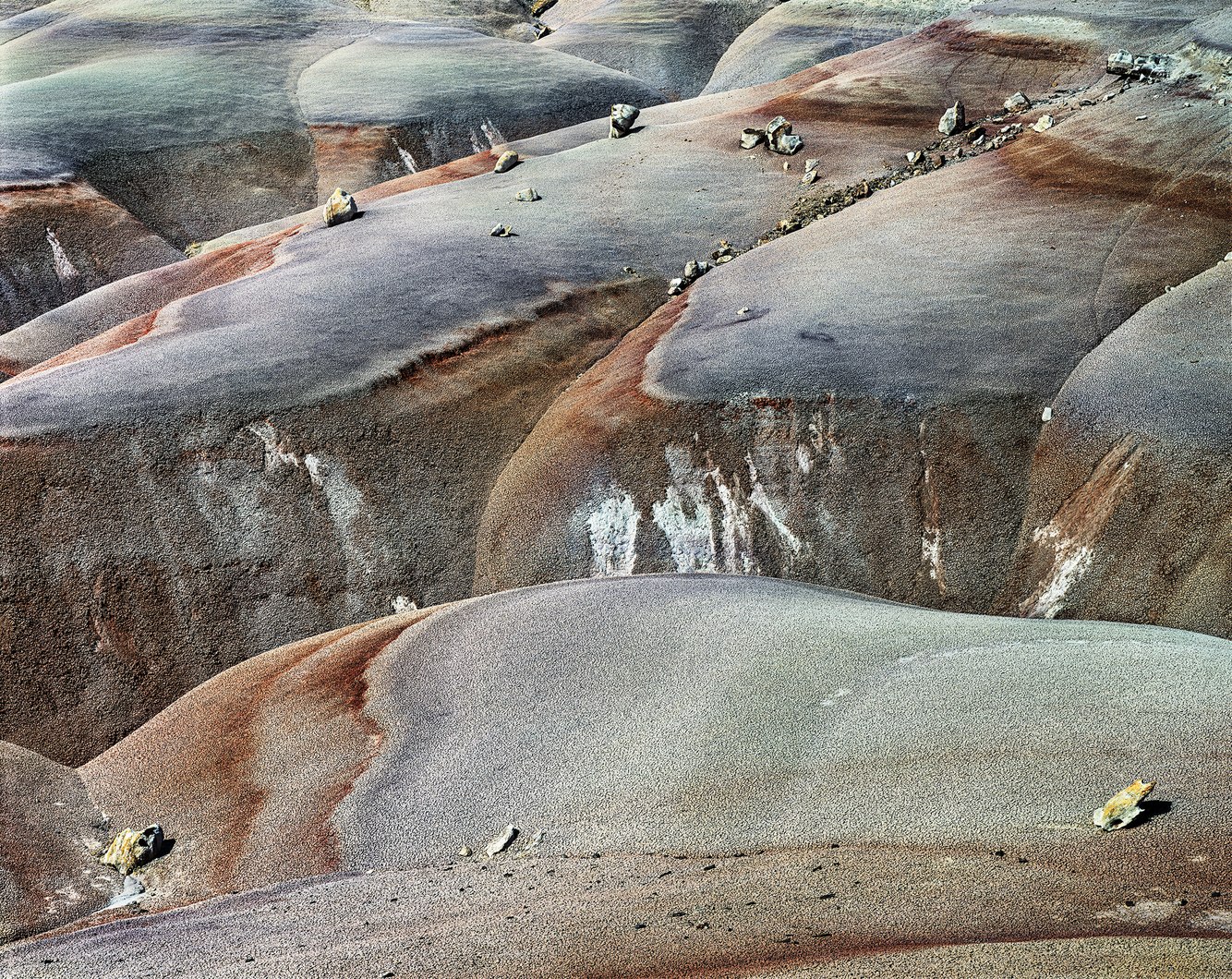
Bentonite Hills, Capitol Reef, Utah
Central Utah is a wild, desolate, untamed landscape. Outcrops of the Morrison Formation—laden with dinosaur bones and plant remains—stretch from New Mexico to Alberta, Canada. Sedimentary layers of clay, silt, sandstone, and volcanic ash were once deposited by rivers across floodplains. Uplifted by movements of the Earth’s crust into a desert plateau, these steep, smooth slopes are striped with colorful bands of gray-green, reddish-brown, and purple.
Underfoot, this land’s crunchy, popcorn-like texture results from repeated wetting and drying of the formation’s volcanic ash (bentonite). When dry, the hardened surface shields the soft clay. When wet, the clay expands into a slurry that is impossible to walk across or drive over. In any weather, exploring this territory is a test of patience; the unstable soil slips beneath hiking boots. Under the summer sun, its slopes become unbearably hot. Not surprisingly, this territory is rarely marked by visitors' footsteps, though I love tracking through its otherworldly beauty.
The clay’s perpetual contraction and expansion, along with its high salt content, make it impossible for plants to take root. With its soft, loose clay, the Morrison Formation is eroded by infrequent but strong summer thunderstorms. Littering its multihued slopes are broken ledges of warm-toned limestone, evoking the backgrounds of the long-running 1950s and 60s television series Death Valley Days, which was, in part, filmed in these canyonlands.
more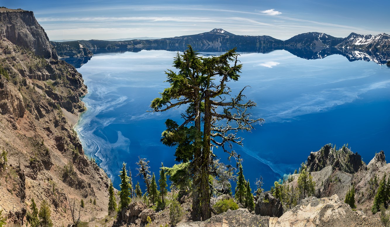
Pollen, Morning Light, Crater Lake from Merriam Point, Oregon
The pure water of central Oregon's Crater Lake absorbs all colors except those at the blue end of the visible spectrum. This hue becomes most vibrant in early summer, when the sun is highest in the sky. The light penetrates deeper into the lake, which then radiates back an almost surreal ultramarine cast.
Mid-morning in June several years ago, I took this photograph. The still lake reflected clouds above its eastern horizon, but I was surprised by something I hadn’t seen on prior visits: floating sheets of pollen.
This caldera, filled with water, is oval-shaped. The lake's origin is recounted in the oral histories of the Klamath People. Several thousand years ago, Mt. Mazama erupted, expelling large volumes of gas, ash, and cinders into the air. As the mountain's interior hollowed out from the explosion, what remained collapsed, leaving a deep sunken valley below the former peak that eventually filled with snow and rain. The lower edge of the mountain remained intact, becoming the lake’s cliffed rim.
Given how little organic matter enters the caldera, airborne pollen shed from lodgepole and ponderosa pines became one of the few sources of nutrients for the lake’s fungi, bacteria, and zooplankton. Depending on the fickle breezes caught in this sheltered basin, pollen curls around projecting outcrops, accumulating along its shore, and eventually sinking into this lakebed.
more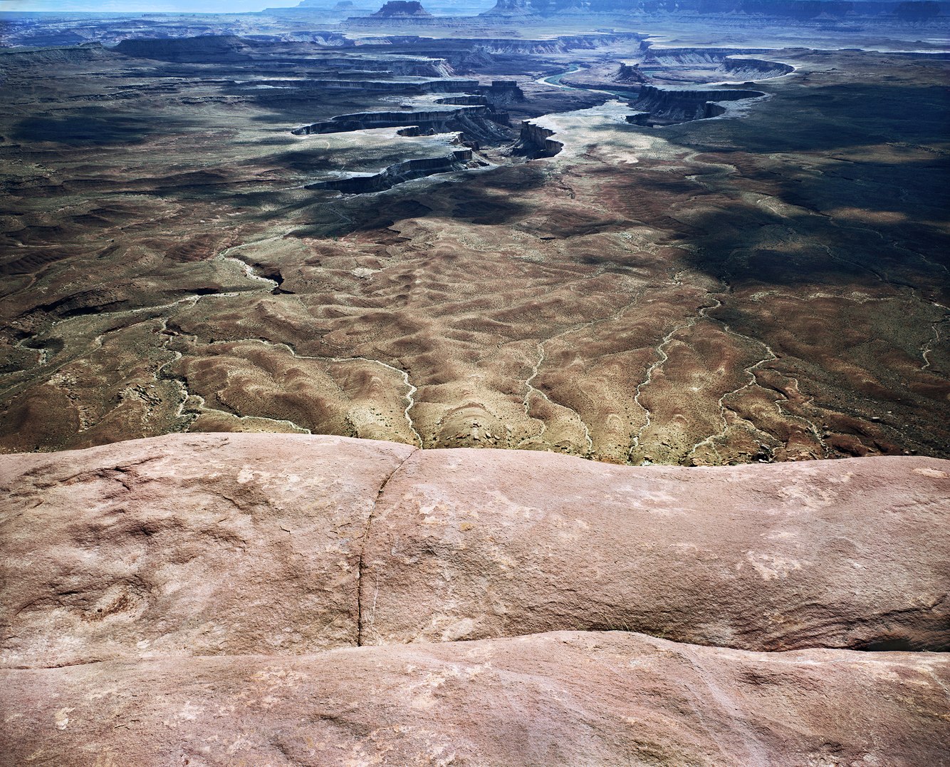
Green River Overlook, Island in the Sky, Canyonlands, Utah
From a sheer cliff, looking southwest, this photograph shows the Green River twisting south through the expansive Soda Springs Basin. This sweep of geologic time is viewed from a flat-topped mesa called Island in the Sky, above eastern Utah’s Canyonlands National Park. Just beyond this view, the Green joins the Colorado River; the vast land in between was carved by the erosive force of these rivers through ancient, accumulated layers of sandstone.
On July 17, 1869, John Wesley Powell, as his boat rounded a bend in the Green River, wrote in his diary, “The landscape everywhere, away from the river, is of rock—cliffs of rock, tables of rock, plateaus of rock, terraces of rock, crags of rock—ten thousand strangely carved forms…in long, gentle curves the river winds about these rocks.” For the next six weeks, he and his historic expedition floated the Colorado River, making the first river traverse through northern Arizona’s Grand Canyon.
Standing a short distance back from the edge, where this picture was taken, the foreground seems to merge into the desert 1300 feet below. Approaching the rim, as others have, I felt the pull of the vast, silent, almost vacuous emptiness beyond. "Gaze not too long into the abyss, lest the abyss gaze into thee," Nietzsche said that. He knew.", wrote naturalist Edward Abbey in his ode to this landscape, Desert Solitaire.
more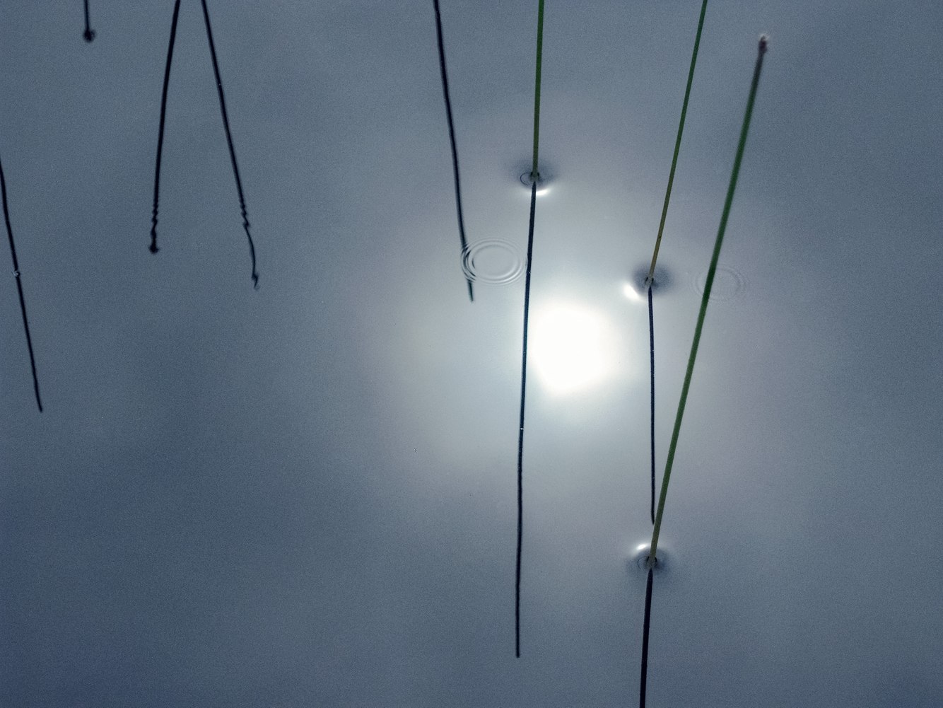
Rushes, near Rose Blanche, Newfoundland, Canada
Along the rugged coast of southwestern Newfoundland, headlands rise abruptly from the sea, rivers are short and turbulent, and a landscape of granite outcroppings, boreal forests, and rolling barrens of peat bogs is interspersed with ponds, lakes, and rivers. During the short summers, shallow ponds blossom with lily pads, reeds, and rushes. This region of the Atlantic, where the cold Labrador Current intersects with the warm Gulf Stream, produces ample rainfall and an ever-present mist that filters the sun.
When hiking along one of the few trails that head inland from the Newfoundland coast, I felt as though I was dissolving into this uninhabited landscape that stretched to the horizon. A track between hills followed a stream stained tea-colored by runoff from peat-moss bogs. In the brief calm of midsummer, still ponds became black mirrors, casting silhouettes of aquatic plants against the dull-blue reflection of a fog-filled sky.
Kneeling, I moved in close to the fen’s flat surface, where rushes breached air and water. At their intersection, their stalks caused the pond's film to curve into a concave dimple as they drew water up their sides, creating barely visible convex rings encircling their stems. Between the stalks, the energy of two falling drops of water hitting the pond created a barely discernible repeating pattern of ripples. A soft chromatic glow radiated outward from the sun’s reflection, shifting from blue to red. Here, the landscape revealed itself at an intimate scale, sheltered within a vast, time-worn terrain.
more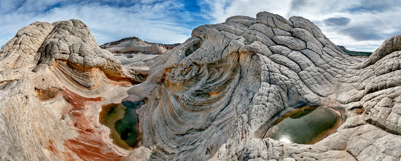
Spring Pools, White Pocket, Vermillion Plateau, Arizona
This remote cluster of sandstone domes, located midway along the Arizona/Utah border, is an odd and entrancing geologic wonder. Its origin is the subject of speculation. The colorfully layered formation may once have been saturated dunes that contorted, the result of an earthquake, a tumbling slide, or both. Either way, some unknown event whipped up a frothy geologic concoction that froze in time.
Exposure to the elements causes its surface to crack into polygonal shapes as it expands and contracts with heat and cold and interacts with seasonal cycles of wetting and drying. Spring catch basins fill with rain, host algae, insects, and other species, including tadpoles that metamorphose into frogs.
Arriving here meant slipping through miles of deep sand on a winding track, with no indication of my destination until I drove over the last rise and saw the twists, swirls, and ridges of White Pocket. Sometimes a landscape is so startling that it is difficult to find footing, to decide how to react, and to proceed. Circumnavigating this relatively small area, less than a square mile, in the silent, early-morning desert was mystifying and mystical.
more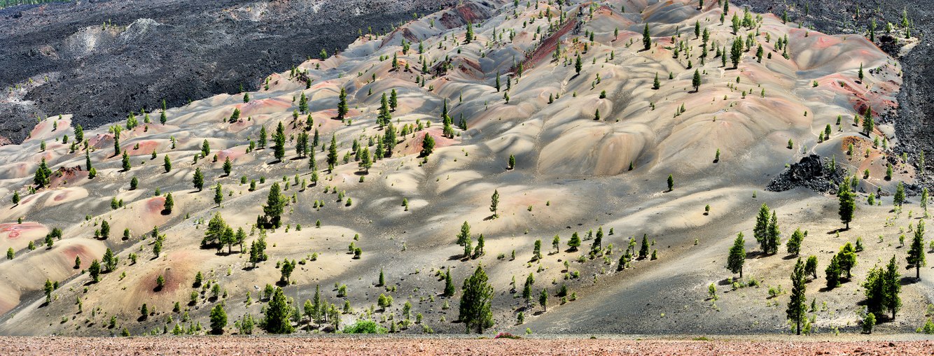
Painted Dunes, below Cinder Cone, Lassen Volcanic National Park, California
These colorful “painted” dunes lie at the foot of a 750-foot-high cinder cone that erupted in 1666 and was formed by the same eruptive activity that sculpted other parts of northern California’s Lassen Volcanic National Park. Hiking up a lava-ash trail, its loose surface softened by the pounding of many hiking boots, I found the climb to the cone’s crest more challenging than I had expected.
The top revealed a walkway akin to a floating platform that encircled a deep crevasse, the inverted center of the cone's sunken core. As remarkable as the view inside the collapsed volcano was, the view outward was even more incredible because it was so unexpected.
The dunes’ colors and highlighted tones resulted from volcanic ash falling onto hot lava that flowed from the base of the cinder cone. Around half of the cone’s base, extending out several hundred yards, titanium-rich ash landed on scorching lava and, through rapid oxidation, became lighter and more colorful than the dark ash that fell elsewhere on the relatively cooler surrounding lava field.
Because the ash and lava flows are nutrient-poor, the surrounding dunes and lava fields are almost devoid of vegetation. Over the past 350 years, the uncompacted ash has slowly allowed shallowly rooted plants to grow, and ponderosa trees have established themselves (albeit with limited growth) in the otherwise botanically desolate dunes. The whole scene was gratefully unmarked by footprints and left to natural erosion and the patterns it left behind, becoming its own painting.
more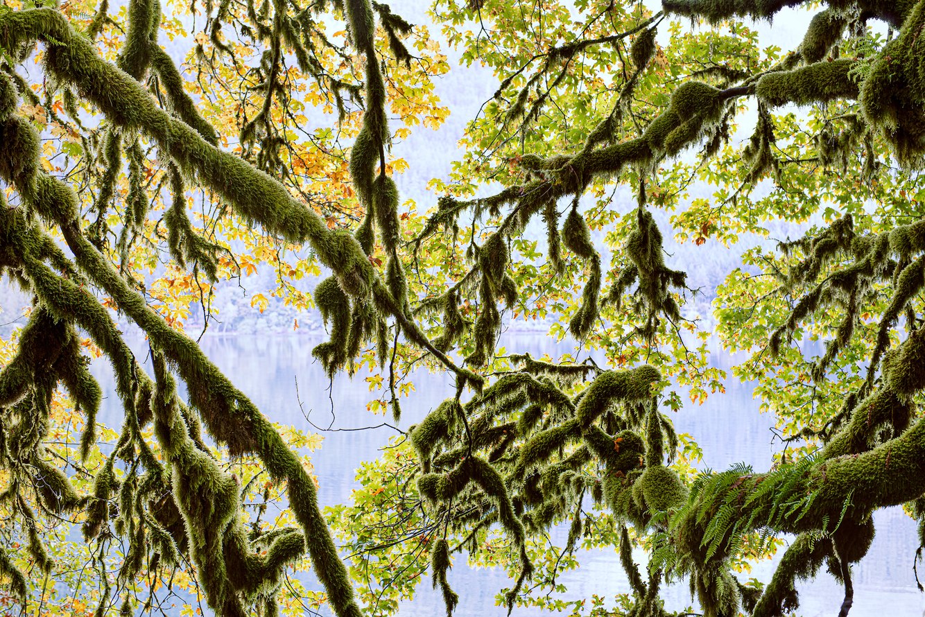
Moss-Covered Branches, Lake Crescent, Olympic Peninsula, Washington
Route 101 runs along the south shore of Lake Crescent in Olympic National Park. Always eager to reach the Hoh Rain Forest or the coast to photograph Second Beach near La Push, I used to speed along this winding highway, unaware of what surrounded me. One day, as I drove by the lake, I spotted a broadleaf maple whose branches bent down and touched the lake’s surface. It was covered in a thick layer of spike moss, nourished not by the tree itself but by rain and nutrients collected from the air.
The lake is pristine, deeply carved by glaciers and dammed by a landslide several thousand years ago. It is cold, clear, and deep, with an iridescent blue-green hue characteristic of a glacial lake. This coloration is not due to suspended sediment but to its cold temperature and the lack of nutrients needed to support most aquatic life. Later, this area became a favorite of my family and me, with the stunning lake, the beautiful Crescent Lake Lodge built in 1916, Sol Duc Hot Springs and old-growth forests nearby.
Over time, with each return visit, the aging tree has gradually leaned toward the lake and begun to sink. The water slowly dissolves the branches, limbs, and trunk as they settle, rot, and disintegrate. This maple, like everything in nature, is a temporary feature—my act of photographing became a last chance to preserve an image of this fully grown tree as it began to complete its arc of growth and life.
more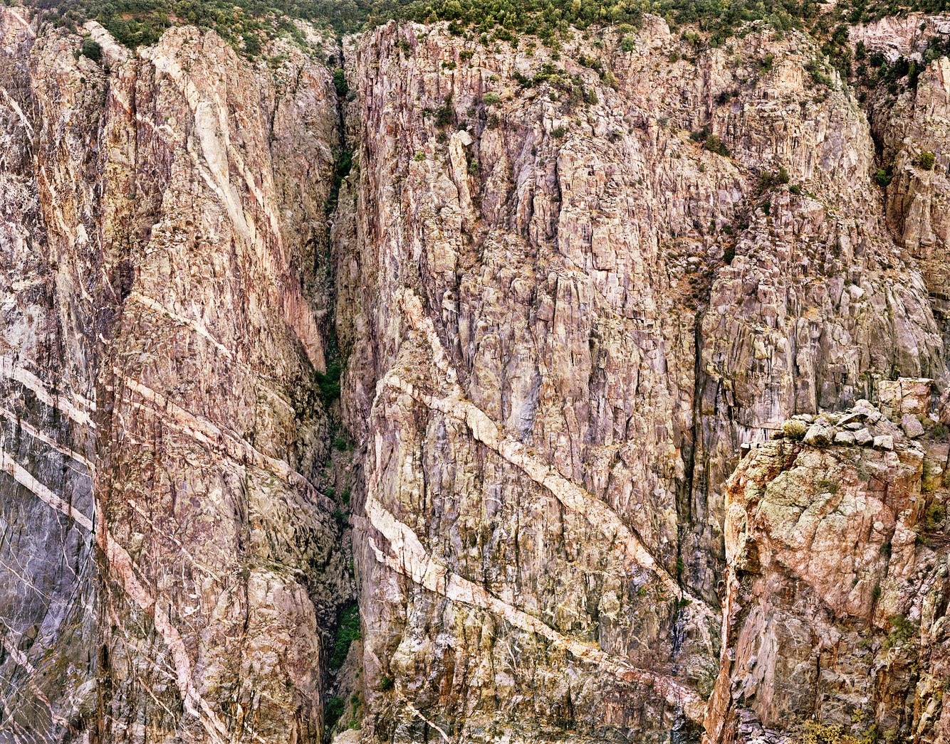
Dawn, North Rim, Black Canyon of the Gunnison, Colorado
A favorite campground in western Colorado’s Black Canyon of the Gunnison National Park sits on the north rim, a quiet circle of sites among cedars, pinyons, and scrub oak. A short walk from my tent first brought me to the vertiginous cliffs of the Gunnison River. The view was awe-inspiring and frightening. Only my impatience to photograph this remarkable geological formation prompted me to approach the edge carefully, gingerly look down, and gaze across this chasm, unlike any I had seen elsewhere in the West.
“No other canyon in North America combines the depth, narrowness, sheerness, and somber countenance of the Black Canyon of the Gunnison,” wrote geologist Wallace Hansen. Carved by the erosive action of the Gunnison River, the canyon was excavated by the river’s voluminous flow and the force of its steep gradient. This powerful agent of erosion cleared rock debris that had fallen from the canyon walls, preserving their nearly vertical cliffs.
Precambrian rocks—hardened by heat and compression during an earlier era in Earth’s long history—comprise nearly all the walls and the floor of the Black Canyon. From the rim to the river, the deepest part of the canyon is the 2,000-foot Painted Wall. In this photograph, I saw how the wall got its name, veined with magma that was squeezed through fractures in the rock and cooled into light-toned, elegantly patterned intrusions. This scene reminds me of ancient Chinese mural paintings, with its flattened perspective and contours, and reduced shadows.
more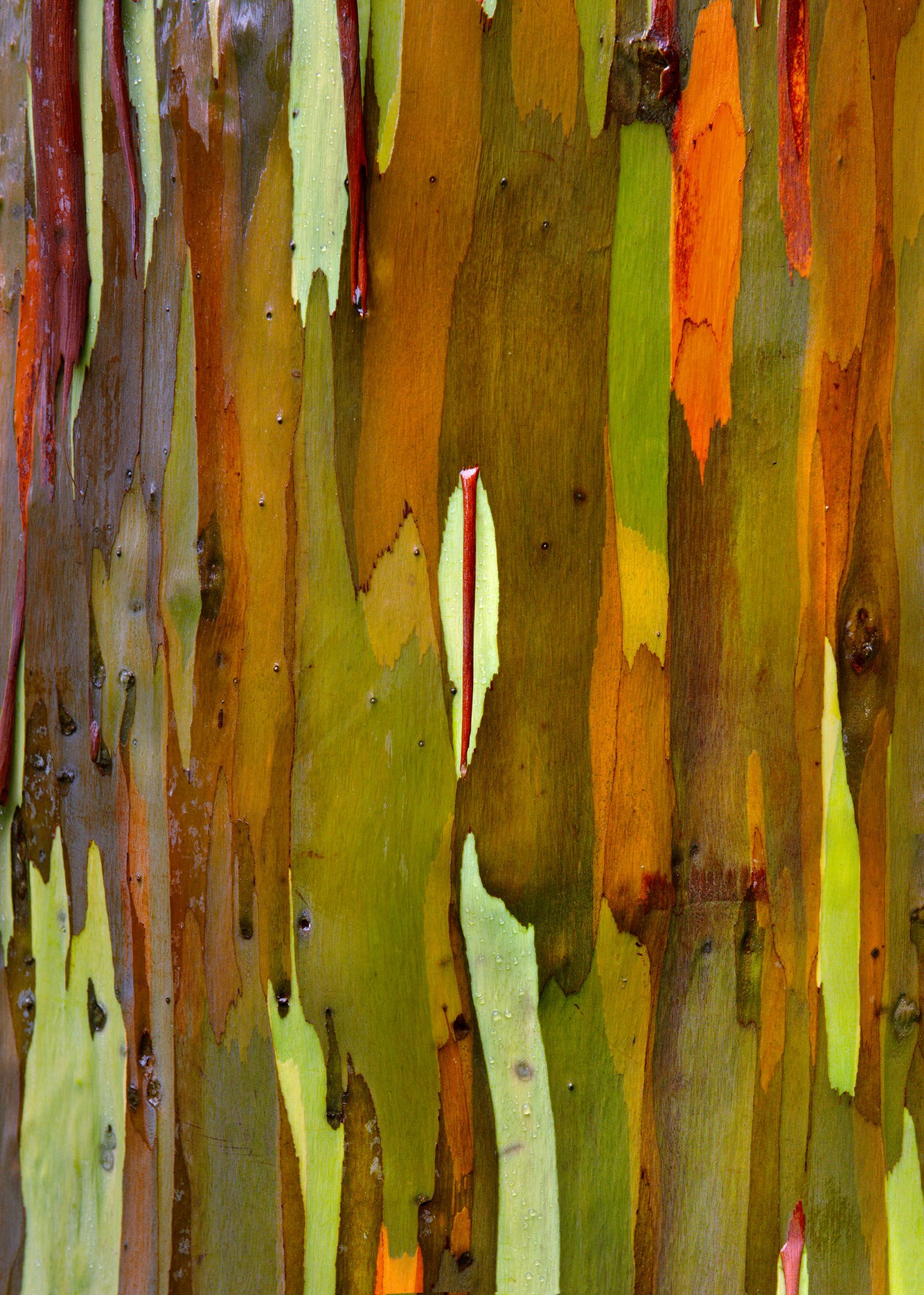
Rainbow Eucalyptus Bark, Keahua Arboretum, Kauai, Hawaii
Visiting the Keahua Arboretum near the center of Kauai, I discovered a forest reserve dedicated to the study of indigenous plants—now mostly extinct elsewhere on the island—and to plants introduced to the Hawaiian Islands by migrating Polynesians beginning in the 4th century. The first rainbow eucalyptuses were brought to the islands a century ago.
What caught my attention was their thin, smooth brown-gray bark, which naturally peels throughout the year. A strip of shed bark reveals a pale green undercoat. Over time, sun and rain turn the torn strips into colorful stripes that gradually darken and shift through a spectrum of red, orange, purple, and blue-gray hues. Despite their name, these are, of course, not the colors typically associated with rainbows, but they are equally kaleidoscopic. This effect is especially pronounced after a rainstorm of unusual intensity, like the one I experienced when I visited this grove, when the bark became saturated and, with it, its colors.
Though the downpour left me soaked, what it revealed was extraordinary. Beyond the delightful spectacle, the ripped, vibrant trunks reminded me of pieces of Clyfford Still's paintings. An early proponent of Abstract Expressionism in the 1940s and 1950s, Still's mature work by the late 50s was as recognizable as, say, Mark Rothko's among painters, critics, and museum curators (if not by the public). His painting style produced dramatic contrasts—colors tearing through each other—symbolizing, in his view, the struggle of "life and death merging in a fearful union."
more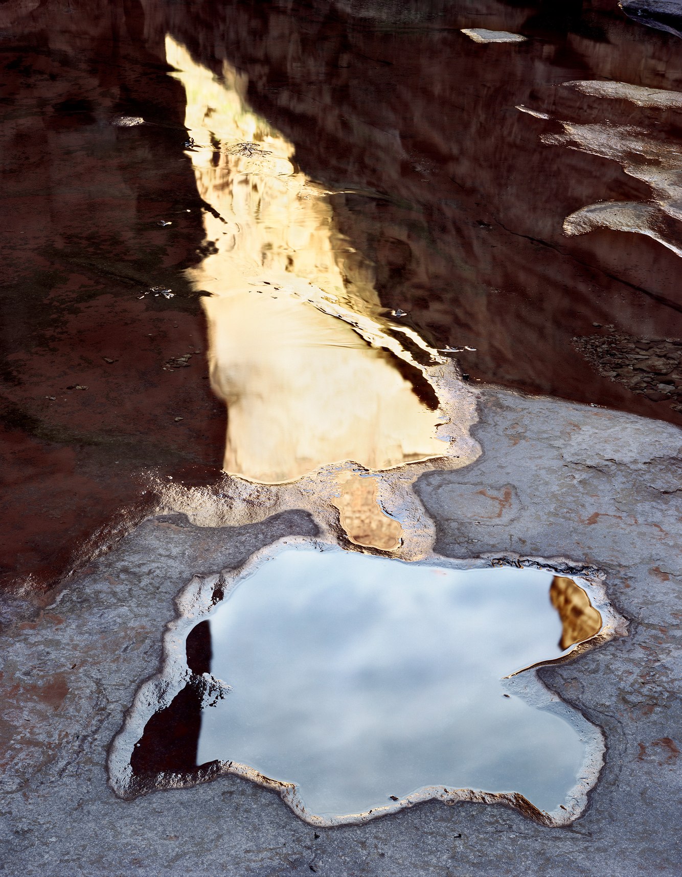
National Canyon, near the Colorado River, Arizona
Rafting the Colorado River through northern Arizona’s Grand Canyon distances one from society, technology, and the unremitting cacophony of the outside world. Awaking in the still dawn, I barely noticed the sound of the river flowing through Class 2 rapids. My campsite—a sleeping bag on a cot—was hidden among the outwash boulders of National Canyon Creek.
This river shore, bordered by a 4,000-foot plateau, soon flooded with merciless sunlight, its shimmering sands rapidly heating the air. Hiking up the canyon offered refuge. The sun hadn’t risen high enough to wash the floor of the narrow ravine. However, the interplay of reflected light from the canyon's lit rim echoed deep within its walls, imbuing the cathedral-like space with the faint hues of the surrounding mauv limestone and, above it, layers of sandstone.
The warm light reflected in a shallow pool appeared to me as a reclining figure. It recalled ancient anthropomorphic pictographs with their broad shoulders and haunting skulls painted by hunter-gatherers of the Desert Archaic culture throughout the southwestern canyonlands.
Later, when I printed this photograph, it reminded me of Édouard Manet's painting ‘The Dead Toreador’ (shown in the comments section). In Manet’s portrayal, the corpse appears to hover above the floor on which it presumably rests, resembling the yellow reflection floating on the pool's surface. In both the photograph and the painting, the right arm lies gently on their chest. Blood drips from the bullfighter’s head, while the pool’s figure of light appears to bleed the cloud-flecked sky.
more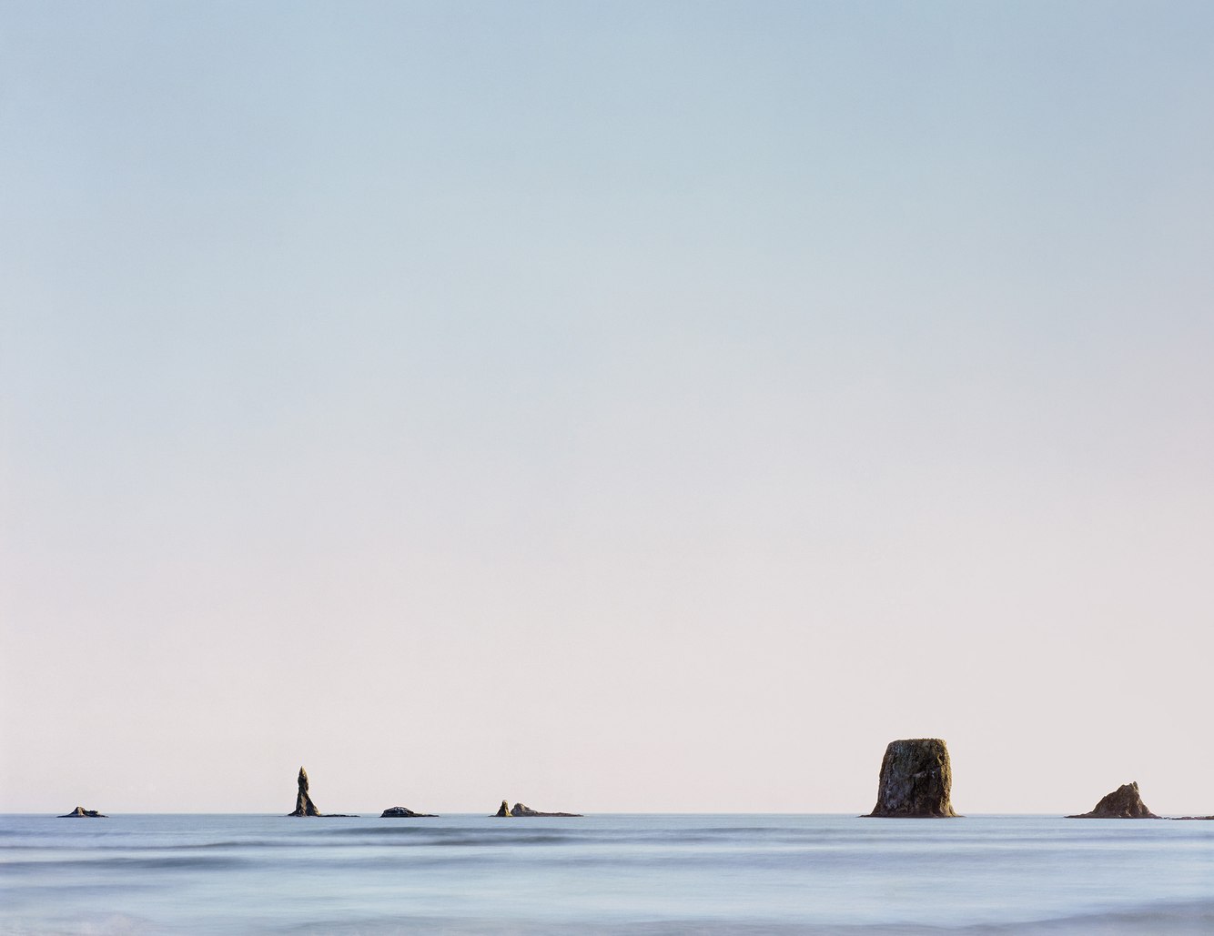
Quillayute Needles, Second Beach, Olympic Peninsula, Washington
The Pacific Northwest coast is fringed by reefs, shoals, and small islands or rock columns that run parallel to its shores, from the tide line of its sandy beaches and promontories, to miles offshore. Known as "sea stacks," they are the remains of headlands formed by the continued uplift of the coastline due to the collision of the Pacific and North American tectonic plates.
Following the last ice age, as sea levels rose faster than the land, tides and waves eroded the coast, pushing the shoreline east by several miles and leaving behind these remnants. A line of sea stacks, seen half a mile offshore from Second Beach on Washington’s mid-coast, rests on a marine terrace just below the high-tide level, which skirts and connects the bases of these stacks.
On my first hike down to this beach 40 years ago, I looked out across a summertime sea, quiet in this season of calm waters. The gentle pulse of the waves reminded me that we’ve inherited the name of this body of water from explorer Ferdinand Magellan, whose ships entered Mar Pacifico (peaceful seas) in 1519 as they rounded the southern tip of South America, leaving behind the stormy Atlantic Ocean.
Around these sea stacks, waves crash, and currents swirl sea foam into lacy tracery. Among their cliffs and atop their capstones, birds nest, drawn by their isolation and safety, where the stacks serve as a way station on their migrations. To the left in this photograph is a narrow, pointed column — a “needle” — from which these stacks derive their name. The Quileute people know the largest islet on the left as Dhuo-Yuat-Zach-Tah, meaning “Bird Rock.”
more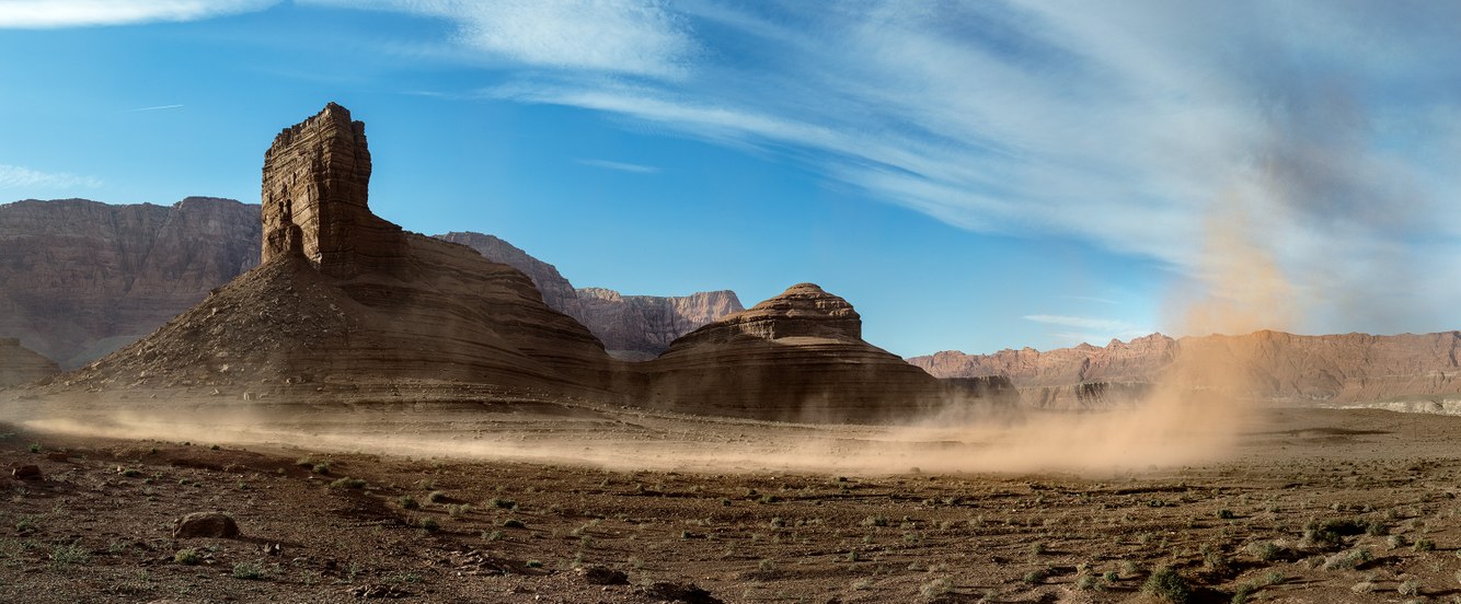
Dust Storm, Lee's Ferry, Marble Canyon, Arizona
April is the windiest month of the year in northern Arizona, where I took this photograph. As the saying goes, "March comes in like a lion and goes out like a lamb," but the climate patterns in this region keep March winds blowing and even intensify into the following month.
During winter, rain and snow wet the desert canyons. Spring brings a higher angle of the sun that quickly dries the ground. When the wind gusts, as it often does in April, the loosened soil creates rolling dust storms that march across the open basins, funneled by sandstone cliffs in places like Lee's Ferry, where southwest winds converge and are funneled by the high bluffs and plateaus on both sides of the nearby Colorado River.
This photograph captures a striking scene as sand and dust lift off the ground, moving across the landscape and shaking the saltbush field beneath Cathedral Rock, gathering debris along its path, gaining height until this blinding phantom finally collapses and dissolves over the rim of Marble Canyon behind me.
Straight-line wind bursts follow every few minutes. This blustery time of year, with its frequent squalls, creates a natural drama that awakens both sky and ground. The terrain becomes a challenging place to hike in or drive through, where you can enjoy the beauty of wildflowers and sage blooming as the seasons shift, while also facing the difficulty of venturing out amid alternating storms and sunshine, with their chill, heat, and wind stirring this otherwise quiet landscape.
more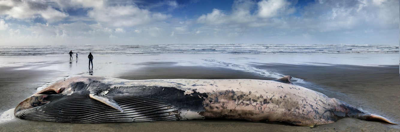
Beached Fin Whale, Sunset Beach, Oregon
Fin whales seldom beach, as they typically live and die far out at sea. On a rare occurrence, one washed ashore on Oregon’s north coast this winter. Coincidentally, and against the odds, another fin whale was grounded in nearly the same spot, and close to the same day two years earlier. Unlike that stranding, this young whale had been dead for a while before reaching its resting place. High seas and winds drove the carcass north to Sunset Beach, near the high-tide line, where it stretched out parallel to the waves that pushed it in.
On the day I took this photograph, groups of visitors stood in wonder at being so close to a whale, even, or especially, a deceased one. Like me, most stayed for a while walking around its carcass, examining it closely, sometimes touching it. At the same time, some debated the reasons for its short life, and a few recalled similar encounters with grounded whales.
Members of the nearby Grand Ronde Tribes were able to harvest parts of the whale, presumably using its bones for carving, and its baleen for weaving baskets, according to tribe traditions. Further up the beach were its entrails, likely removed during a necropsy performed on the whale, which also involved removing sections of its skin to determine the cause of death.
more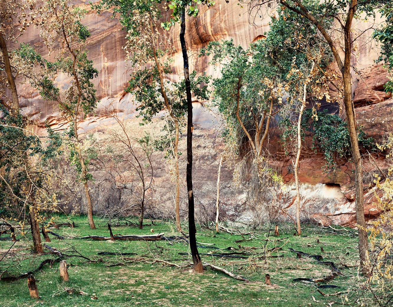
Canyon del Muerto, near White House Ruins, Arizona
In northeastern Arizona, an ancient system of red rock canyons is carved by streams originating in the nearby Chuska Mountains. For thousands of years, these stream basins have been inhabited by native peoples, from the hunter-gatherer Archaic period to the Basketmaker and ancestral Puebloan cultures that built settlements. Today, roughly forty families of the Navajo Nation live year-round in the sheltered tributaries of Chinle Wash to farm and raise livestock.
The canyon's sandstone walls are tinged red by iron oxide, causing them to shimmer with varying hues depending on the angle and intensity of the light. The distinctive shearing of this rock, formed from ancient dunes compressed into stone, creates nearly vertical cliffs with smooth, scalloped surfaces. Rainwater flowing off the plateaus stains the walls, nourishing lichens and bacteria that form tanned streaks, called desert varnish, that stripe the cliffs.
Generations of canyon dwellers left their mark through carved and painted inscriptions. Everywhere I hiked through the canyons, I saw remains of ancestral dwellings along the base of the cliffs and on benches and ledges overlooking this fertile landscape. Rimming the creeks that flow through the farmlands are the currently occupied farmhouses.
more
Greenstone Sea Stack, Bandon, Oregon
Sea stacks along Oregon's south coast are vestiges of rocky headlands that were once located much farther west. Today, we admire their remains: islands, prominences, and pinnacles that dot the nearshore, as shown in this photograph.
Along this coast, before being eroded into these stunning formations, they were created by a mixture of rock types from various locations, pushed together by the collision of tectonic plates floating on Earth's slippery mantle. As softer rocks around them eroded away, the harder blocks appeared to be stranded on this beach. Composed of schist, chert, greywacke, and greenstone, the scene features a variety of colorful, weathered columns.
For this reason, Bandon Beach is well-known for its sea stacks. I've wandered through the maze of these rocks of various sizes—one 20-foot-high pillar shaped like a wizard's hat, another a 100-foot-tall monolith with arches and caves incorporated into its structure. At low tide, looking across the expansive flats and this diverse gallery of formations nearby and far away, I felt as if they had emerged from beneath the flat sandy beach. At high tide, when surrounded by waves, they sometimes resemble floating islands or wrecks adrift.
more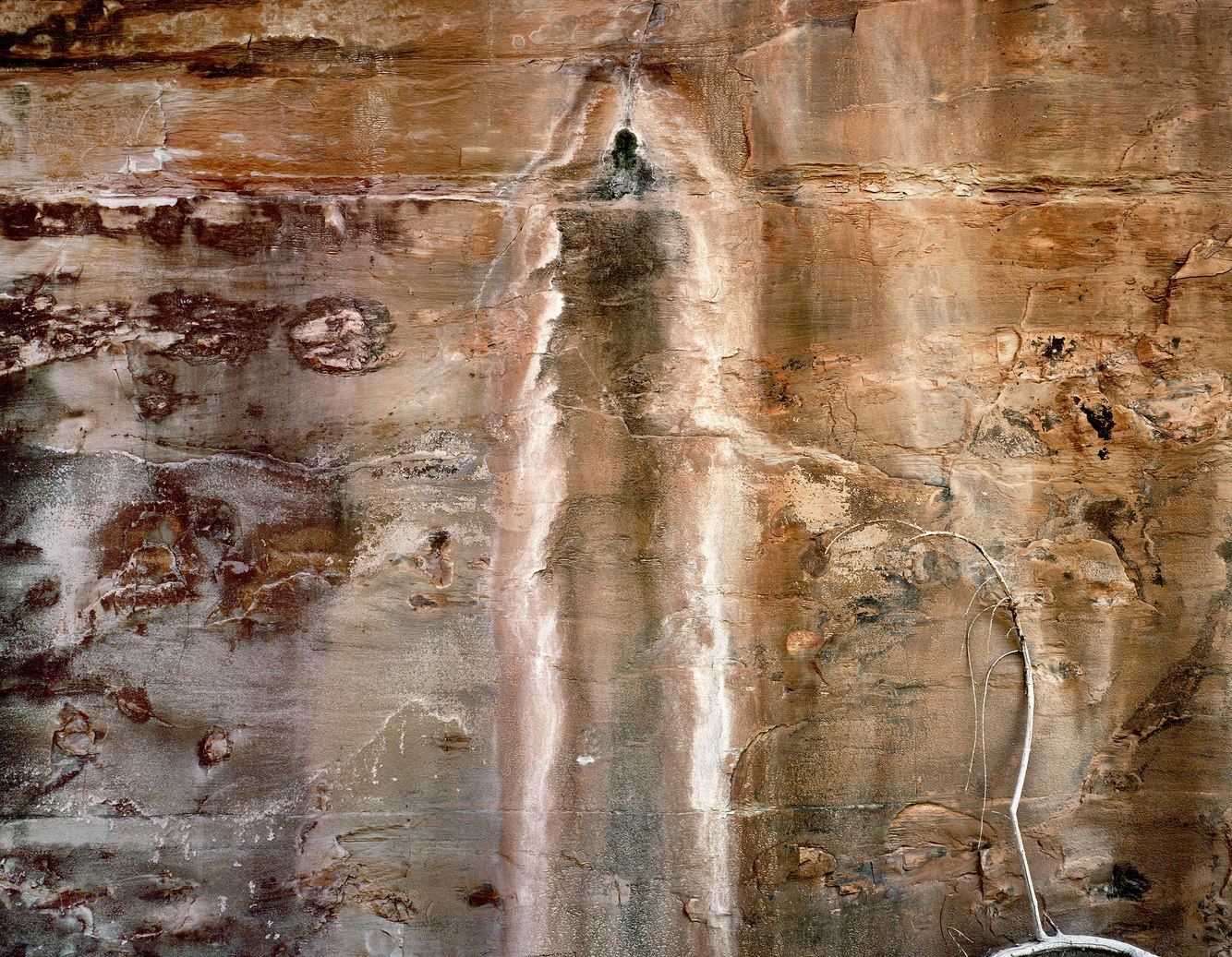
Seep, Grand Gulch, Cedar Mesa, Utah
Once upon time, the ancestral Appalachian Mountains eroded into sand and mud, which rivers transported and gradually deposited in an ancient shallow sea that divided the North American continent. The wall in this photograph shows a vertical cross-section of the compressed sediment that, through the aid of moisture and minerals, bonded its grains into a form of concrete called sandstone. Horizontal lines of varying thickness mark the boundaries between these sedimentary layers of cemented sand.
Bleeding from a fracture in the canyon wall, the dripping aquifer stains red sandstone black with mold, then, further down, feeds green and buff-hued lichens. Its source is 800 feet above this wall, where rainwater and snowmelt, dissolving salt embedded in the lithified sand left by that dried-up sea, descends through porous rock layers from the canyon rim to its floor. Once exposed to the desert air by the seep, the saline water crystallizes into a powdery gown of efflorescence.The surface of the wall, covered with lichens, fungi, salt, and desert varnish, creates a poetic abstraction.
Along the bottom of lower Grand Gulch Canyon, before it joins southeastern Utah’s San Juan River, there are other seeps as well as a seasonally active stream channel. Spring runoff and summer flash floods from thunderstorms scrape canyon walls and fill streambed potholes, nourishing plants and wildlife. A fallen limb and its arching branch rest against this wall, a remnant of a cottonwood tree that once bordered this shaded, twisting watercourse.
more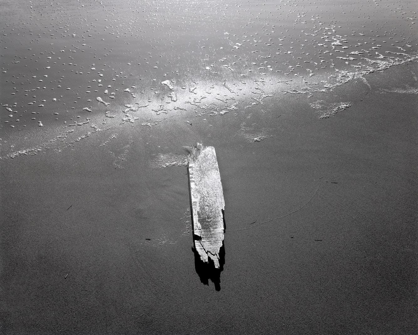
Drift Lumber, Nauset Beach, Cape Cod, Massachusetts
Cape Cod's 50-mile eastern shoreline is periodically strewn with debris left by storm waves, shifting sandbars, and currents. Over the past 400 years, three thousand ships have wrecked along America’s outermost beach. The first recorded wreck, the Sparrow Hawk, in 1626, was one of the earliest and smallest ships to sail to the New World. After being repaired twice, it eventually wrecked again along this same stretch of the outer Cape, which the pilgrims of 1620 named "Tucker's Terror."
During the 19th century, storms (especially in winter) and dangerous sandbars caused the loss of two or more ships each month. The remains of their cargo, hulls, and often the dead were cast onto these beaches from the fierce Atlantic, which writer Annie Dillard described as "a monster with a lace hem."
There has long been a history of 'wreckers' who made their living by reclaiming debris washed ashore. In 1855, Henry David Thoreau wrote, “After an easterly storm in the spring, this beach is sometimes strewn with Eastern wood from one end to the other, which, as it belongs to him who saves it, and the Cape is nearly destitute of wood, is a godsend to the inhabitants.”
On this morning fifty years ago, the beach foam of a retreating wave wetting the sand flats during low tide reflected the brilliant sun, lending this torn and wet piece of timber a radiant glow. Erosion and wave action made it impossible to identify the origin of this driftage. It could have been discarded from shore, lost from a passing ship as 'jetsam', or the rare 'flotsam' from a historic shipwreck.
more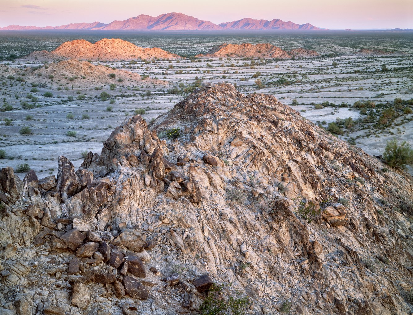
Sunset, Point of Pintas, Goldwater Air Force Range, Arizona
The Intermountain West is a high-desert region that lies between California’s Sierra Nevada to the west and the Rocky Mountain chain to the east. Its geologic centerpiece is the Basin-and-Range country, a series of north-south valleys and mountain ranges that corrugate the earth’s surface from Arizona to Oregon, formed by the push and pull at the intersection of the massive North American and Pacific Ocean tectonic plates.
For this photograph, I stood atop the northern tip of the Sierra Pintas, a range that rises from the floor of Arizona’s Tule Desert to its 2,200-foot ridge. I climbed a hill of light-speckled granite, and as the sun set behind me, I aimed my view camera eastward across a wide, flat basin toward the red-lit cordillera etching the horizon. What lay between was the accumulated clay, gravel, and rock eroded from once-loftier mountains. A place of blessed solitude, these flat drylands felt like an inland sea.
I camped there two decades ago as part of a group exploring the Goldwater Air Force Range to the north and the Cabeza Prieta National Wildlife Refuge to the south. Together, they encompass the otherwise empty southwest corner of Arizona. Scattered stands of palo verde, greasewood, ironwood, and other desert trees dot the landscape along the arroyos that carve through an undulating terrain. During most of the year, the ground has the color, texture, and hardness of concrete. Though it appears uninhabitable, it is the traditional territory of the O'odham Tohono people, who have continued to dwell, cultivate, and collect plants on this otherwise unsettled land for several millennia.
more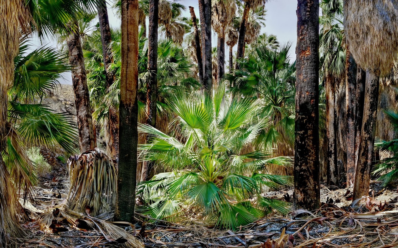
Young Palm, Palm Canyon, California
Even in February, temperatures in Palm Springs, California, can soar. On one such hot day several years ago, I hiked a favorite path along shaded Palm Canyon Creek. Surrounded by thick groves of California Fan Palms, these ‘trees’ thrive on the creek’s water. On that day, the current flowed at the surface as it usually does during the winter, and the saturated soil beneath the creek bed nourishes them in the dry season.
The steep, rocky canyon lies in otherwise barren desert country east of the 11,000-foot San Jacinto Mountains, the northern terminus of a chain of ranges that form the long spine of Mexico's Baja California peninsula. Palm Canyon is located on the Agua Caliente Band of the Cahuilla Indians Reservation a few miles south of Palm Springs.
The California Fan Palm (Washingtonia filifera) is the only palm native to the western United States, and its largest natural stand is in this canyon. Often described as a tree, the palm is a flowering plant more closely related to grasses. It grows around desert oases such as this stream, fed by fresh snowmelt from the nearby mountains.
The leaves of the California Fan Palm, called fronds, are durable and slow to decay; the Cahuilla used them to make sandals, thatch roofs, and baskets. If not removed by wind or trimmed by human hands, the dead gray-brown fronds will cover their entire trunks, forming, as they do in this canyon, petticoats that shelter small birds and invertebrates. Fallen fronds mat the canyon floor and can easily ignite fires that periodically blacken the palms' trunks and foster reproduction.
more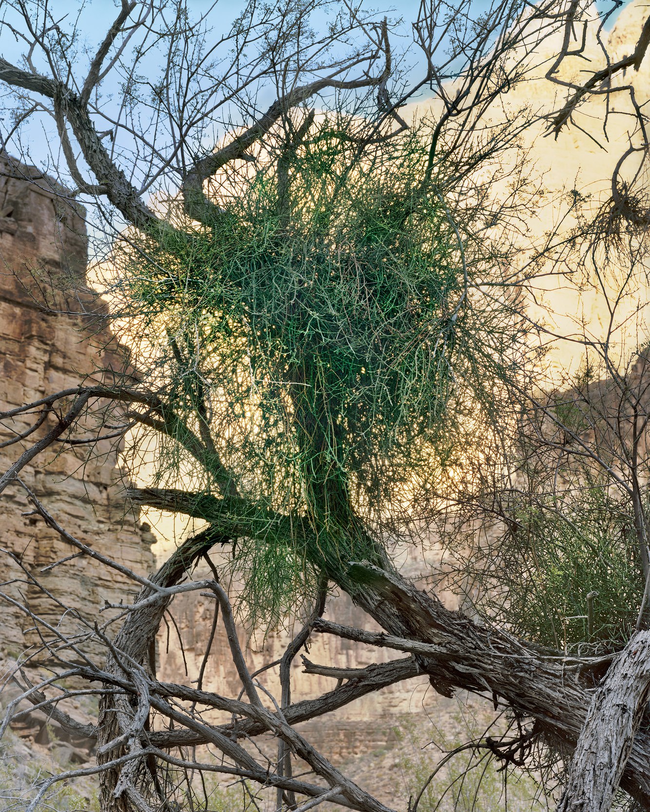
Desert Mistletoe, Parashant Canyon, near Colorado River, Arizona
Camping along the Colorado River during the final days of a Grand Canyon river trip, I hiked up a narrow, dark side canyon along Parashant Creek, a short distance from the river. In that early spring two decades ago, the creek, a major yet seasonal tributary of the Colorado River, was already bone dry. Deep in a sheltered ravine, an old mesquite tree grew, its shaggy branches tipped with blossoming buds.
A loosely raveled tangle of green thread, thriving on its ancient host, nestled between its limbs. Mistletoe found in northern Arizona’s Grand Canyon is in many ways very different from the type used for the Yuletide tradition of kissing under the mistletoe. However, all members of the species share one thing: they germinate on and grow directly from tree branches. In the desert Southwest, they attach to acacia, ironwood, and mesquite trees, sending their roots beneath the bark to access nutrients. Its genus, translated from Latin as “tree thief,” can weaken a tree, though it rarely kills it.
Its red-purple berries provide food for birds, and indigenous people used the sweet fruit for food and medicine. While the plant itself is toxic, the desert mistletoe’s berries are edible for humans, unlike those of other varieties, which are poisonous. It also provides nesting for the Phainopepla, a desert flycatcher that is the most common ‘planter’ of desert mistletoe. It eats its berries and quickly processes them, leaving sticky, undamaged seeds on tree branches where it can flourish and grow.
more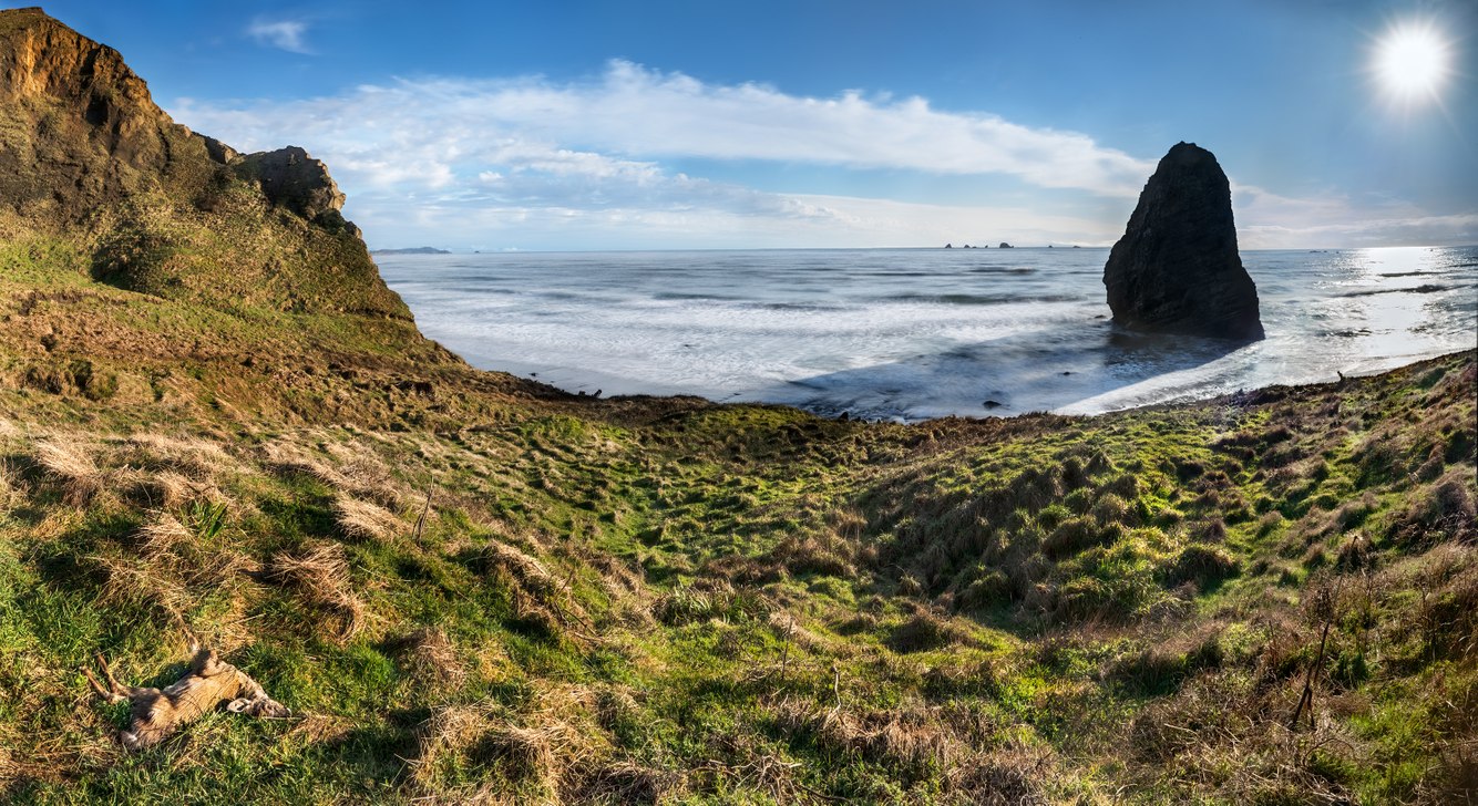
Needle Rock, Dead Fawn, Cape Blanco, Oregon
Descending the field that slumps off the south side of Cape Blanco’s headland, I stepped into a tangled heath. It was late winter when I made this photograph a few years ago, but even at its coldest, the marine climate of this coastal terrace allows the thick undergrowth to thrive, almost hiding a foraging mother porcupine and her two porcupettes. Giving them a wide berth, I came upon another young creature nestled in the grass, a fawn. It looked peaceful, though closer inspection revealed it had died, the cause unknown to me.
While mid-winter is almost always cloudy, wet, and fiercely windy, this late afternoon offered a respite. As I navigated farther down the banked meadow, I saw a bank of cumulus clouds receding south. The sea was relatively calm, the air still and clear, and the sun intensely bright after a storm’s passage. Needle Rock, a sea stack, cast its long shadow across the empty beach.
Etching the horizon, the Orford Reef looked like a school of whales. In fact, it is a cluster of eight small rock islands that provide habitat for marine wildlife, including anemones, fish, sharks, and nesting seabirds. Behind me rose a headland of sedimentary rock that over geologic time, had been rapidly uplifted from the sea. Along this coast, where tectonic plates collide, the floor of the Pacific Ocean pushes eastward into and under the North American continent, raising the former ocean floor 200 feet above sea level to form the state’s westernmost promontory.
more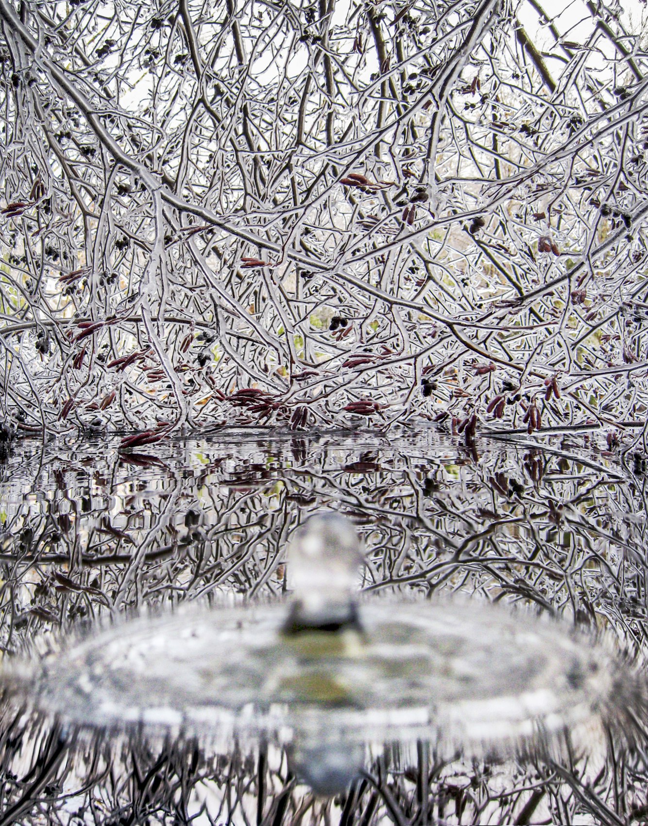
Water Drop, Ice Storm, Falmouth, Maine
One of the most impactful ice storms in its history hit southern Maine on December 11 and 12, 2008, pelting the region with snow and frozen rain. Power was out for days. Stuck at home, our fireplace kept us warm as we listened to the snapping of limbs and the crashing of trees around us. Power lines hung perilously low or were broken, cluttering streets and sidewalks, and the roads were ice-coated, making it too hazardous to walk or drive.
Ice storms are not uncommon in New England, which is affected more often than other parts of the country. Especially along the coast, where its own weather patterns and occasional cold-air intrusions lead to ice storms. This one began when snow fell through a mile-thick layer of relatively warm air, turning to rain a thousand feet above the ground. Then, a frigid northerly breeze at the surface, accompanying the storm, cooled the ground to just below freezing. Raindrops instantly froze on contact with solid objects.
After it passed and temperatures warmed, I visited the pond at the edge of our property, sitting under the bent and ice-coated willow branches, watching and listening as the water drops hit and then bounced off the pond’s now-melted surface. Using my small digital camera, I captured one drop hitting the pool directly in front of the lens as the shutter clicked.
more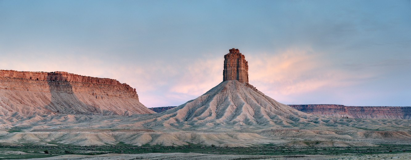
Sunset, Chimney Rock, Ute Mountain Tribal Park, Colorado
As I drove along Rt-491 in southwestern Colorado, the light faded from Chimney Rock and the cliffs to the east as the sun set. Just before it vanished, I pulled over and quickly took a series of overlapping shots, which I merged into this panoramic.
In the dying glow, the highlighted pillar and its soft-pastel shadows revealed the scene’s subtle colors and textures. As the day grayed into dusk, it reminded me of how haunting these drylands are at this hour; a very different feeling from earlier, when the late afternoon sun created a dramatic interplay of light, shadow, and color.
Formally known as Jackson Butte, in honor of photographer William Henry Jackson, who documented this region on glass plates in the late 19th century, it is now commonly referred to as Chimney Rock. From a distance, it appears to be a volcanic neck, formed when magma hardens within the vent of an active volcano and later becomes exposed by erosion. In fact, the 900-foot-tall pillar is made of Point Lookout Sandstone, a sedimentary formation found in New Mexico and Colorado. It is lithified sand, a remnant of a beach that bordered an ancient sea that divided western North America. The tower’s base is made of softer, slope-forming Mancos Shale, which originated deep beneath the same sea from clay and mud. As the land rose, these sedimentary rock layers eroded into the plateaus and canyons of today’s red-rock country.
more
Frozen Sand, Provincetown Dunes, Cape Cod, Massachusetts
Walking across the dunes outside the coastal port of Provincetown on a rare, calm, sunny winter morning felt like crossing an arid wilderness, devoid of vegetation, open and flat. This landscape invited me to look down at the patterns in the sand until I came across one that, at first, made no sense. After making this photograph and learning more, I found that, in winter, these dunes are buffeted by winds that move the sand. Snow is often covered with sand blown in from the surrounding dunes and beach. Surface cracks and dimpled hummocks form as the snow beneath alternates between melting and freezing.
Describing the character of this desert, Henry David Thoreau wrote in his 1854 book “Cape Cod,” “None of the elements were resting. On the beach, there is a ceaseless activity, always something going on, in storm and in calm, winter and summer, night and day.” Eighteen thousand years ago, clay, rocks, and sand deposited by receding glaciers formed what would become Cape Cod. As sea levels rose to near present-day levels, the outer part of the cape took on the shape of a forearm. The northernmost reach of the cape (the fist) is where wind and ocean currents transported sand, forming sandbars that are continuously changing in size and height.
more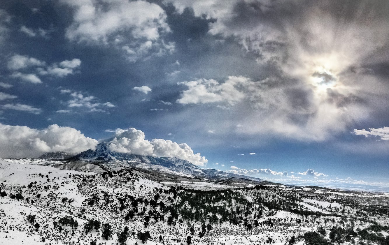
Winter Sun, Mount Lamborn, Paonia, Colorado
During the winter, winds carry moisture from the Pacific Ocean across several ranges and basins between California and Colorado. When lofted off the dry plateau and pushed up against the abrupt slope of this 11,402-foot mountain, clouds form and congregate above its summit. On the day I made this photograph, a vaporous shroud veiled the sun above the tilted plain. Filtered shafts of sunlight spread from behind a cumulus cloud, resembling a spiritual apparition, and for a moment, conjuring the opening lines of Genesis.
Mount Lamborn is a prominent peak marking the western edge of the Rocky Mountains, a mile above the North Fork of the Gunnison River and not far from the Colorado-Utah border. Ancient upwellings of magma from the Earth’s deep interior created the Rockies. Looking east from the town of Paonia, the rolling foothills of juniper and piñon give way to the sudden ascent of Mount Lamborn’s pyramidal face.
Further east lies a mélange of intertwined ranges stretching 200 miles to Denver, where the Great Plains begin. To its west lie the red-rock canyonlands of eroded plateaus, vaulted arches, and desert rivers. When I lived in Paonia, I enjoyed daily hikes across this threshold (geographically known as an ‘ecotone’) between two distinct geologic and botanical regions, with a mountainous network to the east and vast drylands to the west. Despite living there a decade ago, I still remember how distinctly different the air felt, as I traversed from the desert's dry warmth into the conifer-scented alpine air.
more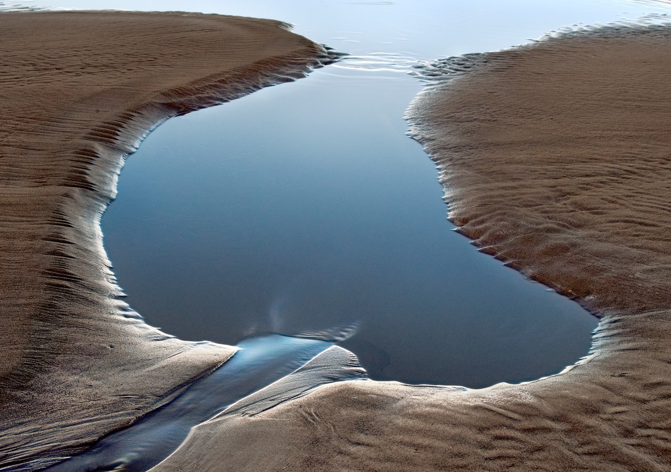
Dusk, Low Tide, Lincoln Beach, Oregon
Water drains from beneath Lincoln Beach’s bluffs, forming meandering streams that cross the wide sand beach to reach the Pacific Ocean’s shore. The resort city, named for its famous beach on Oregon’s northwest coast, faces west. In this photograph, the water’s edge catches the afterglow of the setting sun during a “King Tide.” Caused by the gravitational pull of the sun’s low winter-solstice angle, a full moon, and the Pacific Ocean’s winter storms, this type of tide rises higher and falls lower than usual. At low tide, more of the ocean bed is exposed, highlighting ripples in the sand left by waves and currents.
The resort, in effect, began in 1837, when two couples arrived by horseback from the Willamette Valley to celebrate their honeymoons, a generation after the 1806 encampment of the Lewis and Clark Expedition, a hundred miles north of this beach. They bathed in the ocean, dug for clams, baked fish, and recorded in their journals that their health improved after several weeks of sun and sea air.
They wrote that they loved the untrammeled feel of the beach. Until then, this part of the coast was inhabited solely by the Siletz, Yaquina, and Alsea peoples. For at least 10,000 years before the newlyweds arrived, settled villages along the river bays and on the ocean thrived in the favorable climate and abundant food sources.
more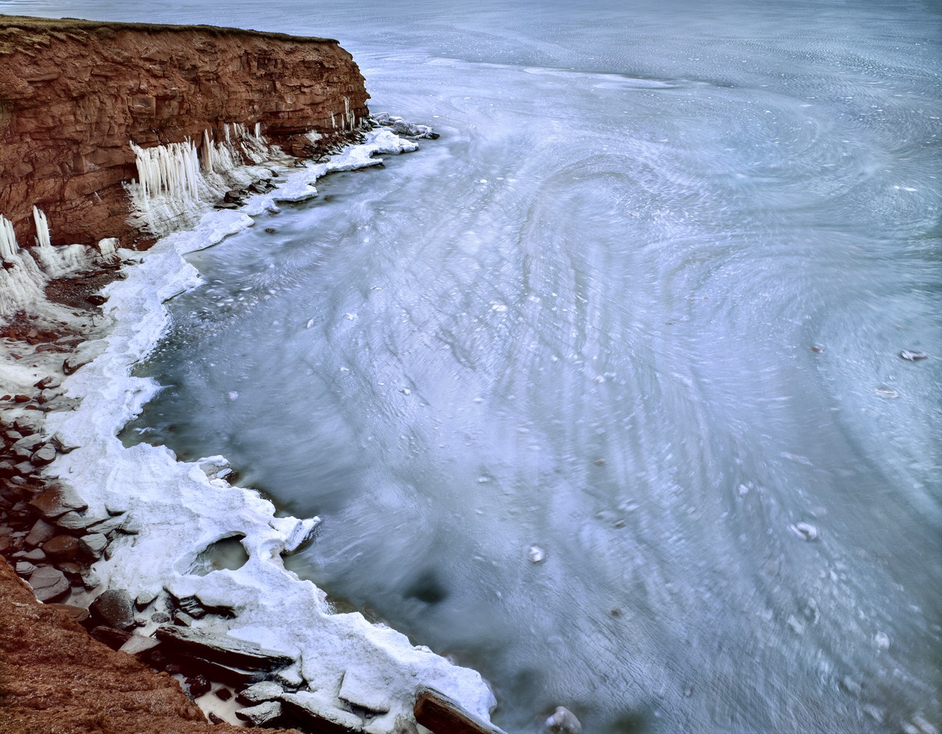
Sea Ice, Gulf of St. Lawrence, Prince Edward Island, Canada
Damp, windy, and cold are the adjectives that best describe Prince Edward Island's winters. An eastern Canadian province in the Gulf of St. Lawrence, it is renowned for its sublime summers. However, from November through April, sea ice often covers much of the gulf's waters, attaches to its beaches, and coats the cliffs along its coastlines. In fact, Prince Edward Island’s coast marks the southernmost extent of seasonal sea ice in North America.
Edged by sandstone cliffs, inlets, and capes, the miles-long, windswept marine terrace I hiked offered incredible views of a frozen ocean. Thirty years ago, seeing sea ice for the first time was entrancing. I watched it oscillate as gentle swells rolled beneath it, and between visits noticed that ice flows alternately retreated toward the open sea and advanced, piling up against the shore. Sometimes the floating ice gyrated in spirals. Driven by surface winds and ocean currents, this loose, floating field of ice, in effect, traced and tracked the sea surface’s movements.
Fast ice and ice stalactites form a thick layer that encases beaches and cliffs when briny saltwater freezes at 29°F. The offshore slushy drift ice buffers the coastline from winter storm erosion by reducing wave height. Unfortunately, the typical four-month period of protective ice cover has been nearly halved due to warmer winters. If the seasonal sea ice blanketing the southern Gulf of St. Lawrence continues to disappear, the shoreline will erode more rapidly.
more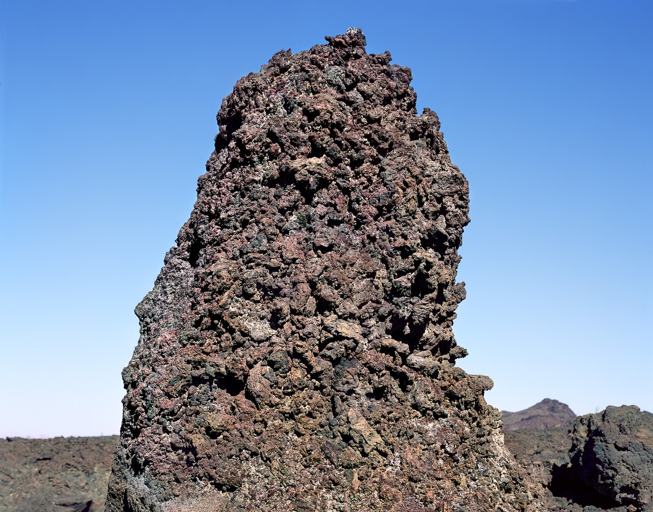
AA Lava, Volcanic Field, El Pinacate, Sonoran Desert, Mexico
There was no discernible path through this volcanic field in northwestern Mexico's desolate El Pinacate. While traversing this rugged terrain strewn with sharp rocks, I had to climb over and step around numerous cavities, risking getting stuck. My progress was slow and cautious, and with each step, I had to carefully adjust my balance.
An unexpected benefit of my slow progress was that, out of necessity, I had to focus on the details of what became a strangely alluring territory. It felt primal. The Earth's burning interior literally reached out toward space, then was cooled by water and air into a crust. Described as a wasteland, 19th-century European explorers found the Sonoran Desert inhospitable; it was (and to some extent still is) terra incognita to everyone except the Tohono Oʼodham tribe, who hold their homeland in reverence.
Eruptions began four million years ago, forming this region's lava flows and volcanic peaks due to dramatic shifts in the Earth's crust along the San Andreas Fault, less than 100 miles to the west. Multiple times, molten lava moved across the landscape. Its surface solidified into loosely packed, highly irregular fist-sized clinkers (fused, cooled, and hardened lava), while underneath, hotter, fluid magma carried them along.
more
Above Imperial Rapid, Cataract Canyon, Utah
The Colorado River originates on the west slope of Rocky Mountain National Park. It flows 1400 miles to Mexico’s Gulf of California, although it no longer reaches the ocean due to irrigation diversions. Halfway along its route, the silt-filled river runs through Utah’s deep Cataract Canyon, slow-flowing stretches alternating with, according to its name, white-water cataracts.
This part of the river has numerous rapids, most often dammed by rocks purged from side canyons by flash floods. Further downstream, the Colorado is blocked by Glen Canyon Dam, which, ironically, transformed the lush Glen Canyon into a desert reservoir, Lake Powell.
Twenty years ago, in the early light, I photographed along the riverbank at Ten Cent Camp, where our river trip had pitched tents the previous evening. The new day’s first rays illuminated the canyon rim. In the pooled water above Imperial Rapids, reflections from the canyon walls highlighted mud-coated stones.
From our campsite, I could hear the roar of Cataract Canyon’s final rapid. For many years, it was drowned by Lake Powell. After a severe drought in 2002-3, the lake level dropped, and the arduous chute reappeared.
Of this stretch of river, explorer John Wesley Powell wrote in 1869, “From the edge of the water to the brink of the cliffs it is one thousand six hundred to one thousand eight hundred feet. At this great depth, the river rolls in solemn majesty. The cliffs are reflected from the more quiet river, and we seem to be in the depths of the earth, and yet can look down into waters that reflect a bottomless abyss.”
more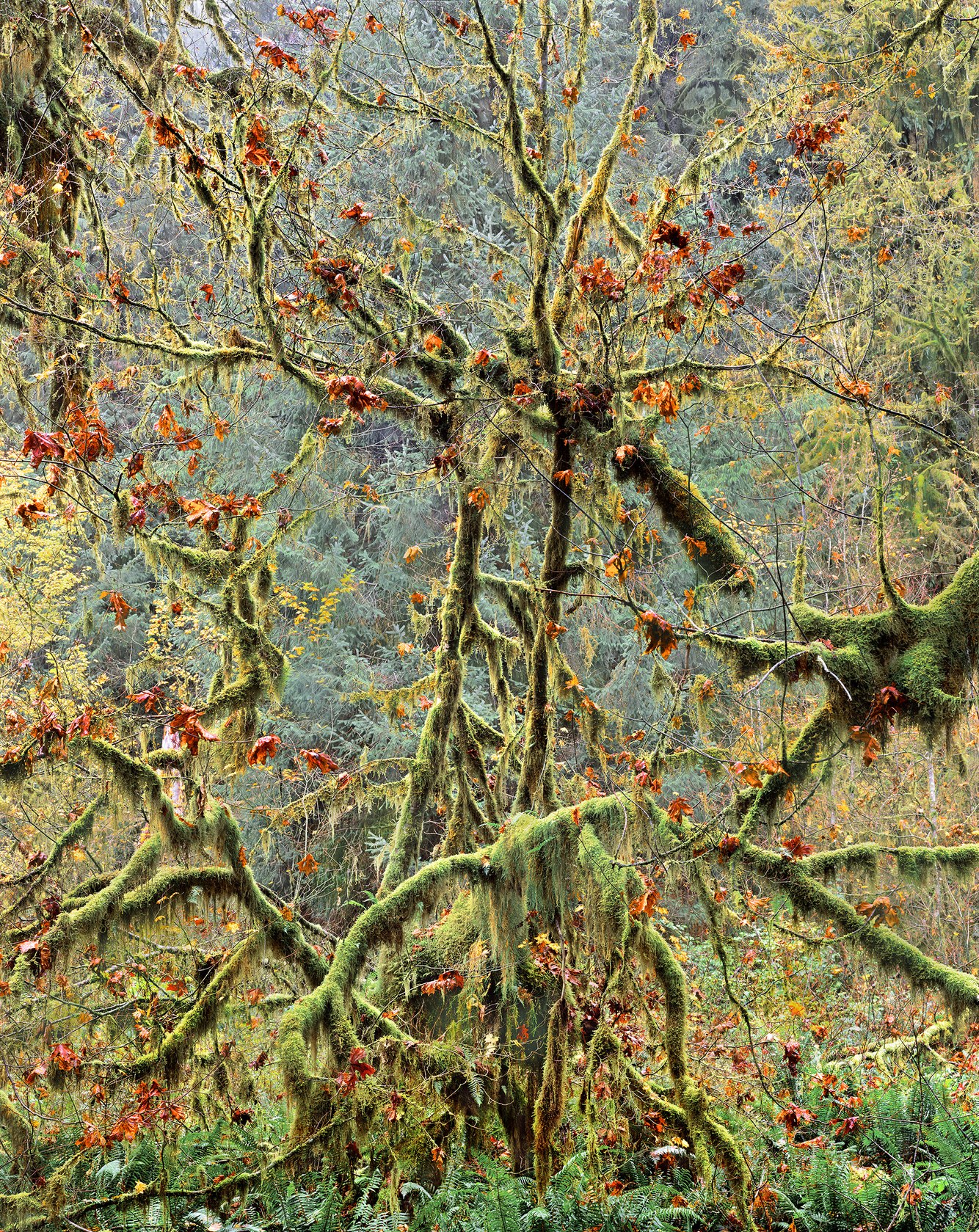
Dying Vine Maple with Hanging Mosses, Hoh Rainforest, Washington
On my first visit 30 years ago, when I entered the Hoh Rainforest, I realized that despite the wind, cold, and very wet conditions, late fall is the best time of year to experience western Washington’s Olympic Peninsula. November is one of the wettest months in the Pacific Northwest. It’s when the moss-covered growth of this primeval forest is most alive and vibrant. The drenched air saturated me.
During the short daylight hours of late autumn at this northern latitude, my long drive to the forest made my visit brief. Hastily walking the Hall of Mosses trail, I passed ancient towering cedars, firs, spruces, and hemlocks. On a recent visit, I noticed the forest had thinned; many old giant trees had long since fallen.
At the edge of the grove stood a vine maple, usually about the size of a large bush, though this massive plant nearly reached the height and girth of a tree. In autumn, its leaves turned a strikingly rich shade of orange-red, contrasting with the soft blue-green of the conifers. Its bark was coated with mosses and lichens, lending an ethereal appearance. At the same time, overgrown and tangled, the stretch of its tentacled branches resembled an ominous and brooding creature, ready to reach out and encase me.
more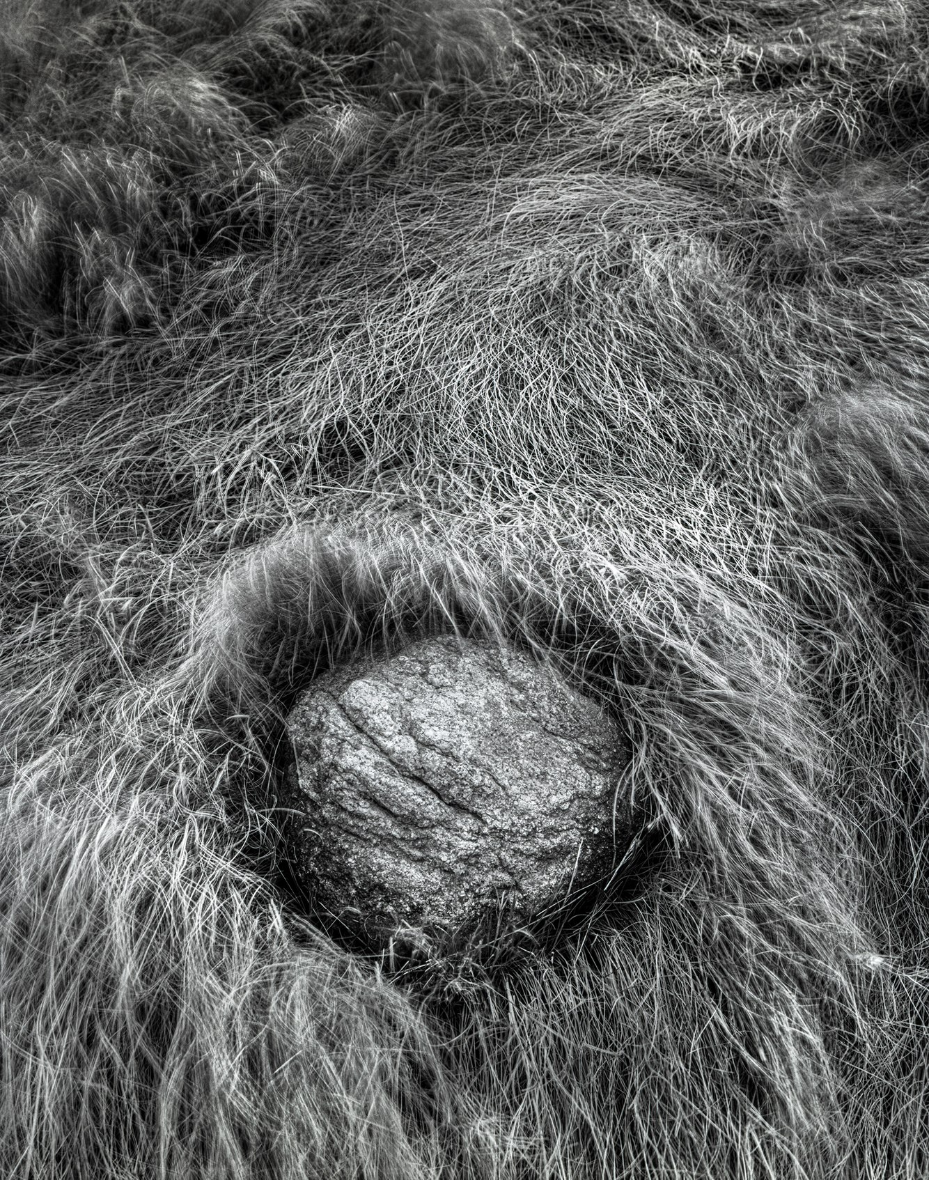
Marsh Grass and Glacial Erratic, Nauset Marsh, near Eastham, Massachusetts
Autumn proved to be the ideal time for me to explore Cape Cod's outer shore near the village of Eastham on the eastern arm of the cape. Fifty years ago, in late October, when I visited, summer crowds had long abandoned the beaches. The nights were cool, and the days stayed mild. The colors of warm-hued leaves and meadows deepened as the days grew shorter.
I was drawn to the grass-covered dunes and sea marshes just south of the Coast Guard Beach Lighthouse. Unlike the western United States, which I later explored and initially overwhelmed my senses, in my earlier black-and-white work along New England’s coast, I sought out intimate places where nature revealed itself in unexpected gestures.
Especially in this marsh, where I found a glacial erratic nearly hidden among the wind-blown salt meadow cord grass. Carried over an unknown distance, this boulder was rolled into its smaller rounded shape beneath mile-deep ice, reaching the eastern edge of a continent-spanning ice sheet.
Ten thousand years ago, the glacier left behind a moraine of sand, gravel, and rocks that formed New England’s outermost shoreline. This embryonic erratic appeared as a softly glowing wonder that seemed to have arisen naturally from this brackish basin.
more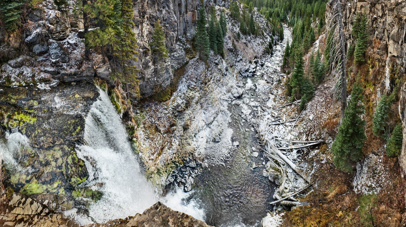
Tumalo Falls, near Bend, Oregon
Waterfalls are abundant in Oregon, especially in the Columbia River Gorge. They are less common east of the Cascades, where the climate is drier. Central Oregon's Tumalo Creek — whose name comes from the Klamath people's word Tumallowa, meaning "icy water" — is fed by the remnants of a glacier covering the upper slopes of Broken Top. This ancient volcanic cone sits on the crest of the Cascade Mountain Range.
On a cold November morning, I hiked up to the overlook at the top of the falls. The night before, snow had fallen. Later in the morning, the sun broke through, melting the snow on the surrounding plateau and the canyon’s sides. However, the overnight cold settled into the river basin. It preserved a trace of snowfall covering the base of the falls along the stream to the water-diversion dam that provides Bend residents with fresh glacial water.
During the last ice age, glaciers shaped the creek's narrow channel. The 90-foot falls mark the divide between the upper sections of the river that flows down from Broken Top and the flatlands at the mountain's base. The river once flowed higher in cooler, wetter climates. Retreating glaciers and diversions for municipal water to nearby Bend, Oregon, have reduced its flow.
more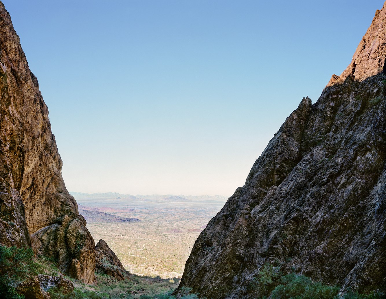
Looking Southwest, Mouth of Palm Canyon, Kofa Mountains, Arizona
After climbing the rugged path into Palm Canyon, I turned around to take in the scene. The space between the canyon’s walls opened a window onto the dry, hot desert several hundred feet below. The vista I photographed framed a picture reminiscent of early westerns; B-roll for a John Ford film, with brilliant light from the western plains bleeding into the far mountainous horizon that surrounds this sheltered enclave. It was a stage set, promising a drama ready to unfold, with the appearance of a solitary figure—the lawman or rustler—silhouetted in profile against the hazy desert heat.
These shaded walls of rhyolite, a volcanic rock that easily cracks and fractures into vertical ramparts framing the canyon’s entrance, separated the space I was in, from the flat, expansive La Posa Plain below. A faint track led up through a narrowing ravine briefly sunlit during midday. The slopes featured desert cacti such as saguaro, agave, and cholla, as well as palo verde trees and wildflowers along its streambed.
As an oasis, it protected plant life from the hot, dry Sonoran Desert. The canyon shelters not outlaws but, according to its name, the remnants of a relic species: a grove of rare native palm trees preserved within a cool, moist recess of this volcanic canyon. Descendants of palms that grew in this region during the last period of North American glaciation 10,000 years ago, botanists believe, gradually migrated into this canyon as the climate grew hotter and drier. The canyon serves as an ecological ‘island,’ and with its half-mile-high walls, limited sunlight, and available moisture, the palms depend on and thrive within its unique geography and microclimate.
more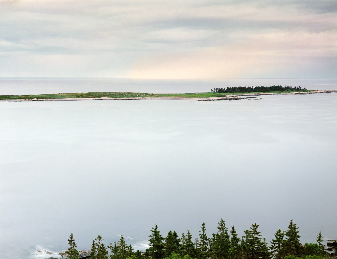
Schoodic Island near Winter Harbor, Maine
The word "Schoodic," a seemingly unique term, may have originated as "Eskwodek," named by the M'ikmaq peoples, meaning "the end" or "point of land." In the mid-19th century, Mark Twain wrote, "The very word schooner is of New England origin, being from the Indian schoon or scoot, meaning to rush, as Schoodic, from scoot and anke, a place where water rushes." Others trace its origins to early northern European roots. Fortunately, all their meanings apply equally to this exposed piece of land where water rushes against the coast.
The view east from The Anvil, a two-hundred-foot granite outcrop, offers a broad panorama of the Gulf of Maine and its coastal islands. It impresses a sense of vastness at the southernmost tip of a peninsula stretching far into the Atlantic from the central Maine mainland. Landfall on Europe's nearest shores is 3000 miles east. In between, the temperamental Atlantic, constantly generating swells, shapes, and erodes this hardened peninsula tirelessly. Initially formed from molten magma deep inside the Earth, it gradually cooled into granite that eventually cracked and, much later, became interspersed with dark, faster-cooling diabase dikes.
One low-lying outcrop of granite, Schoodic Island, lies east of the peninsula. It serves as a nesting sanctuary for American bald eagles and other seabirds—isolated from other wildlife, they can safely congregate. Schoodic Harbor, the deep thoroughfare between the headland and this island, is seasonally dotted with lobster pot buoys checked daily by local lobstermen. On a rare autumn evening, the typically restless ocean takes a respite and lies almost still.
more
Neahkahnie Viewpoint, near Manzanita, Oregon
The road north of Manzanita on Oregon’s northern coast curves around sharp bends high above the ocean. The overlooks can only be fully appreciated when leaning over the edge of the rock walls to experience the full horizontal sweep and vertical depth of the views. Here, waves generated across thousands of miles of the Pacific crash onto the shore in a steady rhythm of breaking swells, where the fog-bound coast meets a radiantly blue ocean and sky.
Oregon’s cold seawater is constantly upwelling, bringing nutrients as phytoplankton. These tiny one-celled organisms have a type of glue that holds them together, and when they die, their skeletal remains release that substance. At the same time, crashing waves push air into this frothy mix, and when it bubbles up, the shore is rimmed with sea foam. Although ocean foam can sometimes be associated with toxic blooms, along this shore, it indicates a healthy ecosystem.
Neahkahnie Mountain—meaning “the place of god” from the language of the Tillamook tribe—is one of the tallest headlands on the Pacific coast. Along the base of this 1,700-foot-high basalt formation ran an ancient trail that, during the 20th century, became a two-lane highway with a line of turnoffs beneath the mountain’s peak, each a few hundred feet above the ocean.
more
Muley Point Overlook, above the San Juan River, Utah
Cedar Mesa, where Muley Point marks its southernmost tip, was once a fertile highland inhabited by the Ancestral Puebloans, who carved homes from caves and cultivated beans, maize, and squash. As the climate dried and warmed about 800 years ago, they moved away from the plateau. Today, campers and hikers explore remnants of an ancient culture in this stunningly beautiful area.
The cliff’s edge where this photograph was taken is fractured by the alternating freezing and thawing of rain and snow, breaking the surface of the plateau into rectangular blocks. These boulders will eventually fall into the shadowed gorge carved by the San Juan River, a major tributary of the Colorado River.
The San Juan was once a slow, meandering stream crossing a nearly flat delta near sea level. Starting a few million years ago, as this plain rose into a plateau, the river carved deep, becoming entrenched in its original path a half mile below this rim.
Between sunset and twilight, the stark land shifts from dun-colored to iridescent hues of red, magenta, and purple. In the distance, the buttes of Arizona’s Monument Valley contour the far horizon. At this time of day, the brilliant sky and somber land blended into one, creating a rare moment in which I felt untethered from where I stood, like in a dream.
more
Cirque below East Summit, Mount Sopris, Elk Mountain Range, Colorado
Mt. Sopris is a commanding presence in the Roaring Fork Valley of Central Colorado. Part of the Elk Mountain Range, it rises nearly 7,000 feet above Carbondale. Although it is only of medium height within a range of 14,000-foot peaks, it stands alone, starts from a lower base, and sharply interrupts the horizon line. Its profile might remind one of Japan's Mt. Fuji from certain angles, as it apparently did for a couple (she was born in Japan) who built their home in a location that replicates the mountain’s iconic view.
In truth, it has two summits separated by half a mile, reaching the same elevation of 12,950 feet. Between them lies a cirque, a steeply sloped bowl facing northeast. Sweeping beneath the twin peaks, its shaded orientation makes it ideal for the early buildup of snow that starts to fall at this time of year.
This prominent landmark was created by molten magma rising from deep beneath the Earth's surface. Geologically, the mountain is a pluton, a bulge in the crust formed as the Earth's molten core cooled and solidified, starting around 30 million years ago following the initial uplift of the Rocky Mountains.
While hiking up to the peak wasn’t difficult, footing can be tricky along the exposed mountain path due to loose and crumbling rock, and a few have slipped to their deaths. Along one arm of its western ridge, I took this photograph after a snowfall in the late afternoon of an early fall day, feeling vertiginous, captivated by the nearly vertical landscape of the cirque.
more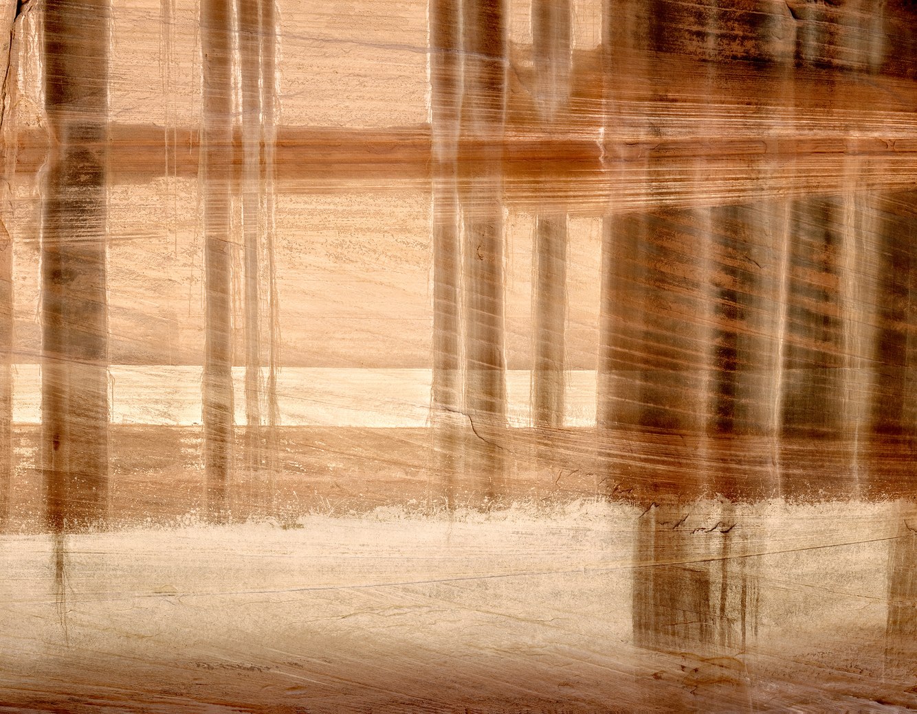
Buckskin Gulch, Paria Canyon, Utah
Walking along a trail to Buckskin Gulch, the desert landscape opened into a stretch of grasses, sagebrush, sand, and rocks; then, sloped hills rose around me, composed of splintered sandstone that narrowed into a small path between overhanging bluffs. Finally, I entered an amphitheater at the trail’s intersection with Buckskin Gulch. To my right, a wall displayed desert bighorn sheep petroglyphs around a long curving line chipped into the smooth sandstone, probably incised to depict the gulch’s winding streambed.
My journey was an underground adventure along the narrow base of a deep fracture in the earth. As I ventured deeper into the slot canyon, the walls closed in around me, creating a beautiful yet phobic space that one hiker aptly described as causing “a mild but pervasive sense of anxiety.” At the entrance of this subterranean world, I photographed a muraled rock face of salmon- and yellow-stained sandstone, illuminated by reflected sunlight.
The cross-bedded patterns in the wall revealed the effects of shifting winds that once carried ancient sand into dunes that eventually hardened into stone. The vertical streaks were desert varnish, formed by rainwater and snowmelt running down its surface, depositing thin layers of manganese and iron that tinted the wall in translucent shades of red, brown, and black. Flash floods periodically sweep through the canyon, carrying sand, clay, stones, and tree trunks. The debris level from the last flood was marked by mud splatter, as shown at the bottom of this photograph.
more
Deep Cove, Deer Isle, Maine
Sitting on the shore on this hot New England day, the cool Atlantic water looked inviting. This indentation at the tip of Deep Cove, located on Maine’s mid-coast, has occasionally served as a swimming beach for Haystack Mountain School of Crafts. In this artist community, I taught a photography workshop and captured this image 50 years ago.
Maine seawater is cold, influenced by the Labrador Current’s icy flow, which moderates the warming effects of the Gulf Stream further offshore. The water temperature reaches the high 50s during late summer and early fall. Only a hardy swimmer can challenge the otherwise welcoming ocean. Still, it’s one of the few places along this coast with a beach that extends far enough into the bay to wade despite its ten-foot tidal range.
Low-lying islands draw a subtle line between the cloudy sky and the deep, tranquil Jericho Bay. Spruce and fir trees densely cover Deer Isle, with a vibrant green understory of lichens and mosses fed by the cool, moist air of frequent coastal fog.
The soft dusk light mingles with the transparent water of an ebbing tide to reveal the near shore’s sandy and gravelly till, sediments from glaciers that covered this region 10,000 to 20,000 years ago. More gently sloped than the rest of the steeply ledged shoreline, granite shelves frame this small cove. The clarity of the water and the lightness of the underlying till, reflected by the glow from the late-afternoon clouds, catch the sun’s muted light, giving the cove a brightness. It seems as if one could wade into a bath of light.
more
Dawn, Little Tipsoo Lake, Mt. Rainier, and Yakima Peak, Washington
Surrounding southwestern Washington State’s Mt. Rainier, the high country has been shaped by volcanoes and glaciers. A moraine deposited by an ice flow 11,000 years ago created a dam that formed Little Tipsoo Lake, now a shallow lagoon. Its name is derived from the Chinook language. Throughout Cascadia, “tupso” is used to modify words that describe prairies, meadows, grasses, flowers, and sometimes even hair, all of which aptly describe this stunning meadow. In this photograph, a clump of bunchgrass in the lake looks like a hairpiece for Mt. Rainier’s summit.
Grasses, reeds, and lush fields of wildflowers and berries surround the lake, including huckleberry, lupine, Indian paintbrush, and partridgefoot. Ridges and peaks of the northern Cascade Mountains surround and overshadow the meadow. On their slopes and around the lake are subalpine forests of spruce, rock glaciers, and perennial snowfields. During summer, the lake fills, and although it is fed by snowmelt, it can warm to 70 degrees by August. As summer wanes, the lake shrinks, and during winter, its mile-high elevation is buried under snow drifts as deep as 65 feet until it melts away by mid-July.
At dawn, on the right side of the photograph, is craggy Yakima Peak. During September, the brush and grasses on its south side turn amber, with yellow sagebrush flowers blending with reddish-brown bitterbrush leaves. In the distance, 14,400-foot Mount Rainier dominates the horizon, its peak rising above the gray, corrugated ridge of the Cowlitz Chimneys, a rugged maze of volcanic pinnacles, spires, and knobs.
more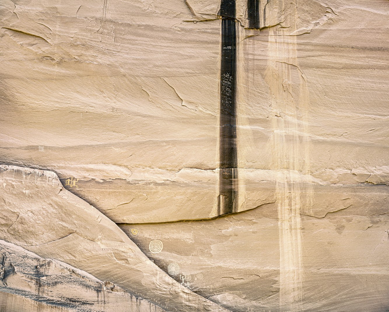
Pictographs, Canyon del Muerto, Arizona
An alcove in Canyon Del Muerto, Standing Cow Ruin, features a historic hogan—a hut built from rocks recycled from an ancient ruin—smooth sandstone walls streaked with a black patina, and pictographs (paintings on the rock wall) from different periods of indigenous habitation. The canyon is part of a national monument that preserves a record of occupancy spanning at least five thousand years, from the Ancestral Puebloans to the Navajo, who began settling in the canyon in the 1700s and continue to maintain traditions of farming and raising livestock.
This photograph shows part of a wall under a large overhang, decorated with images from various eras. A line of pictographs runs along the lower edge of the image, just above the rock ledges where the artists sat while painting on the rock surface. These white and yellow paintings, probably created by the Ancestral Puebloans in the 13th century, include handprints, concentric circles, and anthropomorphic stick figures.
On both sides (out of view) of this long wall's photographed section are important depictions of Navajo history. To the right stands a Navajo hogan beneath a pictograph of a standing cow and other painted figures and designs, likely created by the families that lived there during and before I took this photo 40 years ago. To the left are pictographs depicting a Spanish procession of horses and armed riders from an 1805 campaign that led to the massacre of over a hundred Navajo. Although named Canyon del Muerto (the canyon of the dead) after the discovery of prehistoric mummies in a nearby cave, the canyon also sadly evokes tribal memories of this 19th-century attack.
more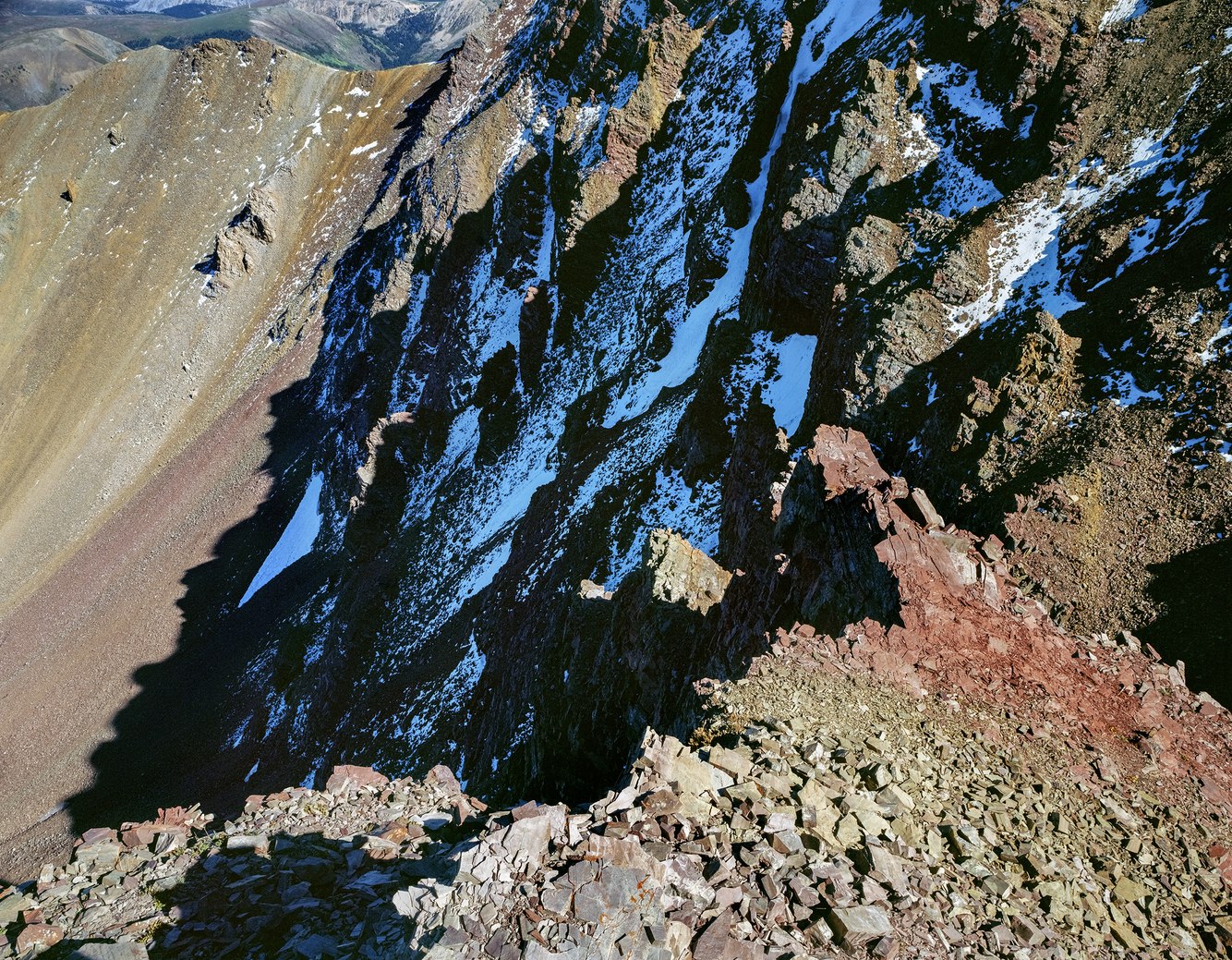
Saddle below Electric Pass, Elk Mountain Range, Colorado
The Rocky Mountains formed through repeated uplift and subsidence, contorting and disordering their rock formations. In central Colorado, the Elk Mountain Range outlines the western perimeter of the Rockies. These mountains—mostly above the tree line—were shaped by glacial cirques with narrow ridges separating deep valleys. Maroon-colored sedimentary rocks were uplifted by tectonic shifts in the Earth's mantle to form the range’s peaks.
Summer monsoonal thunderstorms are wetter in the Elk Range than in the mountains to the east, and their 14,000-ft peaks are also more susceptible to electrostatic discharges and lightning strikes. Just above where I took this photograph, Electric Pass reportedly got its name from a ranger in the 1920s who was knocked to the ground multiple times by static shocks before rolling down a slope to safety. On this clear, storm-free late summer day, I hiked the switchback trail safely through meadows and willow stands with easy access to stunning views of the surrounding mountains and their drainages.
Between Electric Pass and Leahy Peak lies a connecting ridge, a 'saddle' at 13,200 feet elevation, where I rested and took this photograph. The foreground features a tapered bench that crumbles and slips down the talus slopes. Cluttered piles of exposed shales and sandstones are part of the stratified, purplish-red, sedimentary rock formed in the Permian era, about 275 million years ago. The season's first snow accumulates in shadowed crevices below the ridgeline, reflecting the deep cyan-blue color of the high-altitude sky.
more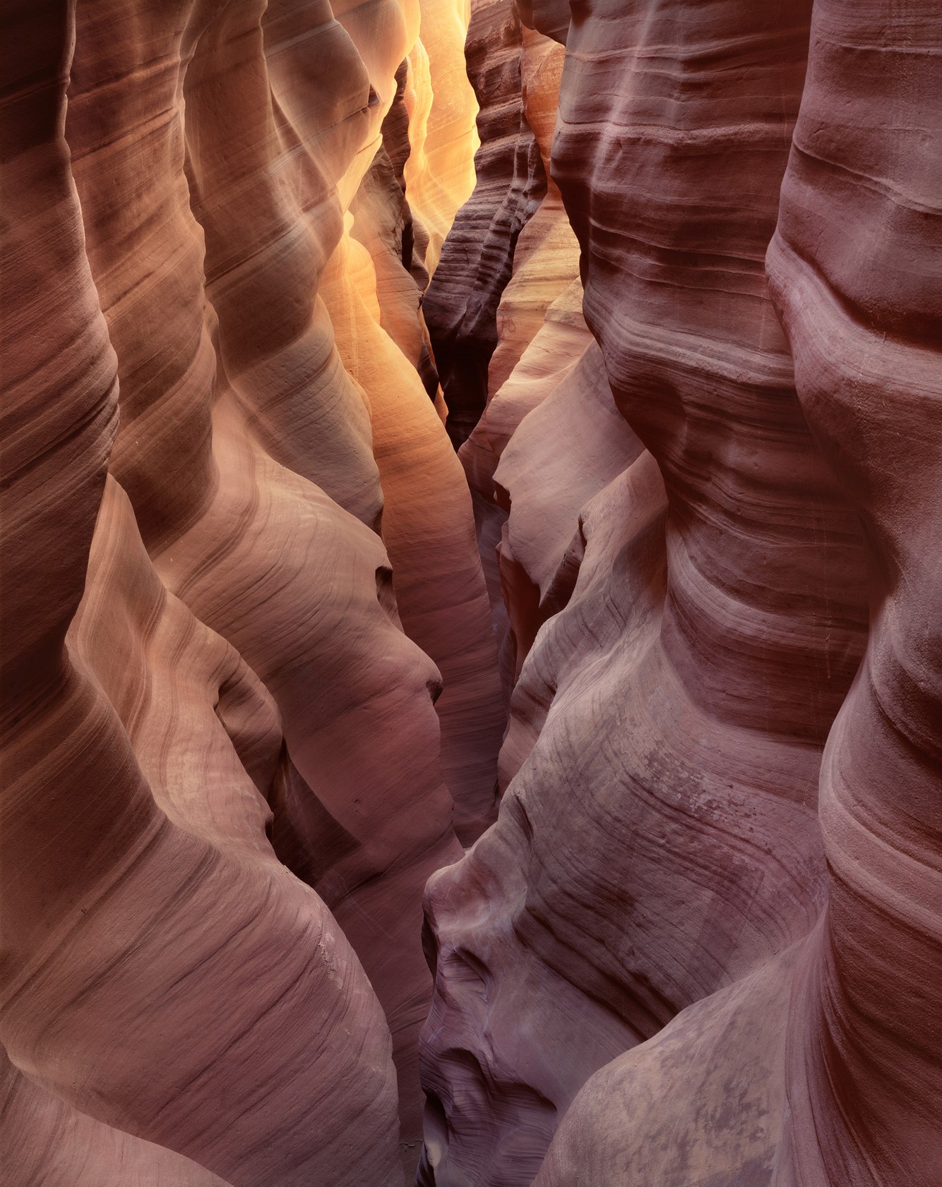
East Fork, Upper Kaibito Canyon, Arizona
A river traversing a desert might seem unlikely, but there are several, including the Colorado River and its many tributaries. One of these, on the Navajo Reservation in northern Arizona, is Kaibito Creek. This remote seasonal stream is visited less often now than in the past, and even then, visitors were rare. However, rivers are not the only thing that carve through the desert scenery. Hundreds of slot canyons carve into the red rock country of the Colorado Plateau, spanning southern Utah and northern Arizona. Towering soft sandstone walls outline these narrow channels, which are formed and eroded by periodic flash floods from monsoonal thunderstorms.
Slot canyons have become more popular, even in this remote part of the Southwest. However, in 1998, a few years after I took this photograph, the Navajo Nation closed the creek and its canyon to public access due to increased trespassing across their reservation and through residential areas, which had disturbed livestock, led to littering, damaged fragile archaeological sites, and sometimes necessitated dangerous rescues of stranded hikers.
Cautiously, I entered Upper Kaibito Canyon, its upper reaches originating just below a water tank off a dirt road, miles from any town. The canyon's entrance, hidden, even from a short distance, suddenly appeared beneath my feet. I was peering down into a V-shaped crevasse that closed in on itself. Balanced on the steeply sloped sides of this narrow gorge, I placed my legs on either side of the precarious gully. The canyon was deeply shadowed; sunlight bounced off the rim and then, again, off its lower walls, creating a subtle twilight-like glow. In the darkness, barely discernible, the resulting photograph revealed much more than I could see then.
more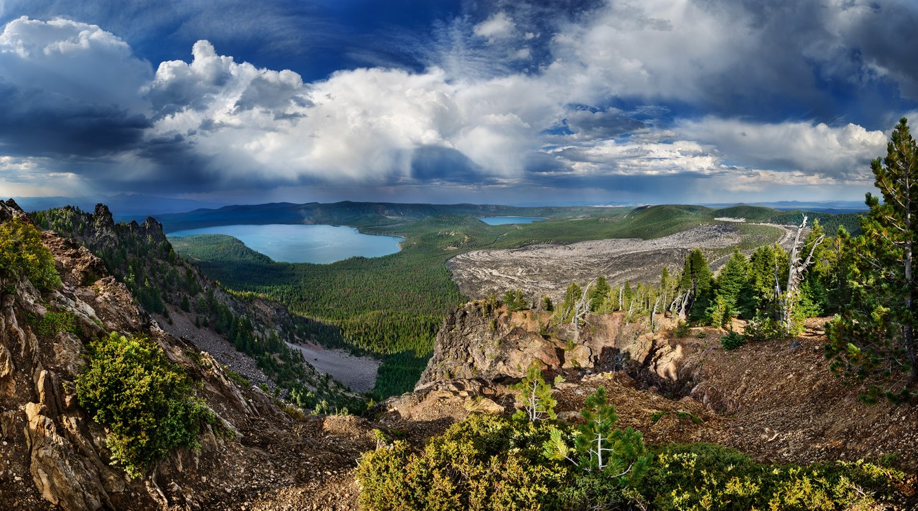
View Facing North, Paulina Peak, Oregon
Standing on the summit of Paulina Peak, the first thing that caught my eye was the approaching storm. Soon, rain and hail hammered the cindered ground, and briefly, the wind picked up; lightning flashed, and thunder echoed off the canyon walls. The storm moved north over Paulina and East Lakes before heading into the high desert surrounding this ancient crater.
At an elevation of 8,000 feet, Paulina Peak is the highest point along the rim surrounding the collapsed Newberry Volcano, which formed the caldera shown in this photograph. The peak offers a 360-degree view spanning hundreds of miles in all directions, from Mt. Adams in Washington State to California's Mt. Shasta.
About half a million years ago, the volcano's 14,000-foot summit was roughly in the center of the photograph, above the lakes and the forest basin of lodgepole and ponderosa pine. Today, resting on a thin layer of the Earth’s crust, the caldera remains volcanically active, with several monitoring stations recording ground vibrations and changes in the shape and movement of the terrain in real-time.
To the right lies a tan-gray obsidian field, the most recent geologic addition to the basin. Lava flowed from the rim adjacent to Paulina Peak 1300 years ago and then cooled into volcanic glass. The obsidian boulders are so sharp along their edges that native tribes chipped arrowheads from them. The crater was initially visited by hunter-gatherer peoples beginning at least 11,000 years ago, not long after the Ice Age ended. Today, the caldera is a land of lakes and forests, a place to camp, hike, and fish.
more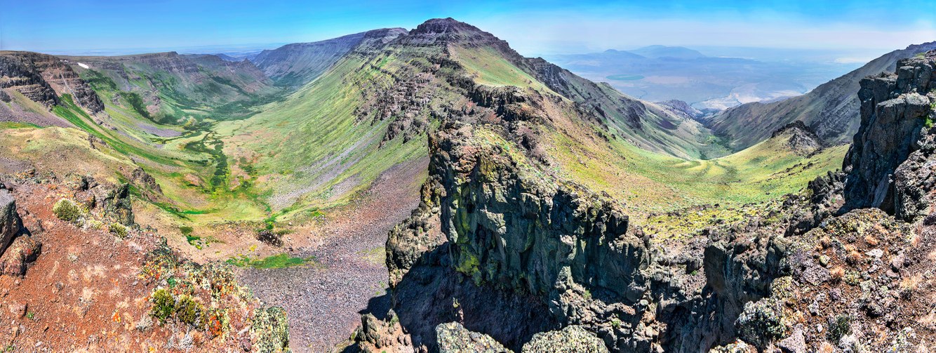
Kiger and Mosquito Gorges, Steens Mountain, Oregon
Extending north from the cliff where I took this photograph a few summers ago, a sharp divide separates two diverging glaciated valleys: Kiger Gorge on the left and Mosquito Gorge to the right. During a cool, moist climate that lasted from four million to ten thousand years ago, glaciers carved out Steens Mountain's dramatic canyons in southeastern Oregon. Accumulated snow compressed the layers of ice beneath it into thousand-foot-thick glacial flows. These massive ice streams once split in two directions, one flowing north to carve Kiger Gorge and the other moving east down Mosquito Gorge. Their immense weight and downward pressure shaped broad, deep U-shaped valleys. The upper parts of the gorges' walls above the glacial ice are rough and rocky, while the glaciers' abrasive action scoured their basins.
The advantage of Steens’ open and elevated terrain is the opportunity to observe the shape and form of gorges formed of volcanic rock and carved by ice. Its ridge lacks trees, unlike other ranges covered with ponderosa and Douglas fir. Here, where the mountain rises from a low desert base, seed dispersal has not occurred as in other highlands connected by higher ground, allowing tree species to spread from one mountain range to the next.
more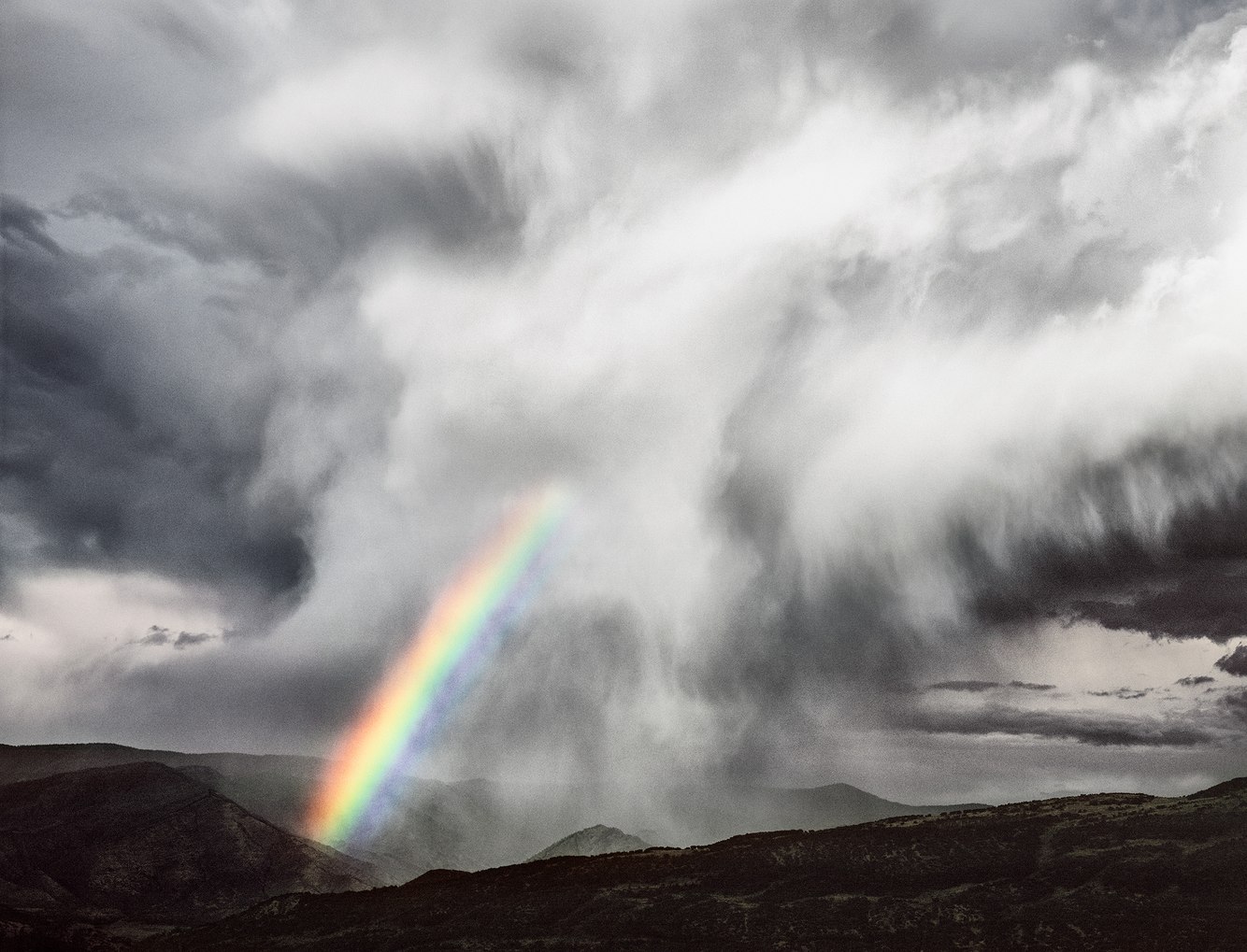
Rainbow, Roaring Fork Valley, Colorado
Beginning midday during the high country's summer monsoon season, clouds form, grow, and rise off the shoulders of central Colorado's Elk Mountain Range. By late afternoon, storm clouds fed by sub-tropical moisture and rising heat channel through breaks in the range to the west and over alpine valleys to the east, trailing hail and shafts of rain. As seen from the top of the Brush Creek Valley near Aspen, a final streak of daylight cuts through the clouds, partially illuminating a rainbow before the sun sets.
As sunlight enters each raindrop that makes up the rainbow, it reflects off the interior rear surface back toward the sun, as its angle changes. The light's movement into and then out of the raindrop separates into a spectrum of colors. Each of these colors exits the raindrop at different angles, so what we see, from the outer to the inner edges, is a progression of red, orange, yellow, green, and blue.
The sudden appearance of this rainbow, especially as a shaft of light emerging from a storm cloud, feels mythological. Interpretations of rainbows vary across cultures. In Greek mythology, rainbows symbolized a bridge connecting heaven and earth. But what moved me most was the story of individuals reaching full Buddhahood. Described as self-liberation from their physical bodies, those who attain enlightenment at the moment of death transform into a 'rainbow body,' a body of light that can appear anytime and anywhere when they direct their compassion.
more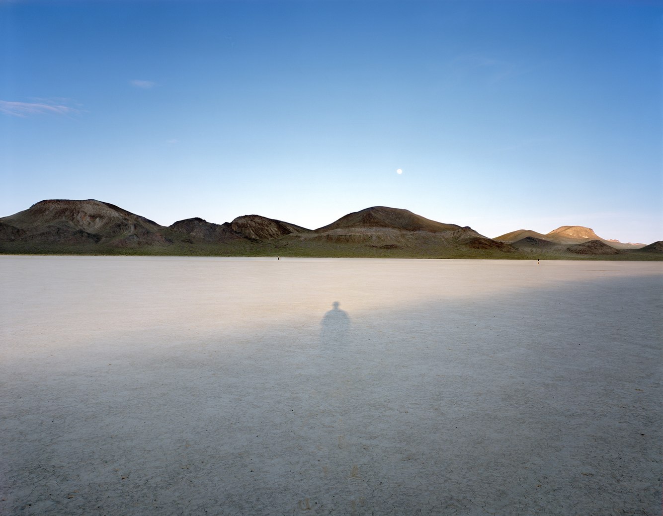
Shadow, Playa near Black Rock Point, Black Rock Desert, Nevada
Tectonic forces beneath the Earth's crust shaped the corrugated topography of the Intermountain West from Mexico to Oregon. Uplift and subsidence folded the land, fracturing the crust and creating alternating mountain ranges and basins, including Nevada's Black Rock Desert.
This basin contains silts and clays deposited by Lake Lahontan, which once covered much of Nevada. The lake reached its largest extent 12,700 years ago near the end of the last Ice Age, with its shoreline standing five hundred feet above the current surface of the desert. Over time, it gradually vanished as a warming climate reduced its size. Eventually, the lake evaporated into a flat plain. Bone dry most of the year, during winter and spring, rain and snowfall sometimes coat its surface with a thin layer of water teeming with fairy shrimp, providing habitat for migratory birds and making it impossible to cross on foot or by vehicle.
I took this photograph in a small playa separated from the surrounding desert by the Black Rock Range. As the late-day shadow lengthened from the elevated rim on the western edge of this one-square-mile desert bed, it stretched until it intersected with my spectral shadow. Surprised, I marked the spot, recorded the time, returned the following evening, set up my camera, and exposed the film when our shadows overlapped again. Two meditative figures wandering along the far edge of the playa below the rising moon offset the scene's symmetry. In the early evening, everything seemed to move slowly – the air, the sun, the moon, the drifting people; all except the shadows, which raced across the silent desert floor.
more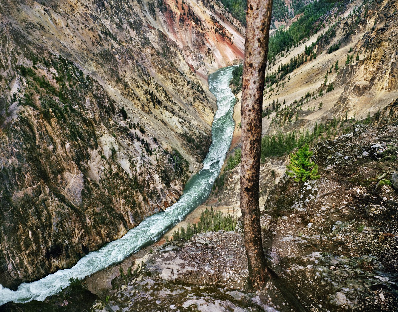
Canyon of the Yellowstone River, Yellowstone National Park, Wyoming
“The whole land seemed restless and alive,” summarized naturalist Edwin Way Teale upon experiencing the volcanically active Yellowstone National Park. Named after the colorful rock of the park’s river canyon, the indigenous Minnetaree called it Mi tse a-da-zi, which Lewis and Clark translated as Yellow Stone during their 1806 return trip through the river's lower reaches. However, neither the Minnetaree nor the Lewis and Clark Expedition traversed the plateau region that includes the Canyon of the Yellowstone River.
The 1,200-foot-deep V-shaped canyon was carved by river flow rather than glaciation, which is more common for canyons in this high-altitude northern region. Just 12,000 years old and formed after the last ice age, this canyon is rapidly eroding. A geyser basin previously located in this area transformed rhyolite left by lava flows. As a result, the rock became soft, brittle, and more vulnerable to erosion; it also rusts, creating a spectrum of warm-toned colors. Ecologist Kristen Prinzing pointed out that this wild, undammed river is the "last river in America that Lewis and Clark would still recognize."
When first visiting the park in 1980, I had recently stopped photographing with black-and-white film and switched to color, which seemed the perfect choice given this subject matter. From my precarious perch on the canyon's rim, I could hear the echo of the 300-foot Yellowstone Falls a mile upstream, loudly plunging into the ravine, with the river rushing down its steep slope beneath me through a narrow channel. Although I was eager to photograph the falls, when I turned around, my attention was captivated by the surreal, otherworldly colors of the canyon walls.
more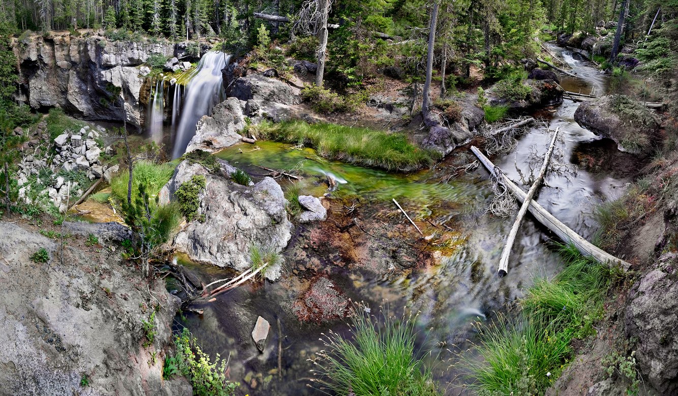
Paulina Creek, Oregon
Central Oregon’s Paulina Creek plunges over an 80-foot waterfall, draining water from Paulina Lake, which lies within a caldera—a basin formed after the collapse of the Newberry Volcano that first erupted 600,000 years ago. The creek begins at a gap in the caldera’s rim, and its path was shaped by floods that carved a channel through the volcanic rock from past eruptions.
Today, magma beneath the caldera heats springs under the lake and around its edges. The lake’s flow into the creek is mainly supplied by inflow from these hot springs. Over time, soft layers of volcanic tuff beneath the waterfalls have eroded quickly, creating a chaotic pile of boulders at the base of the falls. Along the creek, limbs cut from lodgepole pines are scattered across the streambed, leftovers of forest thinning to lower fire risk and disease.
The caldera has been a site of intermittent human activity for 11,000 years. Upstream, near the top right corner of this photograph, lie the remains of the oldest known dwelling in the western United States- a 9,500-year-old summer camp. It served as a base for generations of the Windust people, mobile tribes of hunter-gatherers who stalked bison and elk and collected fruit and nuts from these highlands. That is, until Mt. Mazama (now Crater Lake) erupted a hundred miles to the southwest, covering the region in thick ash 7700 years ago. After that eruption, the basin was uninhabited for nearly 4,000 years, until native people visited the crater’s obsidian fields to knap arrowheads. Today, campers gather along the basin’s two lakes to fish, hike, and relax in its hot springs.
more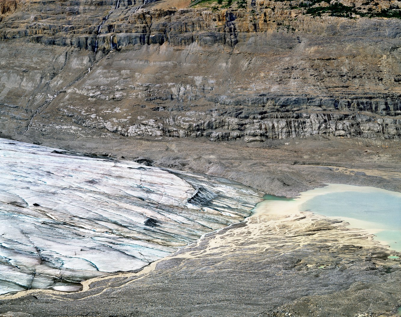
Toe of Saskatchewan Glacier, Columbia Icefield, Alberta, Canada
Formed 240,000 years ago, the Columbia Icefield spans a 10,000-foot-high plateau atop the provincial border between Alberta and British Columbia. It is the largest icefield in the Rocky Mountains and the source of several glaciers. The Saskatchewan Glacier is the largest among them, extending eight miles and dropping a mile in elevation to its terminus.
The glacier’s size has fluctuated, expanding and shrinking due to changes in the climate. After the last ice age, the Saskatchewan Glacier reached its largest extent in the 19th century. Since then, its toe has retreated a mile, and in recent decades, its volume has decreased by about one percent annually. At one time, the glacier scraped against the base of the cliffs at the top of the photograph, three hundred feet above its current surface. Today, melting ice exceeds snow accumulation, causing trees, animal remains once trapped in the glacier, and rocks, sand, and clay to be deposited at its toe. At its current melt rate, the glacier could disappear entirely within another century.
Hiking alone to the glacier’s terminus, the remote and vast terrain seemed overwhelming. I felt small, vulnerable, and initially questioned whether it was wise to proceed. Navigating the trailless valley, I followed a thundering river, scrambled over and around boulder piles, and climbed unstable slopes until I reached this elevated view. What struck me most in this mid-summer scene was the sound of water: multiple water channels flowing on top of, and originating from, the glacier's base, flooded a silt-filled pond; the source of the Saskatchewan River, which then flows 1600 miles eastward to Canada’s Hudson Bay and the Atlantic Ocean.
more
Sheaves Cove, St. George Bay, Port au Port Peninsula, Newfoundland, Canada
The Port au Port Peninsula lies along the ancient Appalachian Mountain range, which stretches from Alabama to the Canadian province of Newfoundland. The peninsula extends into the Gulf of St. Lawrence from the rest of the province’s west coast through a narrow isthmus. During the 16th and 17th centuries, Basque fishermen, who had maintained seasonal fishing settlements for centuries, first called the area the Port of Rest. As year-round settlements developed, Port au Port became home to a mélange culture of bilingual residents from Mi'kmaq, Acadian, Basque, and French backgrounds. Since the 18th century, it has been informally known as the "French Shore."
Although the peninsula lacks natural harbors, Sheaves Cove has served as a sheltered beach where motor dories can be pulled ashore. Partially protected by a rocky headland, this cove is filled with palm-sized stones that shimmer in the midday sun through the clear, rippling seawater. These multicolored cobbles were formed from a complex geologic history of limestone, sandstone, and shale. They have been clamorously shaped by scraping and polishing against each other through the churn of ebbing and flooding swells. Light shifts from the sun's angle to a more vertical direction as it passes through the water. In this photograph, the water’s surface acts like a liquid lens, bending the light to magnify and distort the rounded stones. The various refractions outline and continually reshape their edges and faces as the rhythmic surges of waves from St. George Bay create a pulsing dance of light.
more
Twin Lakes Basin, Crystal Range, Desolation Wilderness, High Sierra, California
The Desolation Wilderness is a granite plateau in the northern Sierra Nevada Range, rising above the western edge of Lake Tahoe. As Kim Stanley Robinson wrote in his book The High Sierra, A Love Story, "Desolation expands after you enter it… The lack of soil created since the last ice age means it's still mostly rock, its scattered trees isolated, small, wind-sculpted."
Few hikers ventured up the trail on this mid-June day. As I climbed, I emerged from the forests at 7000 feet above sea level and entered a strange world I hadn't experienced in many years, where the air was thin and the sky a deep, dark blue. Pockets of plants lined the trail, and fast-moving streams collected snowmelt from surrounding peaks. The spare, expansive space felt almost lunar. Its openness and flat granite slabs made hiking easy, and with the incredibly clear air, the boulders, cliffs, and high rim seemed closer and more attainable. Cold in the shade and hot in the sun, the air became thinner with each step. By the time I reached the trail's end in this vast basin, there was 25% less oxygen to breathe.
At the tree line, life thrives, but the 'standing dead' persist as a reminder of the high country's fragile balance between growth and decay. Enveloped in light, the sun reflected brightly—almost harshly—off the pale granite and glowing snowfields. In 1894, naturalist John Muir described the Sierras as "the range of light…a vast wilderness in a sea of light." Amid the vastness and isolation, this remote corner of California offered a rare and soothing reprieve—a quiet sanctuary in a populous state. Feeling restorative, solitude became a welcome companion.
more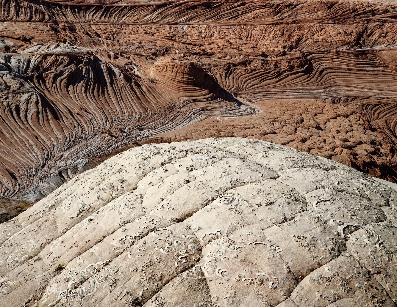
Coyote Buttes, Vermillion Cliffs, Utah
Two hundred million years ago, along what is now the border between Utah and Arizona, enormous dunes shaped by shifting winds migrated across a landscape dotted with oases that provided water and food for several types of three-toed dinosaurs. These cross-bedded dunes solidified into the Jurassic Navajo Sandstone and, after being uplifted a mile by tectonic forces, have since eroded into the striking landforms of Coyote Buttes.
Over a thousand dinosaur tracks are imprinted in the rock, overrun by the sandy footprints of hikers exploring this exotic environment filled with bewildering formations. In the late 1980s, a friend at Utah’s Canyonlands Field Institute suggested I visit the buttes to discover a terrain few knew about—a destination reached by crossing open country near the slot canyons of Buckskin Gulch. At that time, the red rock country was far less explored, with its remote wonders accessible by following deeply rutted four-wheel drive routes, far from major highways.
I was the sole visitor when I first discovered these buttes, though I approached with trepidation as I encountered the fragile sedimentary rock. Time and wind had worn their edges into delicate fins that could barely withstand being touched, let alone hiked on or climbed over. Swirling ribbons of color, formed by the oxidation of minerals like iron and manganese into thin, striped bands, began to attract attention. Published photographs started showcasing this landscape’s surreal beauty, drawing in more visitors. To help mitigate the danger of irreparable damage to the brittle formations, today, visitors apply for a limited number of daily hiking permits and are asked to follow hiking protocols.
more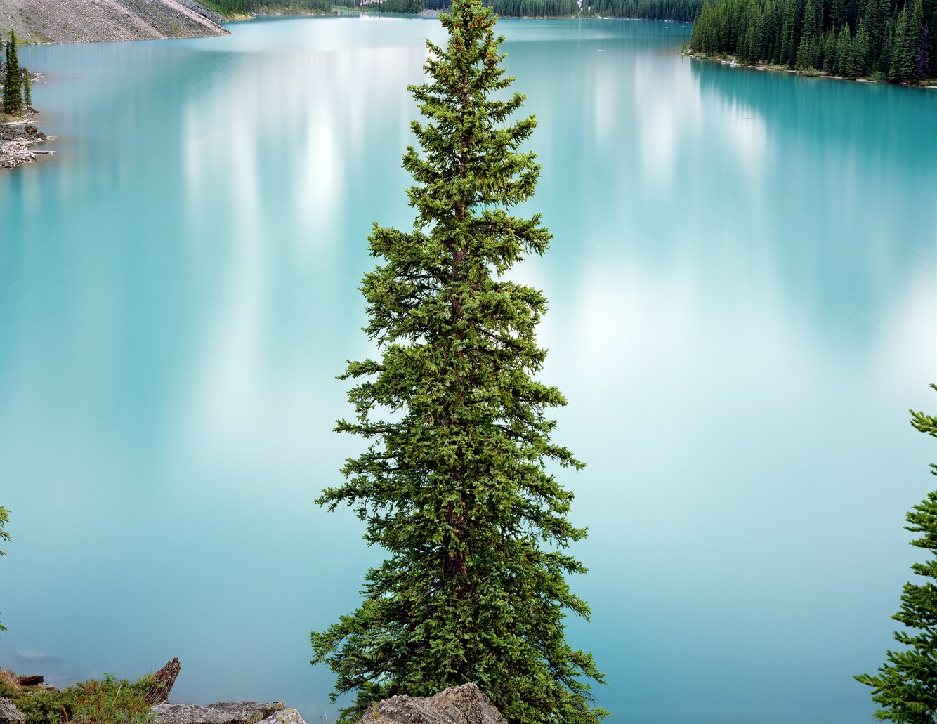
Moraine Lake, Valley of Ten Peaks, near Banff, Alberta
Moraine Lake was eerily still when this photograph was taken on the evening of the summer solstice, just before midnight. The snow-covered slopes of the Canadian Rockies surrounding it were faintly mirrored on its surface, their reflection partially absorbed by the translucent water. The lake appeared otherworldly, emanating an unnaturally radiant glow in the enduring twilight that replaced night at this high latitude as it began transitioning into the next day’s dawn.
The glacially-fed lake reaches its highest level in late June, and when full, it iridizes a stunning azure blue. This unique color arises from refracted light off the rock flour, the dust sheared from glacial debris while suspended in the lake. Composed of silt-sized particles of quartz and feldspar, these particles are small and light enough to remain buoyant when the water maintains a consistent temperature of around 40 degrees. At this temperature, the water is most viscous, supporting the suspension of rock flour much longer than if the water were warmer or colder.
Named by Walter Wilcox in 1899 while mapping the Canadian Rockies, he wrote of Moraine lake, "No scene had ever given me an equal impression of inspiring solitude and rugged grandeur.” Later, it became clear that the lake was not formed by depositing a terminal moraine from an ancient glacier. Instead, a large, haphazardly piled hill of rocks and boulders dammed the lake as a result of one or more landslides, either transported to this location atop a glacier or, more likely, slid down from the Tower of Babel, a nearby peak. This accumulation of stones rose so high that it provided an elevated view of the lake.
more
Decaying Ponderosas, Fremont Point, above Summer Lake, Oregon
Hiking along the lofty rim of Winter Ridge, I felt as though I was perched high above the desert landscape surrounding southern Oregon’s Summer Lake, 3000 feet below. The view had a dizzying effect on me, much like it did on John Fremont, a western expedition leader who camped with his team on December 16, 1843, at the edge of this escarpment. He wrote, “At our feet–more than a thousand feet below–we looked into a green prairie country, in which a beautiful lake, some twenty miles in length, was spread along the foot of the mountains, its shores bordered with green grass. Just then the sun broke out among the clouds and illuminated the country below; while around us the storm raged fiercely… Shivering on snow three feet deep and stiffening in a cold north wind, we exclaimed at once that the names of Summer Lake and Winter Ridge should be applied to these two proximate places of such sudden and violent contrast.”
Fremont was correct in every aspect, except for the elevation relief, which is three times greater than he stated. Fremont Point is the highest elevation along the crest of this fault-block mountain. Looking east, it overlooks a deceptive landscape where distant views appear close, and its cliffs and lakes resemble miniatures. Near at hand, today’s rim trail is alonf an infrequently visited and extraordinarily beautiful ridge blanketed with wildflowers, sagebrush, ponderosa pines, aspens, and grassy meadows. The dead trunks and branches in this photograph are remnants of long-lived ponderosas. The cause of their demise is a matter of conjecture, though it is likely the result of a wildfire, bark beetles, drought, old age, or a combination of these factors.
more
Spring Runoff, Shoshone Falls, Idaho
In 1868, while leading a government geological expedition in southwestern Idaho, Clarence King remarked upon first beholding Shoshone Falls: "You ride upon a waste. Suddenly, you stand upon a brink. Black walls flank the abyss. A great river fights its way through the labyrinth of blackened ruins and plunges in foaming whiteness. Nor does the flashing whiteness brighten the aspect. In contrast with its brilliancy, the rocks seem darker and more wild."
Plunging 212 feet, the falls formed approximately 14,000 years ago from a cataclysmic flood originating from Lake Bonneville, which once occupied the same basin as today’s much smaller Great Salt Lake. The flood carved through southern Idaho's volcanic landscape within weeks, shaping the Snake River Canyon. The floodwaters struck a hardened layer of pink-gray rhyolite, resulting in a natural dike that created the falls. Located one thousand river miles from the Pacific, it once marked the limit of migrating salmon and the fishing grounds for the Shoshone ("salmon eating") people before the construction of downstream dams.
The river, which originates on the western side of Yellowstone and Grand Teton National Parks, flowed at a robust 14,000 cubic feet per second on the day this photograph was taken, showcasing a cascading sweep of water typical for early June. On the opposite side of the river from this overlook, a dam situated just above the falls diverts some of the river’s water to a hydroelectric plant at the base of the falls. Every year, as the summer growing season progresses, upstream diversions for crop irrigation reduce the flow to a mere trickle between the gaps in the cliffs.
more
Head of Sinbad, San Rafael Swell, Utah
The Head of Sinbad is the highest point on the San Rafael Swell, a large plateau in central Utah, rising a mile and a half above sea level. Here, pale yellow-gray limestone from ancient marine life elegantly erodes its cliff faces. Creeks and streams radiate from the summit, flowing in every direction. Standing at its crest, I enjoyed a 360-degree view, surveying buttes, canyons, and distant ranges.
Although a short distance from Interstate 70, which bisects Utah and is within earshot, this location is only accessible via a rough four-wheel-drive path that winds through junipers, pinyon trees, and sagebrush. Just out of sight and to the right of this scene lies a shamanistic rock art panel (Barrier style) painted by hunter-gatherers who traversed this territory thousands of years ago.
A 1941 WPA guidebook to Utah credits the name "Sinbad" to Mexican traders who transported goods by mule train along a mid-1800s trail connecting Santa Fe and Los Angeles. The early 19th-century revival of Moorish architecture influenced what those travelers observed. The sight of the pillars, cliffs, and buttes along the route through central Utah's swell left an impression of "arabesque monoliths of multiple shapes and colors" representing "scenes or castles described in the Arabian Knights," according to the guidebook. While one might envision the rain-sculpted features of the cliff as having once been a castle's fallen peaked turret or the remnant of an ancient column, I see in its natural architecture something even more ancient: Jordan's city of Petra, which began construction in 150 BC by the Nabataeans out of and into its sandstone cliffs.
more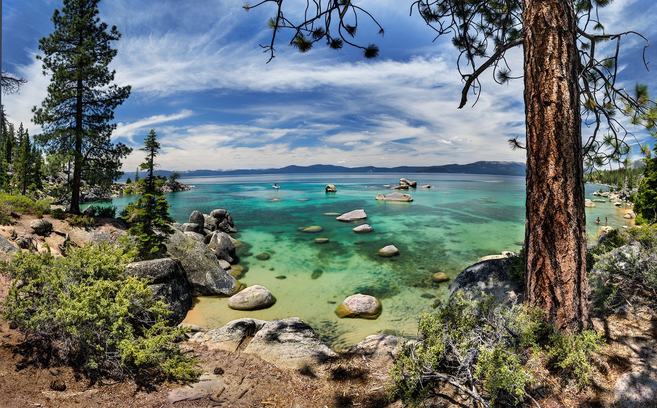
Whale Cove, Lake Tahoe, California
Around the summer solstice, when the sun reaches its highest point in the sky, sunlight penetrates deep into Lake Tahoe, enhancing the blue hues of its depths. Even in the shallows of Whale Cove on the lake’s eastern shore, the water’s luminosity differs from other times of the year. In winter, the low sun merely skims the lake's surface. In late spring, when the sun is directly overhead, as shown in this photograph, the lake's floor appears vibrantly colored. The rounded boulders that breach the surface almost seem to float.
Whale Cove derives its name from a large boulder located to the right of center that resembles a whale emerging from the lake with its broad mouth open. To the left, a motor skiff is anchored, and swimmers dive into the clear, chilly waters from its stern. A couple of visitors linger on the warmer shore to the right, soaking up the intense sun at this elevation of 6,000 feet. Others are tucked away in the shade of overhanging ledges, enjoying a book, meditating, or engaging in idle conversation.
The landscape was shaped by the surrounding ranges that rise several thousand feet above the lake. The Sierra Nevada Range to the west and the Carson Range to the east cradle the lake. Between these two ranges, the land’s subsidence and a volcanic tongue of lava damming its northern end have allowed snowmelt to fill the basin. The lake drains through a low point as the Truckee River, which then flows into Nevada’s Great Basin and empties into Flathead Lake before evaporating into the desert air.
more
Yampa River near Confluence with Green River, Colorado
Mirrored in the Yampa River, a 1,500-foot butte overlooks the convergence of two major tributaries of the Colorado River, marking the northern boundary of the red rock canyonlands. It is here, in Colorado’s northwest corner, that the green-blue waters of the Green River, cleared of its sediment by an upstream dam in Flaming Gorge, merge with the coffee-colored waterway of the free-flowing Yampa, the last of such rivers in the West. At this point, the converging rivers blend before being carried downstream by the current.
On June 17, 1869, after navigating a treacherous series of upstream rapids on the Green River, explorer John Wesley Powell camped with his crew at Echo Park, an open stretch of cottonwood trees and a large field of grasses adjacent to the confluence, marking a stop before their heroic passage through the Grand Canyon. In the shade of the same grove (if not all the same trees), my wife and our young children camped 123 years later. A few years later, the embankment gave way as the river changed course, eliminating the campsite and the grove.
In the late 19th century, Butch Cassidy and his infamous Wild Bunch passed through Echo Park as one of the stops along a series of escape routes and hideouts known as the Outlaw Trail. In the 1950s, Echo Park became the focus of a proposed dam just downstream from this confluence, which would have flooded portions of both river canyons and Echo Park. The resulting political battle led Congress to explicitly prohibit the construction of dams in national parks and monuments.
more
Ebb Tide, Cousin's Shore, Prince Edward Island, Canada
Garry Winogrand once said, "I photograph to see how something looks photographed." Like Winogrand, I often wonder how what I see through the viewfinder will translate into a photograph. Standing on the tranquil north shore of the Canadian Maritime province of Prince Edward Island, I set my view camera on its tripod and made a long exposure, contemplating how the sea might be rendered as it rhythmically lapped against the beach.
The resulting image gives the impression that time has stopped; everything seems perpetually fixed in place. That day, as I lingered on the beach, the sky cleared, the wind picked up, and the waves grew. However, for the most part, my memory has been replaced by the image itself; its enduring serenity has persisted for 50 years. The Bay of St. Lawrence appears to bulge slightly, with the light-toned ocean stilled by a brief period of calm along its near shore, while the darker tone just below the horizon depicts a brush of wind.
Sometimes the image is so spare that it could have been made anywhere. But upon closer examination, it features a few subtle characteristics unique to that location. The flat, granular evenness of the beach’s surface is indicative of a shore long worn down to sand and pebbles. Tides change little along this coastline, diminishing the size of waves on the incoming tides. Highlighting the flatness of the Bay of St. Lawrence, particularly along Prince Edward Island’s north shore, prevailing winds blow seaward, revealing an ocean shaded by the wind only where it strikes far offshore.
more
Sun Dog, Bristol Dry Lake, Mojave Desert, California
Driving through the Mojave Desert in southeastern California, I passed through a wild, open country dotted with abandoned truck stops, motels, and restaurants along old Route 66, now supplanted by nearby Interstate 40. Outside Amboy – a town surrounded by cinder cones, mountain ranges, and dried salt beds – I came across National Chloride, a salt mining operation. In the late winter afternoon, I pulled over to admire the vibrant sky above Bristol Salt Lake.
This brackish lake formed in a depression that collects salt-rich sediments from the surrounding mountains. Unlike other western desert lakes during the Pleistocene era, when the climate was cooler and wetter, the playa has never filled with water. However, after rare rainstorms, it is covered by a shallow pool. Dissolved halite (rock salt) circulates within the water table just beneath the lakebed, fueled by the magma heat of this volcanic region. First extracted here in 1858, salt mining and, more recently, the active development of lithium extraction continue.
Sundogs are a type of halo, an optical phenomenon created by the interaction of sunlight with cirrus clouds composed of ice crystals that float horizontally in the atmosphere. They refract light horizontally, producing red, white, and blue spots to the right and left of the sun (thick clouds obscure the left sundog). Also called ‘phantom suns,’ they can be generated by moonlight and may occur on other planets. They are more common in specific locations on Earth, such as the Mojave Desert, where the sky is often filled with cirrus clouds.
more
Slickhorn Canyon, near San Juan River, Utah
A mile upstream from its confluence with southern Utah’s San Juan River, Slickhorn Canyon shelters an alcove teeming with plants and wildlife. Eight-hundred-foot cliffs shade and protect a pool along a creek fed by spring snowmelt and summer monsoon downpours.
Slickhorn’s talus slopes and rockfalls clutter its gulch with boulders, bordered by cottonwoods and junipers. Flat blue-gray rock, a blend of sandstone and limestone, paves the canyon floor in a series of shelves that stair-step down to the river, fed by a meandering stream and interspersed with occasional oases formed in shallow depressions on the shelves. Like its indigenous wildlife, hikers depend on these pools to fill their bottles as they venture up the canyon from rafting campsites along the San Juan River. Others trek down from the canyon’s upper rim to the river, passing ancient Ancestral Puebloan cliff dwellings and painted and carved depictions of people, animals, and abstract designs on the canyon walls.
At this location along the ravine’s lower end, shale has fractured into perpendicular blocks compressed by the weight of the overlying rock. Undercut by erosion and cleaved from the cliff, the slab in the photograph’s center careened down a steep slope, coming to rest alongside this verdant pond. Coating the exterior surface of the encircling walls are dissolved particles of iron oxide and hematite, trickling down to create a red, yellow, and brown veneer that contrasts with the pale rectangular boulder. Its white, unvarnished glow suggests that it was only recently excavated from the wall above and will, over the next few hundred years, begin to blend with the canyon’s stained walls.
more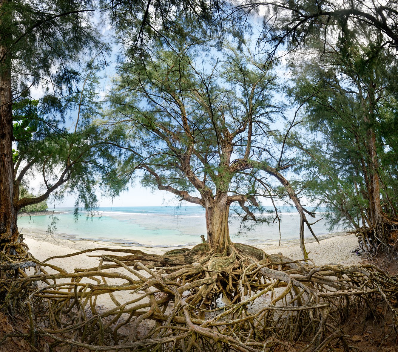
Ke' e Beach, Kauai, Hawaii
At the end of the road along Kauai's north shore lies a beautiful and popular beach, surrounded by a wilderness of high mountains that meet the shore along a narrow fringe of sandy white beaches. From May to September, an offshore reef breaks the waves, protecting the foreshore's tranquil turquoise swimming pool of seawater. This beach becomes increasingly hazardous from October to April as the easterly trade winds shift to a northerly flow, bringing dangerous currents and high waves that overrun the reef and erode the beach.
Evidence of this erosion is the exposed roots of Casuarina trees on the beach terrace. As I approached the beach, this tree caught my attention as it almost seemed to hover in the air, its tethered roots anchored to the ground. Though they might appear indigenous to Kauai, the non-native Casuarina trees were planted in the 1870s as windbreaks. They thrive in the shoreline's saline soil, grow rapidly, and have a short lifespan. After planting, they invade an area, edging out other plants by emitting toxins that prevent them from taking root, leaving the ground bare beneath their thick canopies.
In addition to damaging winter storms, rising sea levels are expected to submerge 90% of the island's beaches by 2100. Kauaians are comprehensively addressing these threats and the growing impact of tourism on beaches. For example, they have closed Ke 'e Beach to vehicles and instead provide bus service as one step in implementing a series of island-wide measures to mitigate these effects on their population, nearly all of whom reside along the island’s vulnerable coastline.
more
Ebb Tide, Elliott Bay, Puget Sound, near Seattle, Washington
South Beach stretches along Elliott Bay in the Puget Sound, extending from the Seattle neighborhood of Magnolia to the West Point Lighthouse in Discovery Park. Formed from sediment deposited by longshore currents, this silt- and sand-laden beach plunges just past the tidal zone to over 100 fathoms. On this late afternoon, evenly spaced waves broke with the regularity of a metronome, undulating in a slow-moving rhythm along the low tide line.
The surface and sounds of the bay are typically quiet. The fetch across the narrow sound is not long enough to create sizable or consistent breakers. “Puget Sound was known as "Whulge," an onomatopoetic Coast Salish word denoting the sound of waves. If you listen closely, the waves washing against the Puget Sound shoreline make a subtle sound. It is not the booming surf of the outer coast but something unique to our region. The quiet, persistent sound of an inland sea," wrote David B. Williams in his book "Homewaters.”
However, large, fast-moving container ships often steam past South Beach as they head to or depart from the Seattle shipyards. The energy generated by plowing through water from the ship's bow sends out trails of V-shaped waves. These ships produce waves of remarkable uniformity and size, lasting for half an hour and reaching 3 to 6 feet, large enough for a small group of Puget Sound surfers. As shown in this photograph, there are times when an oscillating swell created by wind and tidal currents courses diagonally to the ship waves, resulting in a geometric, rippling pattern called a cross sea, which creates a subtle moiré pattern.
more
Spring Melt, Grand Falls of the Little Colorado River, Arizona
Grand Falls in northeastern Arizona lies within a remote basin traversed by the Little Colorado River. The river originates from the snowy peaks of the White Mountains and is fed by natural springs along its 300-mile journey before merging with the Colorado River in the heart of the Grand Canyon. The river's flow varies in intensity and color with the seasons. Also known as "Chocolate Falls," during early spring, rainfall and snowmelt wash muddy sediment from tributaries, tinting the river ochre. An emerald-blue trickle, dyed by travertine-rich spring water, runs over the falls during dry spells.
At one time, my camera's location would have been 200 feet above a canyon that once served as the river's channel. When I took this image decades ago, I stood atop a lava flow that, 20,000 years earlier, had filled its historic gorge. The hard, impermeable lava forced the Little Colorado to carve a new route around the volcanic rock, causing it to cascade over a section of the canyon wall seen on the right side of the photograph.
Across the river, on a butte, lies the hillside letter "G," designating "Grand Falls." That has since vanished, along with the open road to the falls. In 2023, tribal residents closed the area. Like other ancestral sites in the West, rapidly increasing tourism has made places such as Grand Falls unsafe and unmanageable. The river sustains local agriculture and holds sacred significance for the ancient beliefs of the native population. Zuni farmer Jim Enote described the river as "an umbilical cord that connects us back to our emergence place, the Grand Canyon."
more
Steins Pillar, Ochoco Mountains, Oregon
Forty million years ago, a rapid series of eruptions released thick flows of volcanic pumice, ash, and dust that swept across the Ochoco Mountains in north-central Oregon. While still hot, these materials fused into solid rock. As the volcanic tuff began to erode, minerals within it leached over the rock, forming a thin, impervious coating that preserved outcrops of the formation and tinted them yellow and red. When the rock cooled, one section fractured and split into a long, slender column: the 350-foot-high Steins Pillar.
When I moved to Central Oregon, I encountered a landscape almost entirely covered in volcanic rock, so it was a surprise hiking to this immense column, which resembled the types of formation I used to explore in southern Utah's Bryce Canyon. Even the ponderosa pines appeared similar to those along Bryce’s trails, where, like here, they grow around the bases of rocky spires. However, Steins Pillar is not composed of eroding sedimentary rock. Instead, it is part of a long history of Oregon’s volcanic eruptions that shaped its mountains and created the lava flows that cover the high desert plains.
In the Ochoco Mountains, the underlying lava retains water, nurturing dense thickets of ponderosa and lodgepole pines that support a thriving population of deer, bobcats, black bears, and mountain lions. The monolith presides over the surrounding old-growth forest. Rock climbers have long attempted to scale its overhanging layers, grappling with pitons penetrating its hardened exterior, often losing their grip when embedded into the softer, chalky interior. Challenging and dangerous, it was finally summited in 1950.
more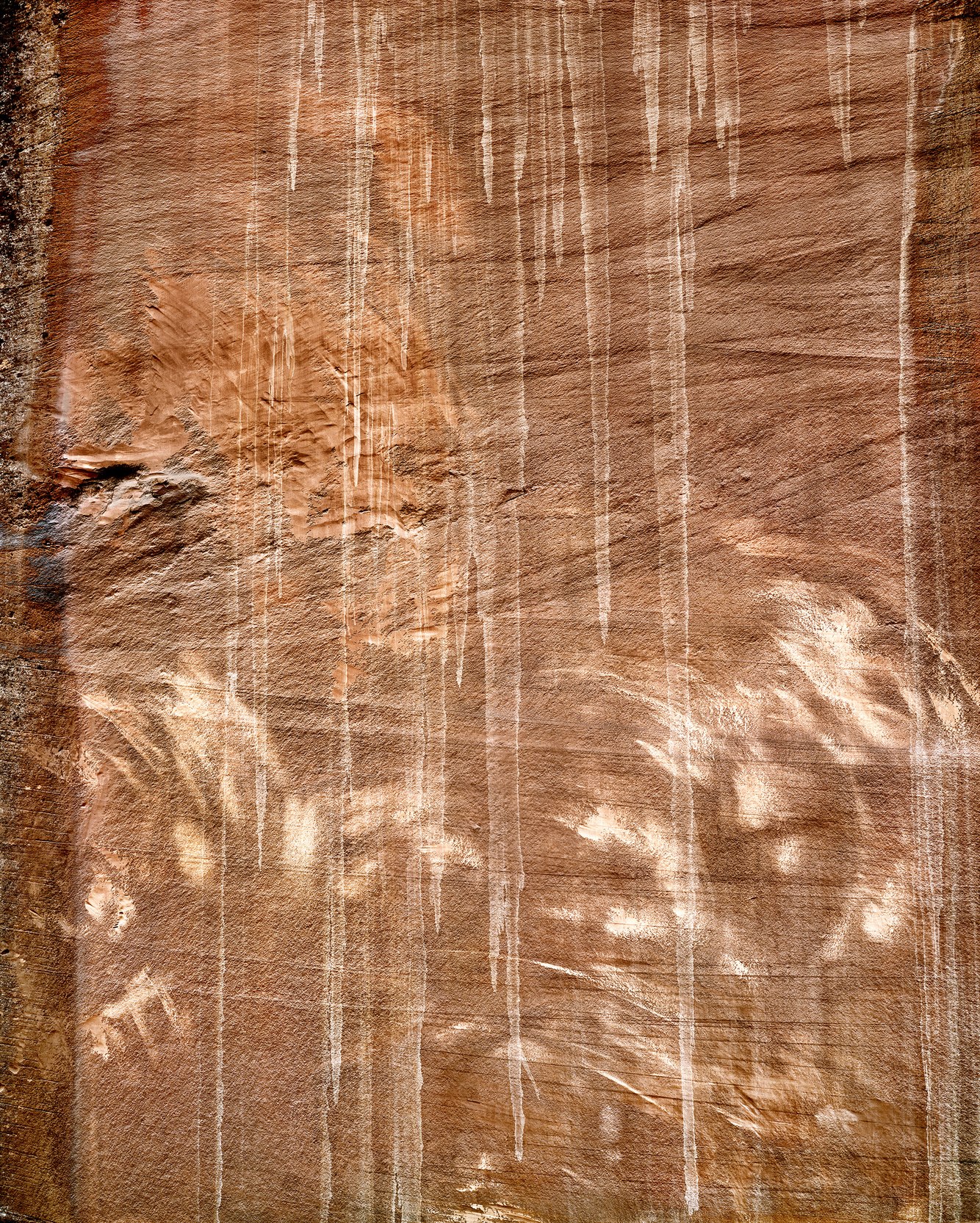
Tree Rubbings, Choprock Canyon, Escalante River, Utah
"There is poetry in everything if you look closely enough," observed artist Cy Trombly. Ancient cliffs border central Utah's Escalante River. The sheer walls chronicle their geologic history, recorded in a palette of tones, colors, and textures on the smooth surface of Wingate Sandstone. Initially, I couldn’t grasp what was at play, trying to parse the complexity of one inscribed wall’s patterns. Underneath its surface markings, layers of once-shifting ancient dunes are outlined in wavy lines. Desert varnish darkens the left side of this wall through an accumulation of minerals and bacteria interacting with sunlight and water. Thin, pale vertical rain streaks leave delicate drip marks down the height of the wall.
Finally, petroglyphs – markings and incisions formed not by human hands but by natural forces – were elegantly scraped and engraved onto the cliff wall. I wondered, "How were these lightly brushed and darkly engraved gestures created?" Observing the dead trunks and limbs of cottonwood trees beneath the wall, I realized that the limbs and branches, swaying in the wind, had produced these marks. It was something I had never seen before.
The convex-curved wall, arching forward in height, intersected with the growing limbs and branches of a cottonwood tree. This effect recalled Twombly's pencil and chalk drawings. As the wind shifted them, the thinner branches lightly brushed against the surface, while the limbs and thicker branches engraved the rock. Whether they are branches as extensions of a tree or a hand as an extension of an artist's eye and mind, both naturally create sweeping marks. As Twombly observes, "I am not interested in straight lines. I am interested in curves, irregularities, and accidents."
more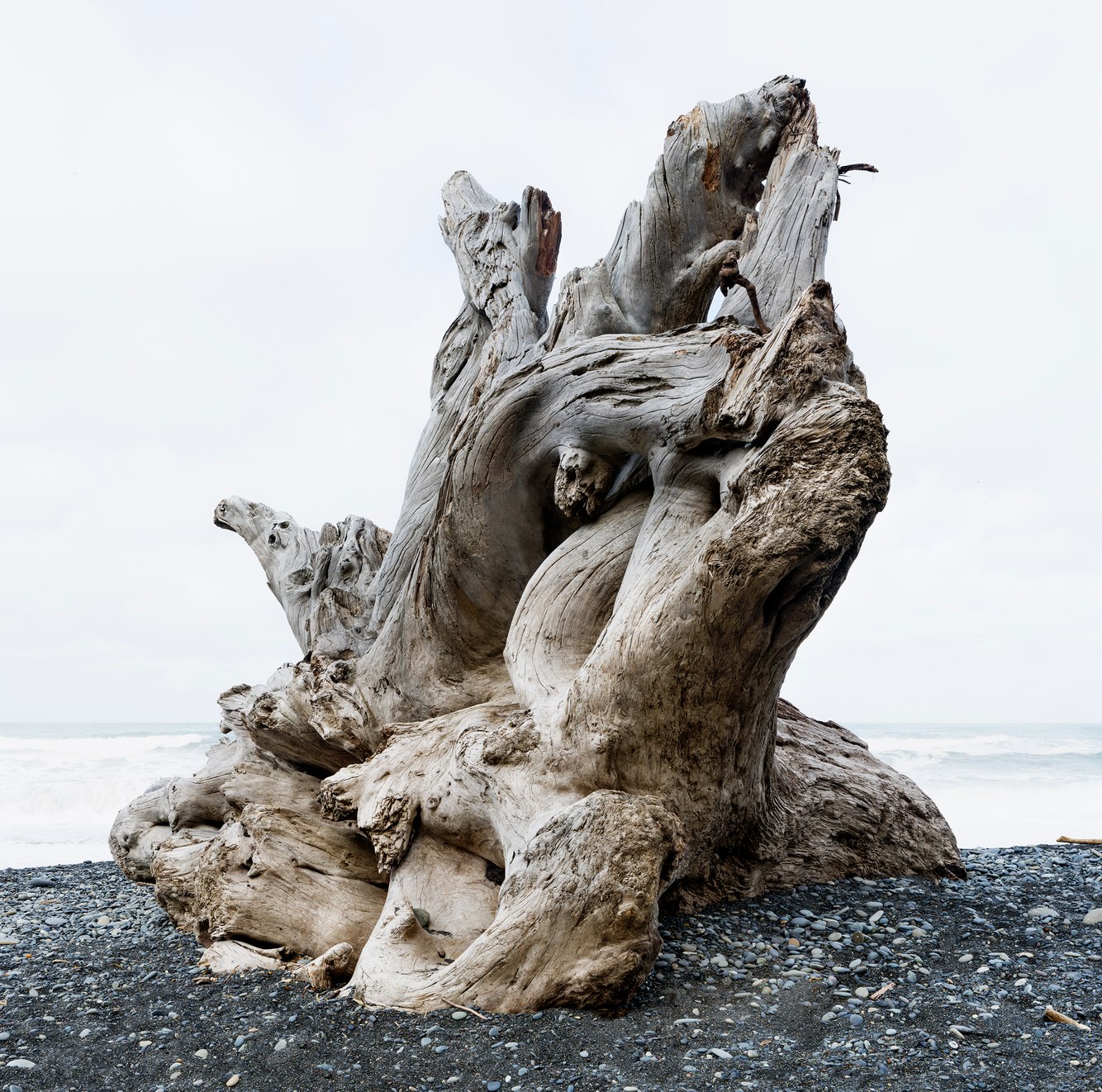
Drift Log, Rialto Beach, Olympic Peninsula, Washington
Rialto Beach is a mile-and-a-half-long stretch filled with driftwood along the northwestern coast of Washington. Sometimes described as a graveyard of trees, it possesses a brooding quality. On this quiet, cloudy morning, the misty shore is a chaotically arranged museum of wizened tree trunks and root balls. Each skeleton of wood, embalmed in salt and bleached by the sun, exhibits a rough-hewn grace, expressively rendering its final gesture.
The beach's proximity to the major rivers of the Olympic Peninsula—especially the Quillayute and Hoh—captures the remains of Western red cedar, Douglas fir, and Sitka spruce that have fallen into rivers and been swept to sea by the current or cut timber that broke away from log rafts sent downstream to ports. The trees, stripped of bark and branches, often traveled great distances, aided by storms, tides, and ocean currents. Timber harvesting has dwindled, and fewer mature forests remain; therefore, less driftwood washes up.
The turbulent ocean has tumbled and smoothed piles of driftwood, ranging from small, polished sticks to massive old-growth rooted trunks. On shorelines like Rialto Beach, which are exposed to winter storms, some of the highest levels of beach loss occur along this coast. However, sturdy embankments of large, stacked driftwood trunks, several yards wide and dozens of yards long, line the upper beach and slow this erosion. When storm waves rise and crash against these piles, the beach rumbles.
more
Joshua Tree, Joshua Tree National Park, California
Anthropomorphizing elements in nature is often used when describing the natural world. While assigning human-like qualities to nature can enhance our sense of connection, it can also be misleading. For instance, in the 19th century, Mormon pioneers crossing the Mojave Desert were credited with naming the Joshua tree; its upturned branches were believed to resemble the arms of the prophet Joshua, pointing toward the Promised Land. In truth, the tree lifts its limbs toward the sun to allow its leaves to convert water into sugar, fueling its growth.
It is also known as “Izote de desierto,” which translates from Spanish to "desert dagger.” This name aligns more closely with its characteristics, as its dagger-shaped leaves store rainwater and protect the tree from animals. The Cahuilla people refer to it as Hunuvat chiy'a, which translates directly to the tree itself rather than as a metaphor or simile. The Cahuilla Nation of inland Southern California utilizes it to make medicines, sandals, roofing, and baskets.
A characteristic that surprises many upon their first sighting is the Joshua tree’s striking resemblance to Dr. Seuss’s Truffula trees. Strictly speaking, Joshua trees are not actually trees but rather succulents belonging to the genus Yucca. To ensure their survival, they have two root systems—one deep and one shallow—that ensure a more consistent water supply, however, young trees are particularly vulnerable to prolonged dry spells. With the changing climate causing ongoing droughts in the Southwest, fewer seedlings are reaching maturity, and they may nearly disappear by the end of this century. As writer Jeannette Walls states in her book The Glass Castle, “it's the Joshua Tree’s struggle that gives it beauty.”
more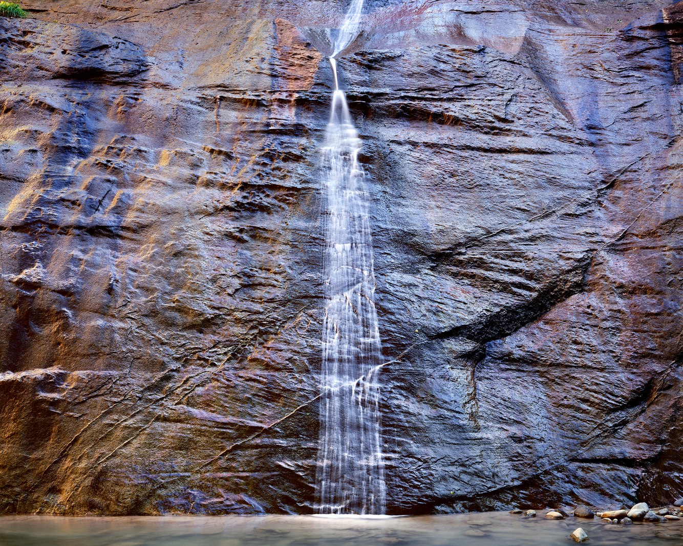
Mystery Falls, Zion Narrows, Zion National Park, Utah
One of my most memorable hiking adventures was walking up the North Fork of the Virgin River, navigating its narrow canyon in southwestern Utah's Zion National Park. At the trailhead, I stepped off the riverbank and into the stream. As I walked against the current, I absorbed the vertiginous scene, gazing up at the 2,000-foot-high vertical Navajo Sandstone cliffs on either side. I felt small, almost invisible.
I walked through the Zion Narrows, where a ribbon of rich blue sky lit the constricted walls. Sunlight reflected off the warm-toned rim of the ravine, adding a subtle blend of colors. I was drawn to a small cascading waterfall etched by radiant light, with a gentle stream spilling down a damp wall covered in moss, lichens, and algae. Later, I learned its name: Mystery Falls. In 1977, the side canyon that feeds the falls was first hiked. Faced with the final 120-foot rappel down the slick face of the waterfall to the canyon floor, the hikers wondered how they would find enough secure footing to descend this slippery incline, calling it a “mystery.”
Sourced at the crest of the Colorado Plateau, this elevated and deeply incised plain spans much of Utah and parts of neighboring states. Over time, geological forces have uplifted the land several thousand feet. Spring snowmelt swells this tributary of the Colorado River, and sudden downpours in the high country can trigger flash floods, increasing stream flow a hundredfold. Consequently, the river's erosive power has carved—and will continue to deepen—this channel through the heart of Zion.
more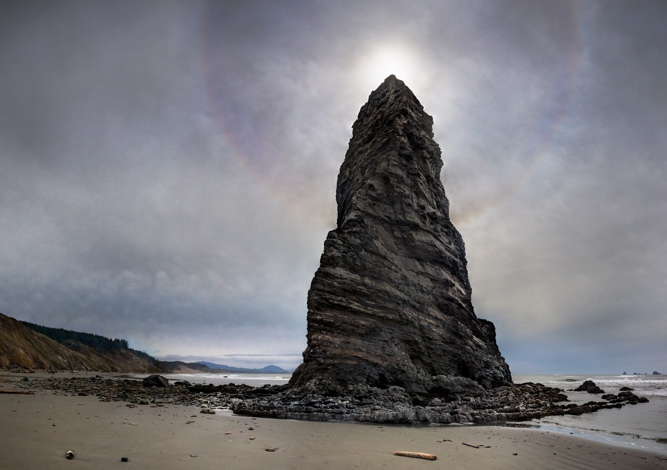
Sun Halo, Needle Rock, Cape Blanco, Oregon
Needle Rock, backlit by the midday sun, appeared out of place and oddly imposing against the soft, haloed light. Resembling an oversized arrowhead adorned with a brilliant, ethereal glow or the enigmatic "Eye of Providence" pyramid found on the back of one-dollar bills, this formation stood prominently at the low tide line of a beautiful, relatively unvisited shore along Oregon's south coast. Like other sea stacks, it is a remnant of a former headland – a hardened wedge of sandstone and conglomerate rock, its swirling layers tilted upward.
The movement of the Pacific Ocean's tectonic plates, slipping beneath the North American continent just offshore, pushes the Earth up along its outer edges. These crustal movements have shaped the headlands behind and to the left of this stack, lifting this part of the coastline into dry land. Geologically speaking, the cape's rising terrace is advancing rapidly, approximately an inch every decade. At the same time, eroding this upward movement, its rubbly slopes are prone to frequent landslides, and winter's ocean storms wear down its cliffs.
The sun broke through the thinning overcast as I set up my camera. Sun halos, while uncommon, form when clouds consist of ice crystals, typically cirrus or, in this case, cirrostratus clouds. They refract sunlight to create a bright circle with a radius of 22 degrees around the sun, accentuated by a sky slightly darkened between the sun and its halo. Under certain conditions, like here, the outline exhibits a color spectrum reminiscent of a faint rainbow.
more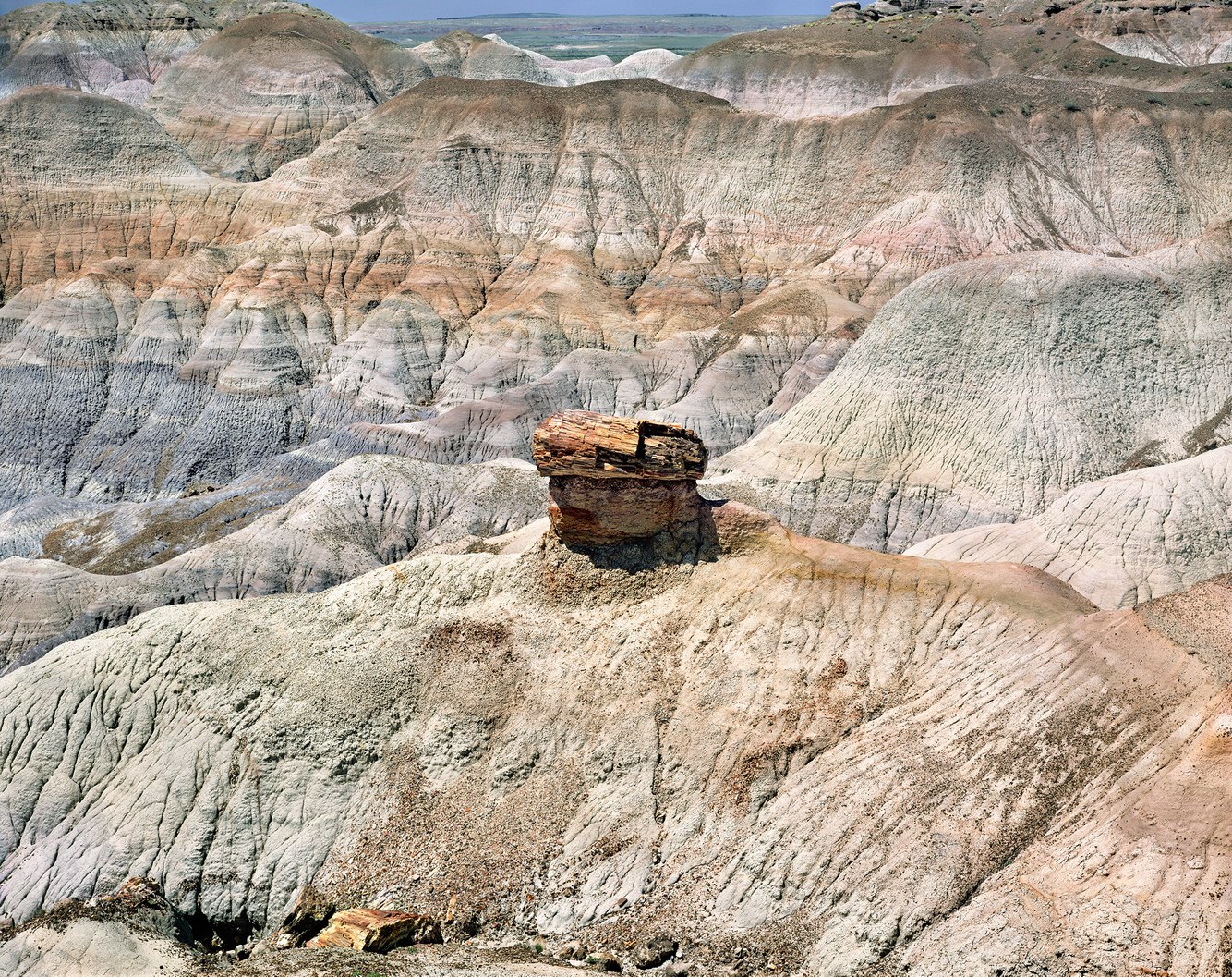
Petrified Tree Trunk, Blue Mesa, Petrified Forest National Park, Arizona
Balanced on a crumbling pedestal rests a piece of petrified wood from an extinct conifer tree buried under clay, mud, and sand in tropical waters 220 million years ago. During that time, conifers, fern trees, and ginkgoes dominated a warm, wet landscape along vast waterways and often reached heights over 200 feet. Because of the way they became preserved, none of the fossilized trees I encountered in Petrified Forest National Park were standing. Trees that fell oftentimes became submerged in river channels or floodplains where the lack of oxygen inhibited their decay.
Stripped of bark and branches and interred in sediment, ash from nearby volcanoes was the primary ingredient for petrifying trunks. Ash filled the air and dissolved in streams, saturating fallen trees and replacing nearly all their tissue, replicating their structure and texture. Through a complex process that begins rapidly and then progresses slowly, the chemical composition of the ash eventually transforms the wood into quartz. Remnants of a tree's lignin, the organic material that provides wood its hardness and strength, were sometimes encased within the quartz, offering a biological trace of its former existence.
more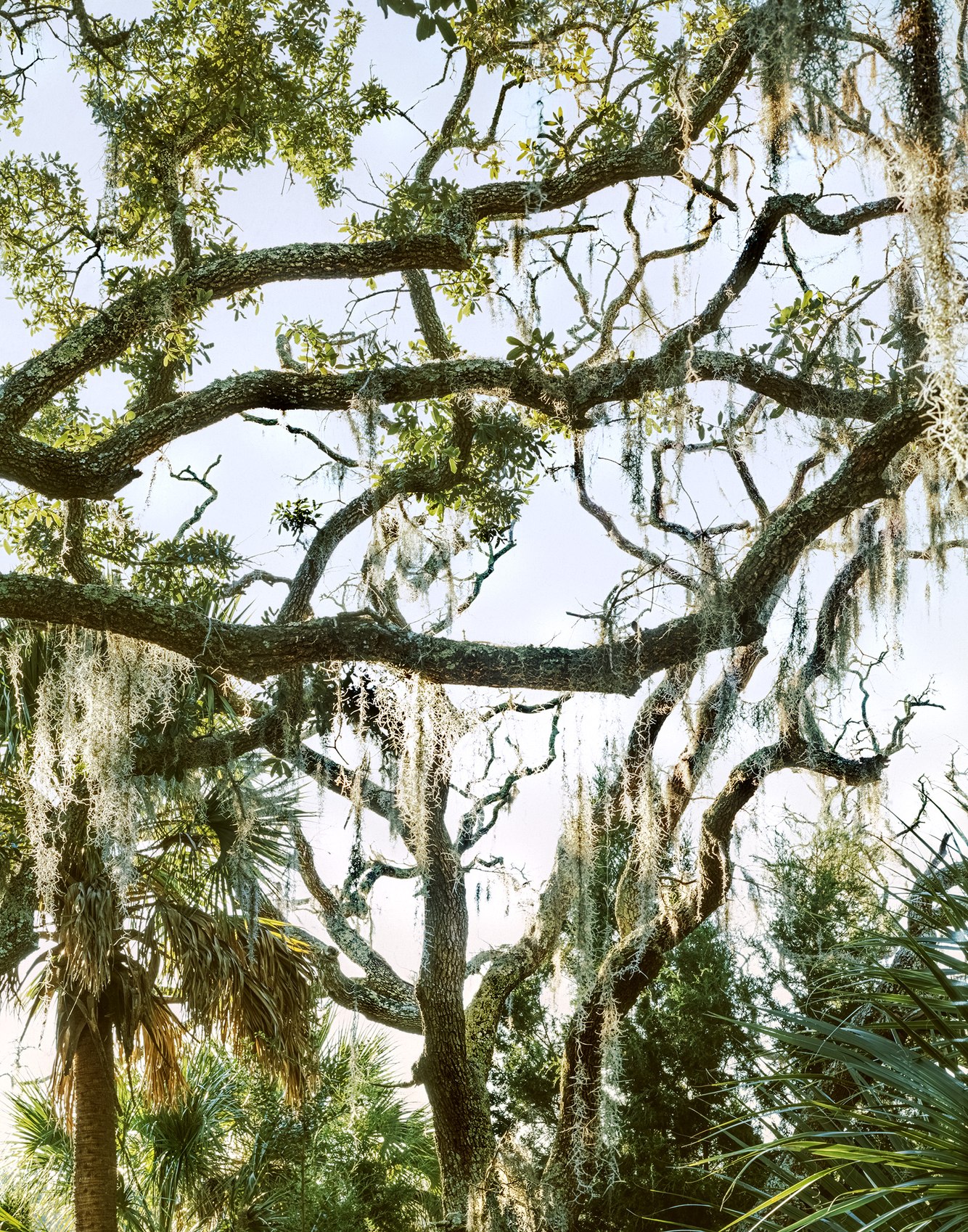
Live Oaks and Spanish Moss, Spring Island, South Carolina
The barrier islands along South Carolina's coast, including Spring Island, present a serene and relaxed appearance defined by their mild climate, lush vegetation, and tranquil waterways, all of which belies a tumultuous past. Geologically, this coastline formed when the enormous continent of Pangaea broke apart, creating North America and Africa and opening the Atlantic Ocean between them. The processes of building and eroding the coastal barrier islands alternated as the climate changed and sea levels rose and fell. Today, the island rests on a foundation of soft sediment skirted by marshland.
The botanical and cultural histories of the barrier islands are intertwined. Spring Island has served as a gathering place for native tribes and, in the last century and a half, a home for European immigrants. Over several millennia, it has been used for hunting, gathering fruits, building settlements, clearing land, and raising crops such as indigo, rice, and cotton.
Today, the island's nature preserve is privately held in trust to restore its natural history. Live oaks dominate the island's native plant life, reclaiming their original foothold. Their limbs bend at the elbow, with branches raised skyward. Long strands of Spanish moss hang from the trees, gathering water for nourishment, appearing grey when dry and green when wet. Beside the live oaks in this photograph stands a Sabal Palm on the left and smaller Needle Palms on the lower right. These plants thrive in the warm, moist climate and prosper in sandy soil, susceptible to sea spray and saline water that would inhibit the growth of many other plant species.
more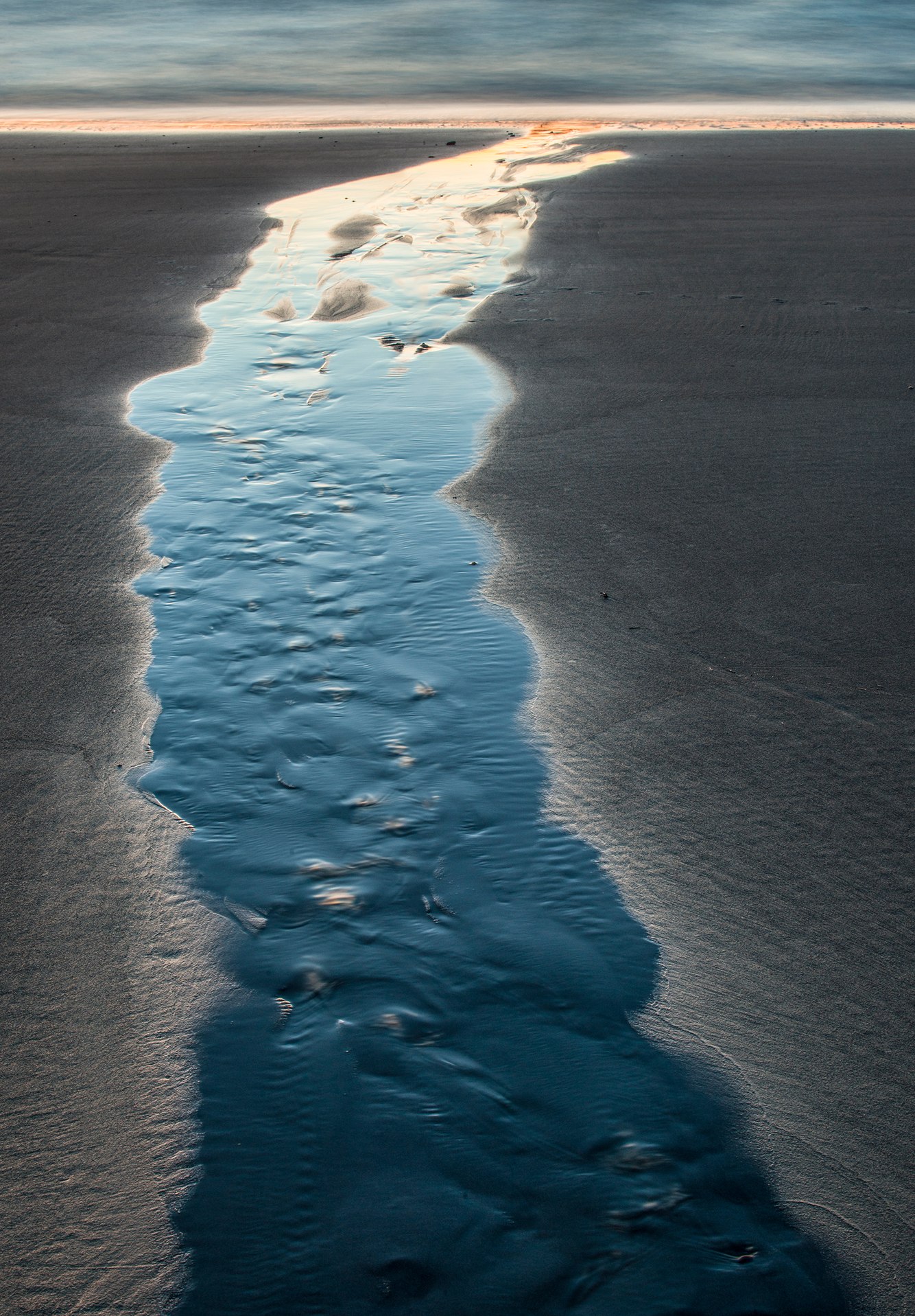
Beach Stream, Lincoln Beach, Oregon
Flowing across the tidal flats during twilight’s low tide, this stream faithfully mirrors the colors of the sky, transitioning from the deep blue of the zenith, to the lingering orange hues of the horizon after sunset. As the tide recedes, these sinuous streams emerge from the base of the cliffs bordering Lincoln Beach, blending the freshwater seeping from the berm with the ocean water released from beneath the intertidal sand. Some streams reach the ocean’s edge, while others fade into the sand.
In this photograph, the high concentration of black ilmenite rock grains darkens the wet sand, lending vivid radiance to these tidal streams. Ripples appear where the stream meets the edge of the sand, and in its center, small waves known as “antidunes” form and travel upstream. The channel carries organic matter into the ocean that nourishes marine life, while land-bound creatures simply enjoy watching them flow.
This expansive flat beach, framed by a forest of Sitka spruce, has a long history of habitation and visitation, beginning with the Coastal Salishan tribes, whose archaeological evidence indicates they inhabited Oregon’s coast for at least several thousand years. Explorers like Sir Francis Drake (1597) were followed by others of European descent who arrived by land and sea. The first known instance of tourism at Lincoln Beach took place in 1837 when two couples traveled by horseback from the Willamette Valley to spend several weeks on an extended honeymoon, enjoying the ocean and cooking clam and fish dinners. Almost two centuries later, modern visitors still travel here seeking the same kind of experience.
more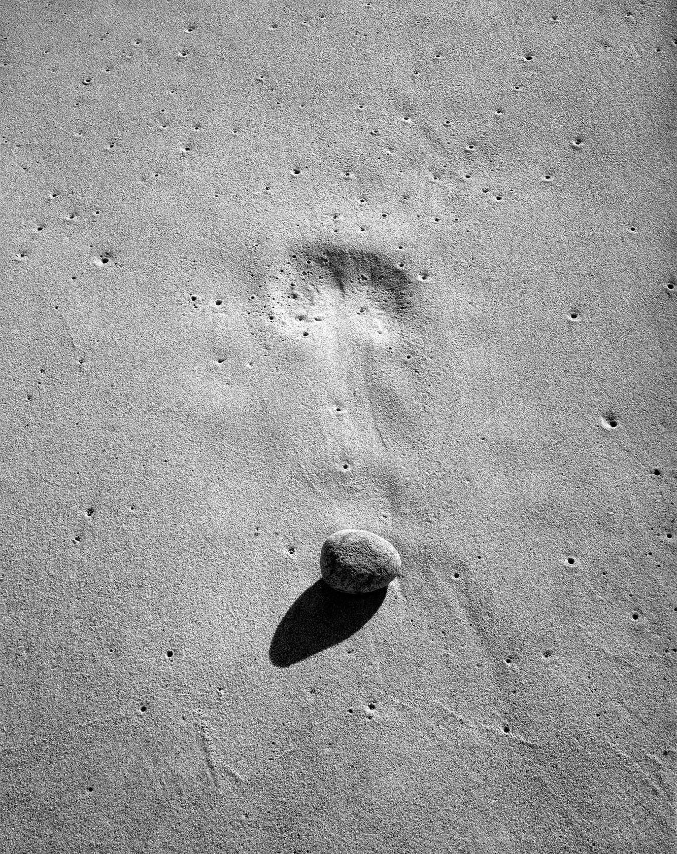
Waterworn Stone, Coast Guard Beach, Cape Cod
“Objects on the beach, whether men or inanimate objects, look not only exceedingly grotesque but much larger and more wonderful than they actually are,” wrote Henry David Thoreau in 1852, reflecting on his walks along “The Great Beach,” the 28-mile outer coastline of Cape Cod that began at the same beach where I took this photograph 122 years later.
The backwash of a breaking wave filled the porous sand with water and air bubbles on this beach facing the Atlantic Ocean. The receding wave lifted a stone from its resting place and drew it down the slope. Water filtered through the grains of sand, forcing trapped air to rise and create tiny cavities on the beach. As these cavities burst, small depressions formed around them. Later, after the tide ebbed and the sand dried, I came upon this unexpected juxtaposition of the stone, its imprint, and this canvas of stippled sand.
Cape Cod is a glacial moraine composed of rock, sand, and silty rubble, spread by outflow streams emerging from the toes of melting glaciers that began 18,000 years ago. They also deposited glacial erratics, ranging from house-sized boulders to rare beach stones found along the shore. Since the last ice age, weathering has eroded the shoreline by a few feet each year. Major storms – like one that occurred four years after this photograph was taken – have caused episodic attrition in Coast Guard Beach. Thus, fifty years after this photograph was taken, its location now lies well offshore. The entire Cape is expected to vanish into the sea in several thousand years.
more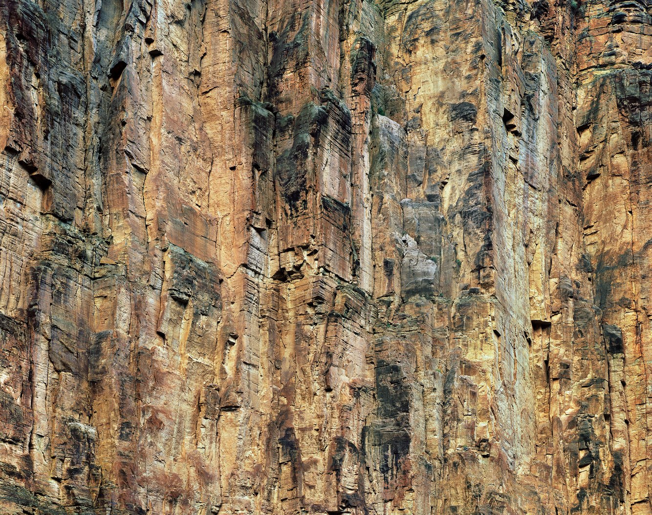
Parashant Canyon, near the Colorado River, Arizona
Parashant Canyon lies at the western end of Arizona's Grand Canyon National Park. Here, the Colorado Plateau, Mojave Desert, and Basin and Range country meet, with each ecoregion hosting unique landforms and life forms. While rafting on the Colorado River, I took passage through a deeply carved landscape to explore and photograph the subterranean core of this botanically and geologically diverse region.
Originating from the Paiute word Pawteh' ee oasoasant, meaning "tanned elk hide," the canyon's sheer, towering walls exhibit a patinated facade that echoes the warm hues and coarse texture of stretched and dried animal hide. The muddy remnants of organisms that once flourished in ancient oceans and shorelines—such as sponges, corals, mollusks, and worms—form the wall’s countless layers. Over the past 500 million years, the accumulated sediment has been compressed and solidified into limestone, mixed with sandstone and shale beds, and then shifted and shaken along fault lines.
Its fractured walls reveal ancient fossils, including the "Book of Worms," a section of rock filled with thick calcified worm burrows at the base of this wall. In his book “The Grand Canyon of the Colorado,” naturalist John Muir wrote: "The whole canyon is a mine of fossils … forming a grand geological library – a collection of stone books … And with what wonderful scriptures are their pages filled – myriad forms of successive floras and faunas, lavishly illustrated with colored drawings, carrying us back into the midst of the life of a past infinitely remote … ."
more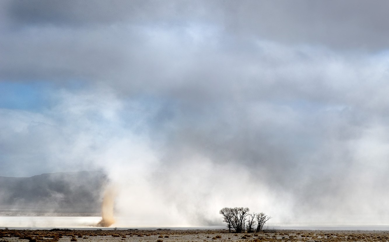
Dust Storm, Alvord Desert, Oregon
The Alvord Desert is a 12-by-7-mile alkali flat in the rain shadow of Oregon's Steens Mountain. Usually, the air above this dry lakebed is still. So still, when lying on its flat surface, one can hear booming sounds believed to be generated by seismic activity along fault lines beneath the desert floor.
During the last ice age, the much larger Lake Alvord extended 100 miles from southeastern Oregon into northern Nevada. Overflowing from glacially fed streams, the lake burst through its terminal moraine, sending floodwaters east into Idaho's Snake River. Over several millennia, the climate grew warmer and drier, and the glaciers melted away, leaving a flat basin filled with mud and sand. Today, what remains is an open expanse of cracked clay. Rainfall is scarce, though natural hot springs along its perimeter water wild horses, and its seeps flow into the desert's edge where nesting birds reside.
In the winter, windstorms raise clouds of silt and salt-laden dust that race across the lakebed. Convective vortices accompany these squalls known as 'dust devils'; rust-colored columns rising to a hundred feet. Whirlwinds erupt aside the lake's old shoreline when there is a heat differential between the playa's baked surface and the cooler air along its grassy edge. These funnels inhale the heated air, rapidly spinning and lifting as the wind's direction carries them. In this photograph, the dust devil's scale renders the nearby grove of fully-grown cottonwood trees minuscule by comparison.
more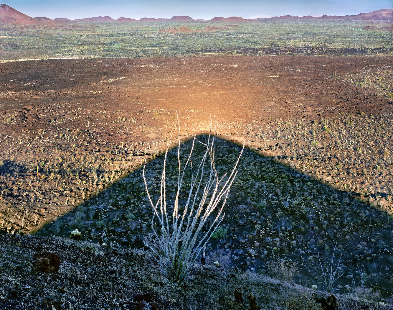
Ocotillo, El Cono Mayo, Sierra Pinacate, Sonoran Desert, Mexico
Occasionally, identifying the location of my photographs can be challenging, especially when preparing to write about a remote area. After searching Google Maps, I discovered I had set up my view camera at 31.897 degrees north and 113.368 degrees west, atop the crest of El Cono Mayo's volcanic cone, a few hundred feet above this lava plain.
Located in northwestern Mexico, the Sierra Pinacate is a lofty moonscape filled with volcanic peaks, lava flows, craters, and cinder cones formed over the past five million years. Designated as an international biosphere reserve – a conservation zone of landscapes, ecosystems, and species – it remains a rugged, uninhabited terrain surrounded by a vast sea of windblown dunes. This region supported an Indigenous population twenty thousand years ago during a cooler, wetter climate. Today, despite only six inches of annual rainfall, these isolated highlands continue to host a variety of life forms, many of which are endemic.
Ocotillo, meaning "little pine" in Mexican Spanish, is classified as a desert plant. However, it was initially regarded as a pine (Ocote) because its stalks produce a similar resin that Indigenous peoples once used. The plant resembles a thorny bouquet of dried branches; its lower stems remain green throughout the year, while red flowers bloom from their tips following the spring and summer rains.
more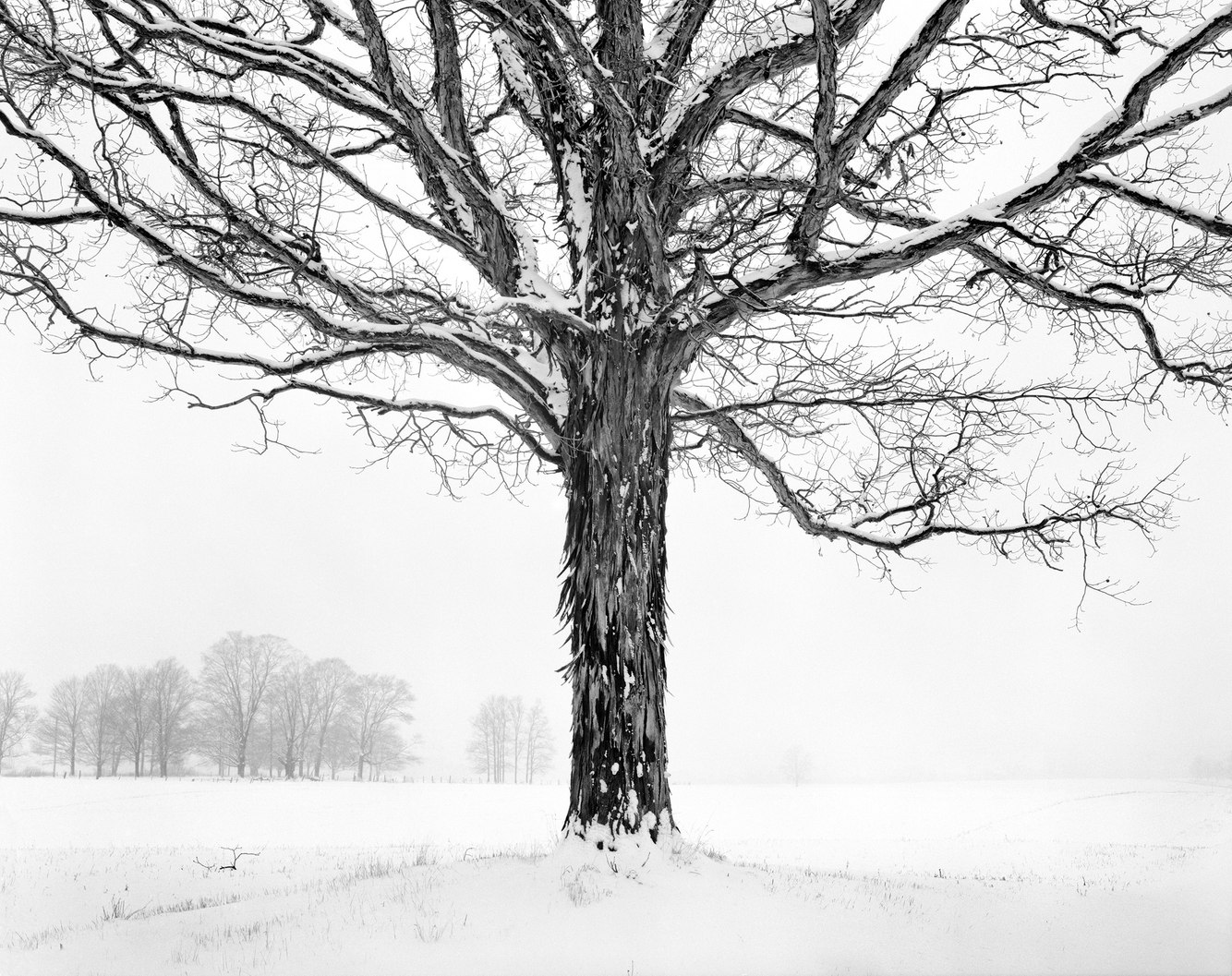
Shagbark Hickory, near Edinboro, Pennsylvania
Although tree species can be hard to identify, Shagbark Hickory trees are distinctive, especially their bark silhouetted against an open field on a snowy day. When mature, large, flat strips curl outward at the ends and naturally exfoliate from the trunks.
Native to the Midwest and common in the eastern U.S., these trees thrive in sunlight, moist soil, and humid climates—making them perfectly suited for Pennsylvania's upland snowbelt southeast of Lake Erie. They possess long taproots, making them difficult to transplant. Due to their long, slow growth—they can live for up to three hundred years—they do not cluster in groves but rather intermingle with oaks, pines, and maples. Many of the trees alive today, including this old specimen, predate the region's agricultural development.
Historically, their wood, bark, and nuts have been highly valued. Eighty percent of tool handles are crafted from their strong, hard, shock-resistant wood. The crevices in their trunks provide a daytime roost for sleeping bats, and the bark has been used as a food source. However, it is the tree's nuts that are truly exceptional. They have historically been a staple for native peoples, wildlife, and anyone willing to patiently crack open their tough shells. Although harvest sizes vary, entire regions yield an extraordinary abundance of nuts once every few years. The exact reason for this phenomenon remains a mystery, but speculation suggests some form of communication—whether through air, ground, chemical signaling, or available pollen—alerts other Shagbark Hickories across hundreds of miles to produce a similar bounty.
more
Santa Rosa Range, north of Winnemucca, Nevada
Driving north on Route 95 from Winnemucca through the Quinn River Valley, this region represents northern Nevada's distinct landscape: stunning, endless basins filled with grasses and sagebrush—an exquisite, existential expanse dotted by ranches and small communities. Occasionally shrouded in smoke and dust, especially during late summer wildfires, I recall Hank Snow’s rendition of “I’ve Been Everywhere," singing, “I was totin’ my pack along the dusty Winnemucca road.”
On this midwinter morning, the air was so clear that I could almost touch the snow-covered Santa Rosa Range etched against the horizon. I paused to photograph these mountains, shaped by the arduous movement of tectonic plates that folded and stretched Nevada into waves of ranges and basins. These ranges created unique ecological islands filled with pristine meadows, wildflowers, and stands of aspens and conifers.
The agriculture and ranching in the area depend on the Quinn River, which is fed by snowmelt from the high country. Grain fields surround the community of Orovada in a valley that once served as a lush corridor between the winter and summer settlements of the nomadic Paiute and Shoshone peoples. Today, the tribe’s reservation and the primarily Anglo ranching community—both reliant on fertile soil and clean air— are confronted by the development of a lithium mine that threatens their way of life. Their communities are profoundly impacted by a mining operation that ironically aims to create efficient and cleaner methods of energy production while endangering the air and water of the people and wildlife inhabiting this pristine landscape.
more
Salt Flats near Little Hebe Crater, Death Valley, California
Two thousand years ago, Death Valley's Little Hebe Crater and adjacent Ubehebe Crater erupted. In contact with molten rock within the Earth, groundwater became superheated, exploding as it neared the surface. The blast episode was short, lasting days or perhaps weeks. It released volcanic rock and pulverized sedimentary limestone, mudstone, and quartzite, forming a sooty, gravelly coating that covered several square miles around the craters. Buried Native American artifacts indicate that the explosion’s ash landed in nearby Shoshone communities.
Later, the salt flat in this photograph began to form from sporadic heavy downpours that typically sweep through Death Valley, dissolving limestone and windblown dust while carving steep ravines into the soft, sedimentary shoulder of Tin Mountain. I wandered into a natural amphitheater at the mountain's base that captures rainwater within its basin. When the climate or season is wet, a temporary shallow lake forms from the runoff. The water evaporates, unable to soak into the ground, and the depression returns to a dry playa, leaving its surface with a surreal coating of calcite, gypsum, and salt.
Most plants find this arid climate and barren land inhospitable. However, a few species are well adapted to the salty soil and extreme dryness, including saltbush, desert trumpets, shadscale, sagebrush, creosote bush, and winter fat. On this damp, dark winter morning, a storm passing over nearby Tin Mountain lightens the mountains with a thin coating of snow, making them difficult to distinguish from the salt-whitened flats dotted with bright, glowing saltbush.
more
Tabor Lake, Sawatch Range, Colorado
Deep within the Rocky Mountains, beneath the 13,000-foot Continental Divide in central Colorado, I hiked a well-trodden trail beside Tabor Creek. I scrambled through ice tunnels covering portions of the stream, climbed up a steep path, and entered the small basin that shelters Tabor Lake. Above the lake's west side, autumn's first dusting of snow blanketed the shaded scree slope below Tabor Peak. The lake's eastern edge met a thin layer of bedrock above a cliff, where its outflow tumbled down a breach in the rim.
Surrounded by the late season's brown tundra, the lake's still water reflected the fresh snow, transparently revealing a rocky bed painted in luminous hues of cobalt, emerald, and azure. Fed by melting snowfields, this glacial tarn is home to rainbow, brown, and cutthroat trout, the latter native to the high, isolated lakes of the Sawatch Range. At this time of year, with freezing nights, the lake's cold top layer sinks and mixes with the warmer water beneath. This process oxygenates the lake, helping the fish survive winter once an ice sheet covers its surface.
Overhead, eagles and small raptors glide on thermals along the mountain crest. On the scree slopes, bighorn sheep and mountain goats climb and congregate. Elk roam across the grassy slopes of the alpine valley below, while ptarmigans shelter in the krummholz, the stunted, wind-blown clusters of trees at the treeline. Fattened and insulated by a summer's worth of grazing, the wildlife will migrate to the protected alcoves and groves for shelter from winter storms.
more
Survey Boundary Marker Impression, Black Rock Desert, Nevada
In Nevada's Basin and Range country, rain does not flow into rivers that eventually empty into the sea. Instead, it collects and evaporates at the bottom of desert basins, like the Black Rock Desert, a vast playa encompassing the state's northwest corner. After winter's snow and rain, the desert plain's clay surface expands; then, as it dries, it contracts, forming V-shaped polygonal mud cracks.
Driving across the playa, I entered a hallucinogenic landscape charged by a lakebed so radiant that it made me squint in the desert's brilliant sunlight. The cream-colored, cracked ground contrasted with the flat, blank, and richly blue sky. Intersecting the sky and ground, dust devils shimmied and lurked along the rim of the expansive, ancient lakebed.
On numerous occasions, this surface was so flat that I took time to close my eyes and walk, not worried about stumbling over any obstacles. I listened to the muted sound of flowing air, felt the soft clay under my feet, and smelled the faint scent of a nearby sulfurous hot spring. When I opened my eyes and examined the ground, I found relics half-buried in the flaking earth: leftover pieces of a Scrabble game, an abandoned bicycle, a rusted stake.
more
Landscape Arch, Devil's Garden, Arches National Park, Utah
Utah's Arches National Park was one of the first places I photographed in the western United States. Compared to New England’s forests and shorelines, where I grew up, this part of the continent felt overwhelming. Even after initially viewing the more prominent arches, I found it difficult to comprehend that these extraordinary formations were created through erosion. Inspired by its name, I hiked up the steep slope under Landscape Arch to an elevated viewpoint, where it appeared to hover above the landscape.
Spanning 306 feet, this arch is one of the longest in the world and one of the most precariously suspended rock spans. During mid-afternoon on September 1, 1991, a hiker heard sounds emanating from the arch. Ascending to where I had taken this photograph a decade earlier, he noted, "I heard again the cracking noises of rocks hitting against the other. The sandstone, however, did not come to rest until a larger amount of rock fell with a loud cracking noise."
This rockfall was the first of three over the next few years. Arches respond to daily and seasonal temperature fluctuations, and earth tremors intermittently shake them. The most durable arches are domed, while the less vaulted ones, such as Landscape Arch, are more susceptible to collapse. As a result of the rockfalls in the 1990s, the diameter of a portion of the left side of this arch was thinned to six feet. While it may have been strengthened by the loss of the weighty slabs that fell, it may have also been further weakened by its diminished thickness. Ultimately, a tremor or a sharp swing in temperatures will lead to its eventual collapse.
more
Palms and Thundercloud, Palm Springs, California
Thunderclouds often form over Southern California's Mt. San Jacinto, the highest peak in a range that abruptly rises 10,000 feet from its base on the west side of Palm Springs. Clouds stream eastward from the crest of the mountain chain, though storms drop almost no rain on the city, as it lies in the mountain’s rain shadow. On the evening this photograph was taken, the smooth lenticular cumulonimbus cloud dissipated as the sun sank below the mountain’s high horizon.
The main streets of Palm Springs are lined with Mexican Fan Palms, which were planted as a civic project in the late 1940s to attract visitors. Long-lived and up to 100 feet tall, with narrow trunks and rounded crowns, they classically symbolize luxury and carefree lifestyles in wealthy southwestern oases, whether in Palm Springs, Beverly Hills, or Santa Barbara.
While Mexican Fan Palms are indigenous to parts of Baja California and the Sonoran Desert, they are the most planted palms worldwide. The other most popular is a similar-looking and closely related species, the California Fan Palm. This palm’s largest grove lies a few miles south of where this photograph was taken, in stream-fed Palm Canyon, on the ancestral lands of the Cahuilla people. Two thousand years ago, the Cahuilla began cultivating this palm along seasonal streams and the Agua Caliente springs, thatching their homes with fronds and grinding its fruit into flour. In their mythology, the Cahuilla tribe credits the creation of the California Fan Palm as a gift from an ancestral tribal leader, marking it as the first palm on Earth.
more
Dingmans Falls, Delaware Water Gap, Pennsylvania
Hundreds of millions of years ago, sediment collected in an alluvial plain formed along the seam between the North American and African continents, which cemented into sandstone and shale. Later, the region rose to become the Appalachian Mountains. As the range uplifted, the rock cracked, creating a break – the Delaware Water Gap – through which the Delaware River carved its course to the ocean.
This photograph was taken at the top of the 130-foot-high Dingman Falls, where a small birch straddles the lip over which the river tumbles down the eastern escarpment of the Appalachians. Dingmans Creek was once flooded by cascading meltwater from ice-age glaciers, leaving steep, shaded slopes and a moist, sheltered valley shielded from summer’s direct sun. Today, this low-light, high-humidity microclimate supports a variety of unusual plant life, including 140 species of native wildflowers.
The area was first settled by the Lenape Indians, and the creek and falls derived their names from Andrew Dingman, a Dutchman who settled here in 1735. Soon afterward, several gristmills and sawmills sprang up along Dingmans Creek. Eventually, treaties crafted by the debt-ridden sons of William Penn (after whom the state was named) took the land from the Lenape. After a period of violence, they were driven from the area to settle in Oklahoma and Ontario, Canada. Today, the land – reestablished as a wilderness – is preserved as part of a National Park Recreation Area. Its proximity to the most populated parts of the U.S. eastern seaboard makes this a place of unexpected tranquility and solitude.
more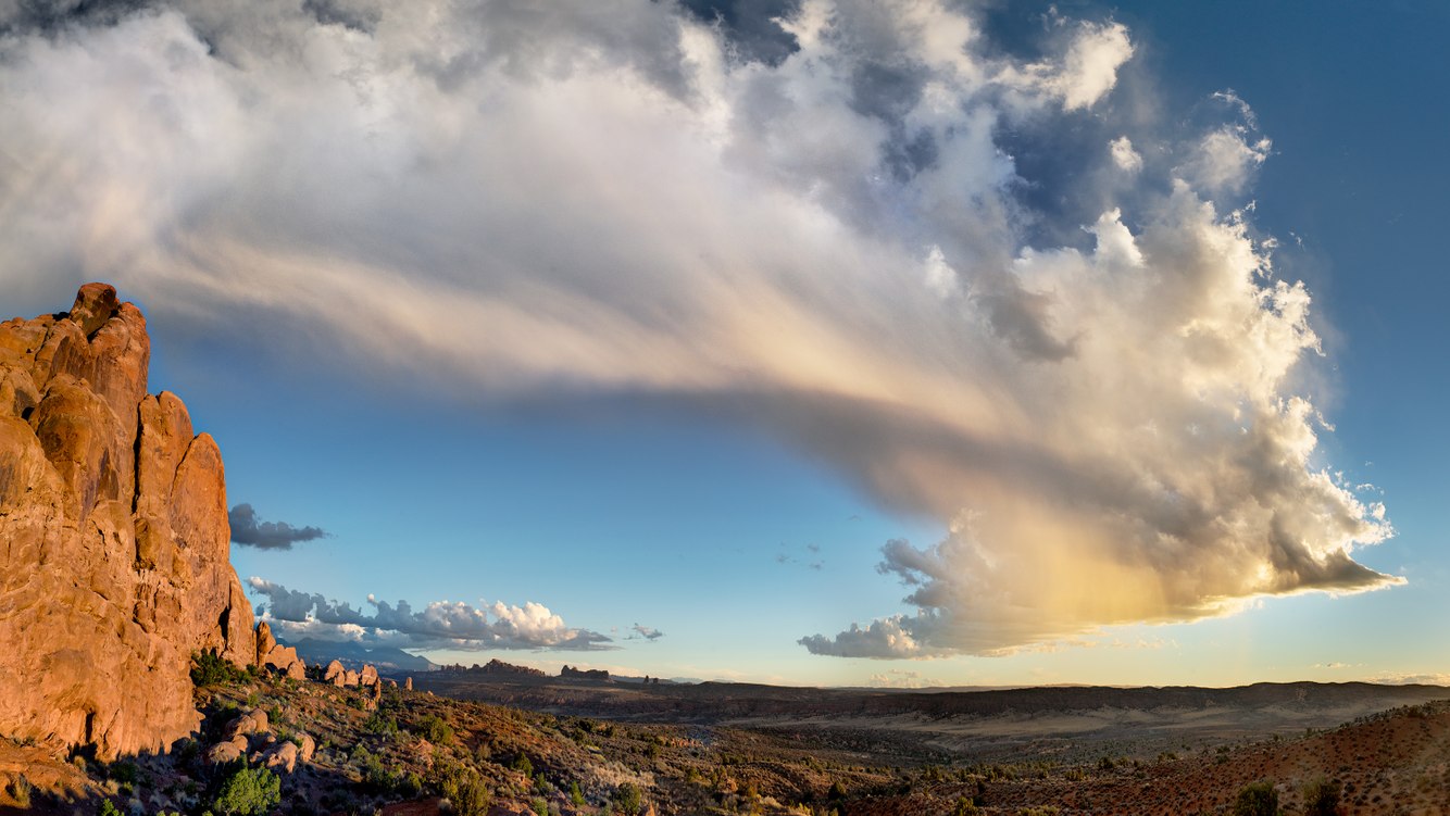
Cumulonimbus, Virga, Arches National Park, Utah
The weather in the Utah Canyonlands undergoes a seasonal shift in early October. Monsoons have long since ended, and a northwesterly flow brings in fall’s first “blue norther.” Several years ago, during the October trip when I captured this image, a cold front came through eastern Utah’s Arches National Park, providing the first rain to dampen the dust and clear the air of wildfire smoke. That evening, the remnants of a towering cumulonimbus cloud dissolved as a brightly lit gush of virga rain evaporated in the desert air.
It is a dramatic time of year when the last days of a seemingly endless summer finally end. On this day, the sun cut through the extraordinarily clear evening air, lighting up the sandstone walls of Arches National Park with an intense red hue that complements the rust tones of the season’s changing colors beneath a brilliant cyan-blue sky.
On the right side of the photograph, the pinnacles of the “Fiery Furnace” – named for their iron-rich sandstone that glows radiantly at sunset – act like a pulled-back curtain, revealing glimpses of the La Sals Mountains, arches in the park’s Windows Section, the distant peaks of the Abajo Mountains, and the ridge of Elephant Butte above the Salt Valley Wash. Scattered Piñon and Juniper are surrounded by fields of cheatgrass, saltbush, and blackbrush. The sandy ground is coated with microbial colonies of cyanobacteria, algae, fungi, lichens, and moss that are vulnerable to the sometimes-errant footsteps of hikers seeking solitude as they strike out into this vast, open wilderness.
more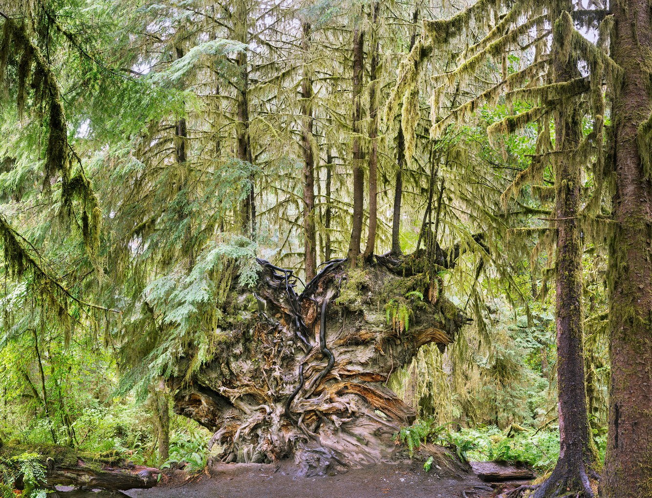
Fallen Western Hemlock, Hoh Rainforest, Olympic Peninsula, Washington
The remains of a fallen tree nourish other plant life in Western Washington’s temperate rainforest. Botanists call the now-horizontal trunk of this toppled snag a "nurse log." It provides seedlings with a moist surface of decaying wood and shelters their early growth from pathogens in the soil below.
It takes about as long for a nurse log to decay as it did for the tree to mature. What appears to have been a western hemlock fell about a half-century ago; a colonnade of hemlocks has since inhabited its trunk along a line that extends a hundred or so feet behind the root ball. In a forest of thousand-year-old trees, typically, the trunk has entirely decayed by the time a nurse log's new line of trees has reached full maturity. Then, after these fully grown trees die and fall, some may serve as nourishment for the next generation.
On the banks of the Hoh River, this downed tree’s root system has been increasingly exposed as the soil that once encased it erodes. Visitors stop and photograph this fifteen-foot-tall feature in a quiet place, free of human-generated sound, absorbed by the moss that coats tree trunks and branches. Annually fed by 12 feet of rain, Sitka spruce, western hemlock, western red cedar, and Douglas fir tower hundreds of feet above the trail. Underneath, thickets of sword ferns, dense brush of vine maples, and broadleaf maple groves create a corridor of lush green flora. A meadow alongside the river opens views of elk grazing in these alluvial bottomlands, backdropped by the glacial mountains that feed it.
more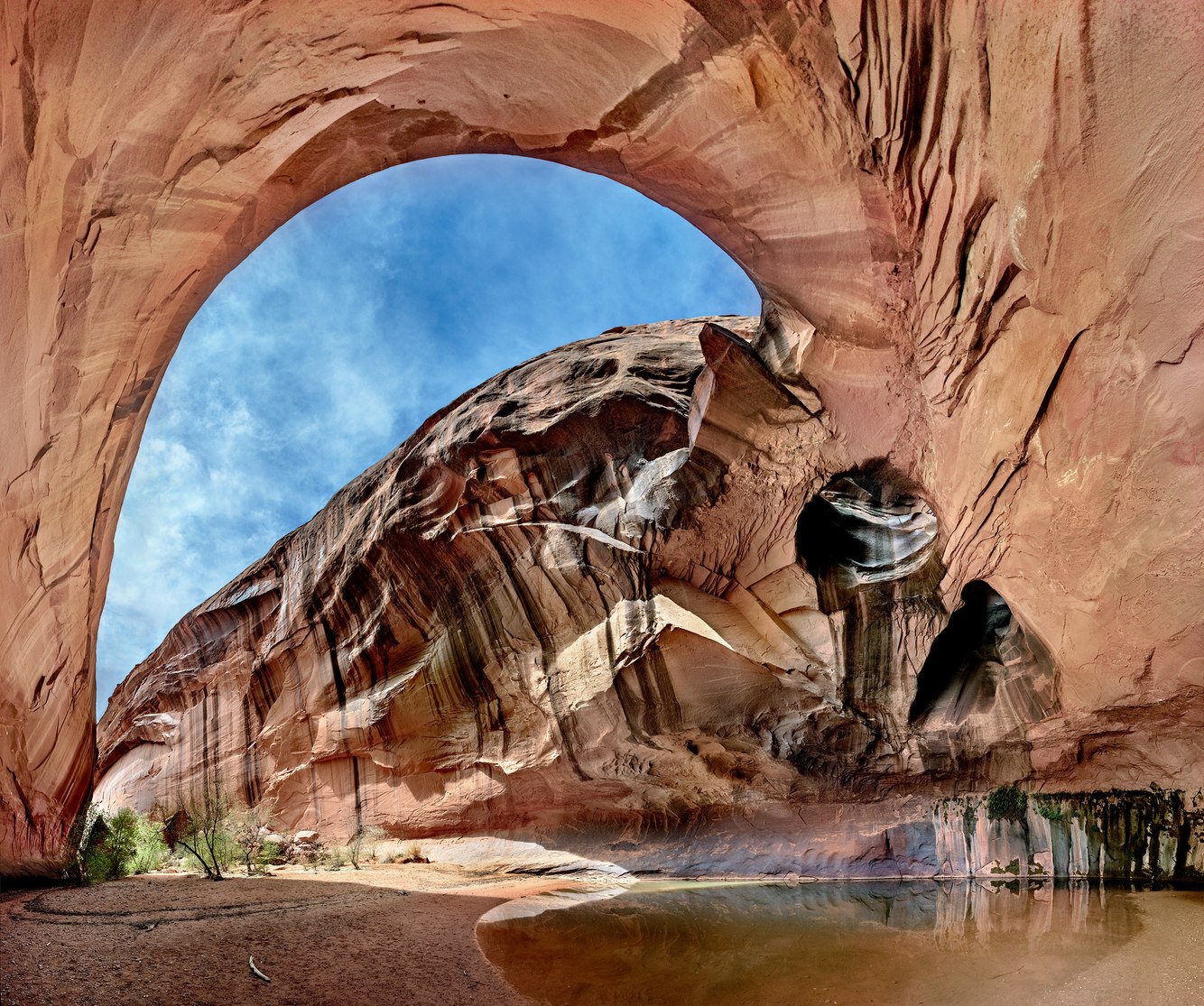
Golden Cathedral, Neon Canyon, Escalante River, Utah
Thirty years ago, while trekking south-central Utah's Escalante River, I accidentally discovered the Golden Cathedral. At the time, it was unnamed, but it later became a popular destination. Of equal height, width, and depth—about a hundred feet in each direction—its character transforms throughout the day through subtle shifts in the sunlit reflections off the walls and pond.
Over time, water carved out sedimentary rock to form this peaceful sanctuary, sheltered from the blazing sun and arid red rock country. The sandstone was fractured and sculpted by the alternating freezing and melting of rain and snow that filled the rock's porous crevices. Other similarly eroded features in the surrounding landscape include a unique assemblage of hoodoos, spires, domes, and natural arches and bridges.
On my most recent visit five years ago, where the Escalante River meets its narrow mouth, I entered Neon Canyon. Appropriately named, sunlight reflected off nearby bluffs in the early morning, brightening the shadowed walls and creating a phosphorescent glow. Hiking a mile up-canyon, I photographed the enormous cave, hoping to convey a sense of its scale and shape. The sky appeared flat, as though painted on canvas, its color enhanced by the red sandstone cliffs that encircled it. Its appearance reminded me of artist James Turrell's "Skyspace" ceiling portals that perceptually compress the dimensions of a vaulted sky, bringing it down to the ceiling's plane, which lent the firmament a sense of immediacy and presence.
more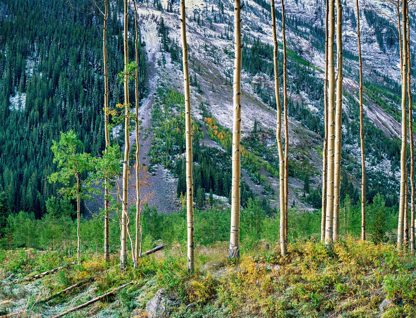
Aspens, Maroon Lake, near Aspen, Colorado
The first snow dusts the shadowed slopes of central Colorado's Rocky Mountains in early autumn, portending the changing seasons. When I visited this incredible alpine valley in the heart of the mountain range, the aspen trees had begun to turn and would reach full color in a couple of weeks.
The valley where I took this photograph and the mountains surrounding it were formed from an ancestral mountain range's metamorphosed and uplifted sediment. More recently, earth slides blocked Maroon Creek, which drains this basin, creating a shallow lake and a large meadow bounded by 14,000-foot summits. Extraordinarily steep, these photogenic peaks are temporary features in the broader sweep of geologic time. Built of friable mudstone, the mountain's flanks quickly crumble, sending rocks tumbling and reverberating down scree slopes, echoing across the valley.
Long-lived spruce forests are replaced by aspens when a landscape is decimated by fire, old age, or, as here, avalanches. Aspens proliferate, are fire-resistant, and have short lifespans. They precede the next generation of spruce, which will ultimately replace them a century or two later.
I remember the cluttered piles of broken and uprooted trees after a 1989 avalanche. In this photograph, taken a few years later, the line of remaining aspens has survived. In the background, budding aspens fill the avalanche's path. A few of the older snapped aspen trunks litter the foreground. The standing aspens may have been small enough to bend rather than break during the avalanche or, situated above the chute, may have been missed by the torrent.
more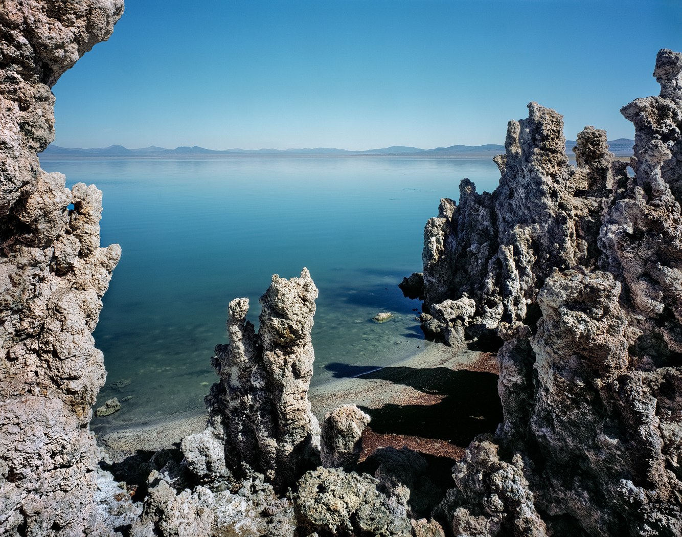
Tufa, Navy Beach, Mono Lake, California
A promontory on the south shore of eastern California's Mono Lake hosts a collection of tufa towers once formed beneath its surface. A few hundred years ago, when the lake was deeper, underground mineral springs bubbled up from its bed, chemically interacting with the saline water to build the limestone tufa formation in this photograph.
One of North America's oldest extant lakes, Mono Lake, was created three-quarters of a million years ago by nearby volcanic eruptions that sealed off mountain streams previously flowing to the Pacific Ocean. The spring runoff from the snow-covered Sierra Nevada Range annually replenished the lake. Beginning in the 1940s, the lake was in danger of becoming an arid playa due to excessive water diversions by the Los Angeles Department of Water & Power until conservation efforts stabilized the lake’s level.
Each time I’ve visited this surreal landscape, it has been a soothing, almost mystical experience. When Mark Twain camped here in the 1860s, he described the lake as a 'lifeless, treeless, hideous desert.' Despite Twain's impression, the lake is a thriving ecosystem in its waters, shore, and air. Beneath its surface, trillions of brine shrimp flourish annually. These tiny creatures and the alkali flies that line the lake's hundred-mile shore have provided abundant food to thousands of nesting gulls, sparrows, osprey, and millions of migrating birds.
more
Fractured Boulder, Roaring Fork River near Independence Pass, Colorado
A 1.7-billion-year-old boulder rests, precariously balanced in the streambed of central Colorado's Roaring Fork River. It is composed of oceanic sediment mixed with molten lava that metamorphosed into granite several miles underground through eons of heat and pressure. After one billion years of uplifting and erosion, the rise of the Rocky Mountains surrounding the Roaring Fork River unearthed this ancient layer of granite.
The deeply carved canyon within which this boulder is cradled has acted as a thoroughfare for glaciers and, more recently, melting snow cascading down from the continental divide. It has also served as a ravine for receiving tumbling rocks that have fallen off the slopes of the steep-faced valley surrounding this stone-cluttered river channel.
After tearing down the mountainside, this boulder neatly cracked in half when it came to a crashing halt. Surging full and muddy during spring runoff and running clear and slow the rest of the year, the river's current courses around and under the boulder, polishing river stones. Along its banks, forests of willows, spruce, and aspen give way upstream to grassy meadows above the tree line.
The riverbank from which I made this photograph was a late 19th-century mule train route, bringing in prospective miners and hauling out gold and silver ore over the 12,000-foot Independence Pass. The four-wheel-drive road—and newer passenger car road across the river—overlay Ute hunting paths going back at least 10,000 years.
more
Saguaros, Full Moon, North Star, Sauceda Mountains, Arizona
The Sauceda Mountains in south-central Arizona straddle the eastern section of the Barry M. Goldwater Bombing Range, which the public can explore with a permit. The Air Force trains air crews in fighter jets that twist and roar across the sky, practicing air-to-ground combat on its 1.7-million-acre range. Rare hikers, including my group, explored an otherwise untrammeled wilderness.
On the slopes of its low mountains, which cross arid basin and range country, saguaro and cholla cactus, mesquite bushes, and palo verde trees wreathe the desert floor. Hot summers attract moisture from both the Pacific Ocean and the Gulf of Mexico, which converges to create cloudbursts. The earth, as firm as concrete when dry, is formed by volcanic lava flows that have long since eroded down mountain slopes to form alluvial fans upon which plant life prospers.
On this night, facing the camera directly north, I exposed a piece of sheet film for seven hours as the full moon traversed the southern night sky, lending the saguaros a glowing radiance. These desert sentinels take one hundred years to mature. Most grow arms; however, a few, called “spears,” grow in drier soil and do not branch out.
more
Paulina Lake, Newberry National Volcanic Monument, Oregon
A conifer seedling grew on the edge of a lake terrace undercut by waves and winter ice. In time, the young tree lost its footing and fell into the lake. Its roots were still anchored to the shore, and its crown and branches landed on the waterlogged trunk of a previously fallen tree. Over time, the top of the young, flexible tree shifted its growth upward. Then, later, as its submerged roots rotted, the tree died.
Though the details of the life and death of the tree shown in this photograph are uncertain, it’s upward shift in direction is clear. Called "gravitropism," cells are designed to monitor the tree's orientation, direct roots to follow gravity, and trunks to oppose it. As a result, the tree responded to its fall by using the sunken trunk underneath to support its ascendant growth.
Central Oregon's Paulina Lake lies in a caldera basin, a unique geological feature created by volcanic eruptions releasing the contents of a now-collapsed mountain that stood here half a million years ago. The caldera is still volcanically active, with dozens of eruptions during the past 10,000 years, the most recent being an obsidian flow 1,300 years ago. The lake is fed and warmed by mineral-rich hot springs underneath and around it. Its high mineral content feeds an active ecosystem and stains the shore's rocks and terrace white.
more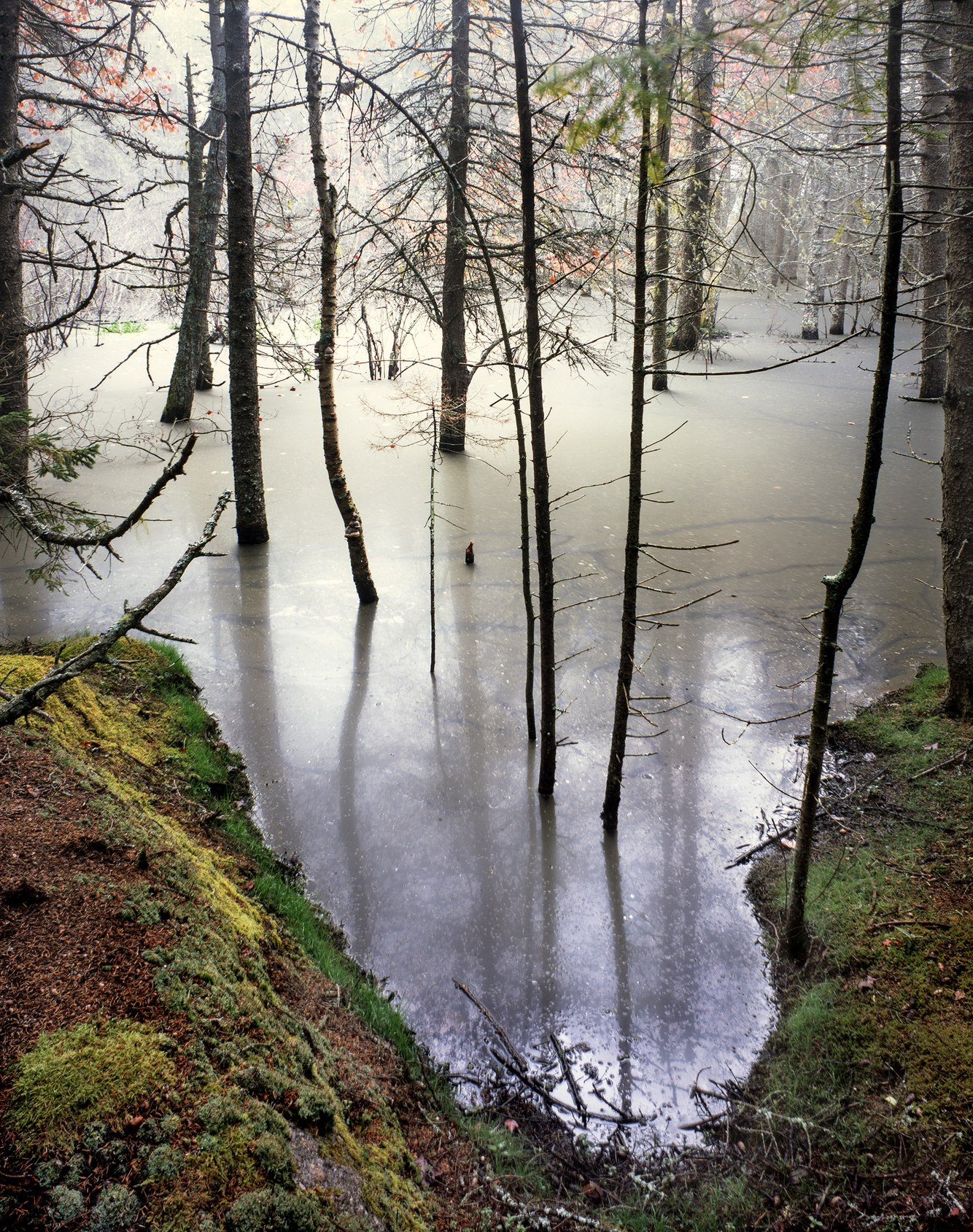
Beaver Dam Pond, Ames Creek, Stonington, Maine
On this autumn day in coastal Maine, streams had diminished in flow, causing a beaver pond to sink. A smoky scrim of dust and organic detritus arose to cover its surface. Bodies of waters like this are commonplace in Maine, where a quarter of its land is comprised of wooded swamps, bogs, marshes, and meadows, several times the amount of wetland in the other five New England states combined.
When I lived in Maine, exploring the backcountry often tested my ability to find dry-footed pathways between bodies of water. In 1912, this problem prompted Leon to invent a rubber-soled, leather-upper boot, which became an indispensable piece of footwear for traversing Maine's stretches of so-called "land."
On this hike, my reward was visiting a primal setting of moss and grass-covered woodlands crossed by a winding stream. Situated near the source of the quarter-mile-long Ames Creek, beaver, stimulated by the feeling and sound of flowing water, constructed a dam of wood, stones, and mud to flood a previously dry field. The pond ended the growth of a young stand of white pine and oak (its leaves turning russet red in their last season).
This pond provided a habitat for beavers, which, in turn, fostered the growth of aquatic plants for browsing moose and waterfowl. In the fall, when I made this photograph, all members of a beaver family were hard at work reinforcing the dam and fully repairing their winter lodge.
more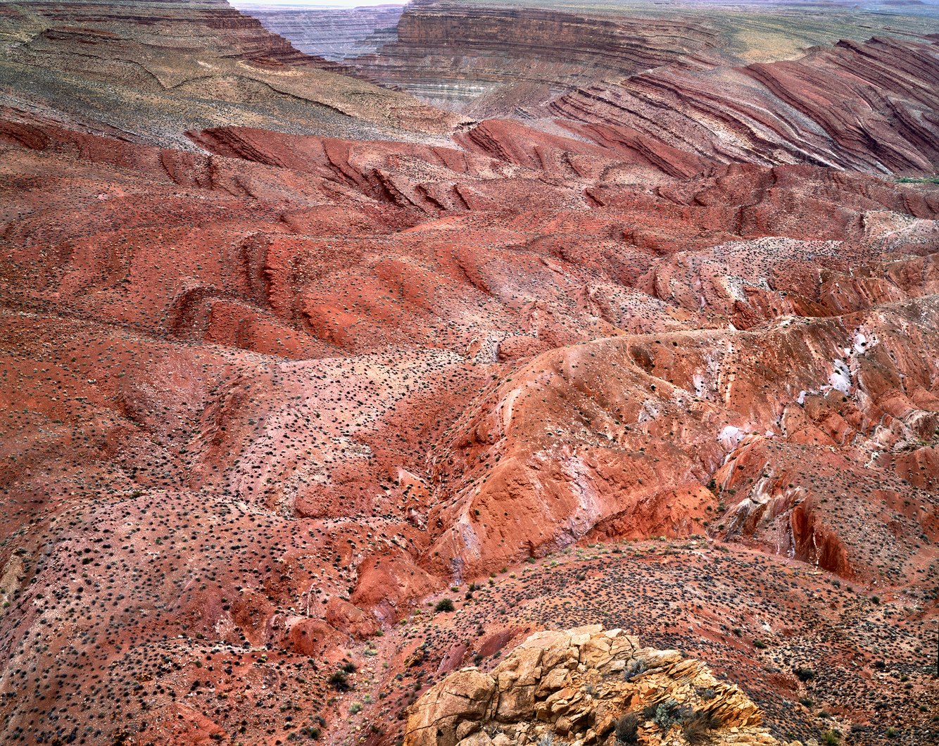
Lime Ridge, from Mule Ear Diatreme, San Juan River, Utah
Over 30 years ago, I took a steep hike from the banks of Southeastern Utah's San Juan River, to the top of a small volcanic crater. Here, 25-30 million years ago, super-heated water erupted at near hypersonic speed through a fissure deep within the earth, dragging rock debris upward and venting into the atmosphere. This geologic phenomenon is known as a diatreme.
Often, diatremes leave shafts that become hardened from the heat of the explosion, forming blackened spires such as nearby Shiprock in northwestern New Mexico. The Mule Ear Diatreme and its surrounding terrain have become so eroded that all that remains today is a shallow, fifty-foot diameter crater. Standing on its edge, I was surrounded by a field of rock fragments containing serpentine, garnets, and other crystals brought to the surface. Above and behind me, a 400-foot cliff of heat-hardened sandstone resembled its namesake: Mule Ear. Below, a broken brown-yellow rock shelf at the foot of the photograph had also been partially metamorphosed by the eruption's searing temperature.
Before me lay Lime Ridge, the ground eroded into fluted patterns by seasonal monsoons that cut through softer parts of the folded sandstone layers. Dotted by black brush on the tilted terrain and low sagebrush along its ridges and floors, 12,000 years ago, the climate was cooler and wetter, and the area was covered with conifer forests. Today, artifacts are scattered on these desert slopes. Spear tips and pieces of utensils, left behind from mammoth and bison hunts, have been discovered at a place once frequented by seasonally migrating hunter-gatherers.
more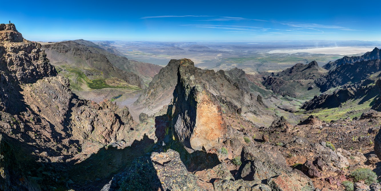
View East from Crest of Steens Mountain, Oregon
Southeastern Oregon's 9,733-foot Steens Mountain trends 50 miles north-northeast, formed by a wrinkle in the tectonic forces that have shaped much of the western United States's Basin and Range country. In June 1831, Hudson Bay Company fur trader John Work described this mountain as "covered with snow," leading to its first name, the Snow Mountains. For most of the year, the crest's treeless subalpine tundra is covered in deep snow and, during brief summers, is carpeted with wildflowers.
The mountain is a thick block of basalt that, from west to east, gently tilts up to its peak, with a steeply pitched east-facing scarp, descending over a mile to the desert floor. Still in the making, the mountain continues to uplift along its eastern edge, shaken by periodic earthquakes. I made this photograph atop the steep headwall near its peak, beneath which glaciers and melting runoff have eroded the steep terrain into a convoluted topography of sharp ridges and spectacular ravines. Streams originating in cirque basins just below this rim feed Willow and Cottonwood creeks.
From the top of the ridge on the left, a visitor leans into a wind, fueled by rising air converging above the slope's ridge. To the east, in the mountain's rain shadow, lies the Alvord Desert. Small working ranches operate along the mountain's base, where the Tsisi-adi band of Paiute once lived. Today, this ancient lake's flat, dry bed is populated by campers, vehicles attempting to score land speed records, and dust devils.
more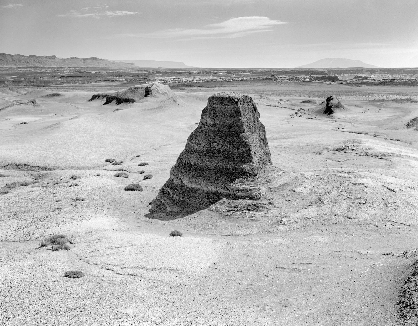
Eroding Hillock, The Moon, near Big Water, Utah
Ninety million years ago, a rising sea flooded low-lying parts of western North America, dividing the continent with a seaway connecting the Arctic Ocean and the Gulf of Mexico. A thick seam of blue-gray fossil-rich silt and mud accumulated in a part of this shallow ocean that once covered the area that is now the Utah/Arizona border. Its weight pressed clay into stone, uplifting a mile above the ground and creating a plateau.
This desert of shale flats, knolls, and ravines, an area almost entirely devoid of life, is locally known as “The Moon.” Ironically, its eroding earth exposes abundant plant and animal remnants from an ancient sea once vibrant with life. Rarely visited, it lies between Lake Powell to the south and the Grand Staircase-Escalante National Monument to the north. It reminds me of a movie set featuring pioneers searching for water and shade. It’s easy to envision Charlton Heston playing John the Baptist here as he did in the 1965 film “The Greatest Story Ever Told.”
Camping on “The Moon,” I awoke to dawn’s radiant firmament illuminating rugged canyons, buttes, and mountains. The absence of life impressed upon me my tenuous sense of existence, where nothing grows (or dies). I explore its splendor and oddity, photographing a pyramidal hillock flanked on the horizon by Navajo Mountain on the right and the Vermillion Cliffs on the left, between which drifted a lone, ghostly alto-cumulus cloud as it dissolved in the dry heat.
more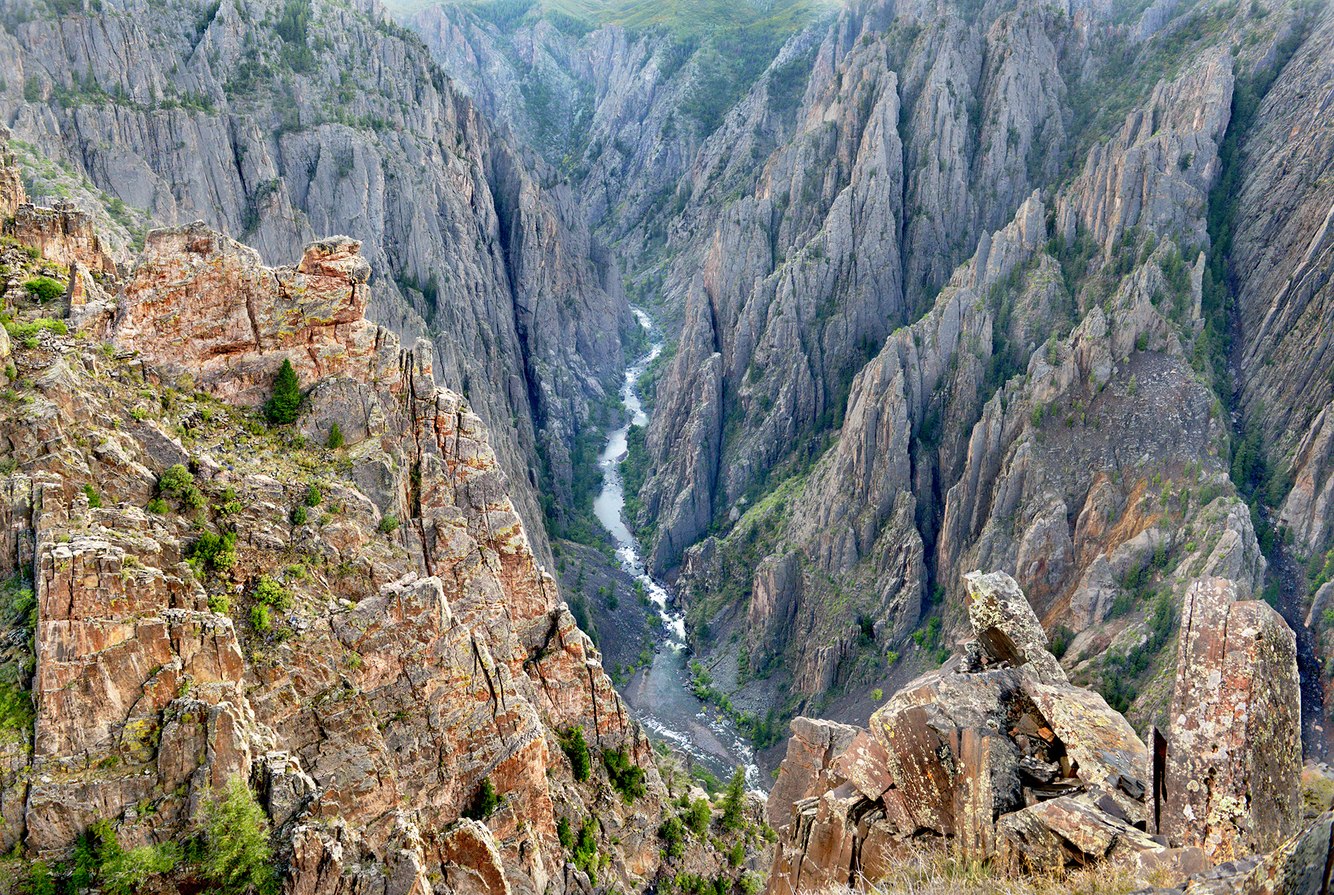
Kneeling Camel Overlook, Black Canyon of the Gunnison, Colorado
"No other canyon in North America combines the depth, narrowness, sheerness, and somber countenance of the Black Canyon of the Gunnison," wrote geologist Wallace Hansen. The Ute People hunted and gathered plants along its rim, but there is no evidence they entered the canyon. They regarded it as a sacred, dangerous place and, perhaps, a portal to the underworld.
Black Canyon of the Gunnison National Park is tucked away in an otherwise untraveled part of Colorado's west slope. The first morning I awoke, camped on the park's north side in the late 1970s, I took the short walk to the canyon rim and was shocked to realize a nearly vertical half-mile drop to the Gunnison River. So precipitous, in fact, that the distance between the north and south rims is less than its depth. While the canyon is not black, it has a solemn and breathtaking aspect that gave me pause; it was at once beautiful and strange, exhilarating and melancholy.
As with the West's other desert rivers—the San Juan, Colorado, Green, and Yampa—that chisel deep canyons through the Colorado Plateau, the Gunnison River carved its course through land that, over time, rose several thousand feet from sea level. As it did so, the river's raw power cleared rocks from its inner gorge and dug deeper into the hard and ancient gneiss and schist.
more
Cannon Beach, Oregon
The Oregon coast—including its cliffs and promontories along Cannon Beach—was formed by 15-million-year-old volcanic lava flows originating in eastern Oregon. They coursed west along the Columbia River's route to the Pacific Ocean coast, well west of today's shoreline. Erosion and rising sea levels left remnants of the former headlands as steep-walled islands that we now call sea stacks.
The first people to inhabit this region arrived 11,000 years ago, and by the 1400s, archeological remains confirm this coast supported well-established communities of Clatsop, Nehalem, and Tillamook people. In 1806, William Clark and the Lemhi Shoshone woman, Sacagawea, of the Lewis and Clark expedition, visited this beach and traded for whale blubber with the Tillamook tribe. Clark wrote in his diary, "We set out early and proceeded to the top of the mountain (Tillamook Head). From this point, I beheld the grandest and most pleasing prospects my eyes had ever surveyed. In my front, a boundless ocean… the high land which forms this course for a long way added to the innumerable rocks of immense rise out at a great distance from the shore and against which the seas break with great force gives this coast a most romantic appearance."
more
Split Boulder, Jasper National Park, Alberta, Canada
In the Athabasca River Valley of western Alberta’s Rocky Mountain Range lies a field of glacial drift made up of limestone and sandstone gravel, stones, and boulders dropped off the retreating toe of the Athabasca Glacier a century ago. Among the rocks rests a boulder, once whole, now split perfectly in half on the slope of a terminal moraine. This kind of clean break can happen after a glacier has retreated, the ground may subside from buried ice melting beneath the surface or rise as it is released from the glacier’s extraordinary weight (or both). These effects cause rocks to fracture. Additionally, water can enter thin cracks and wedge a rock apart as it expands when frozen.
In the mid-19th century, during what is now known as “The Little Ice Age,” glaciers over much of the earth reached their largest extent. A mile from the edge of Athabasca Glacier, this hillock was once covered with hundreds of feet of ice. Since then, glaciers worldwide began thawing faster than they accumulated snow, even preceding the onset of human-induced climate effects. In the case of the Athabasca Glacier, it has lost half its volume, receded a mile and a half, and will entirely melt away in the next century.
more
Exfoliating Boulder, Muley Point, Utah
Southern Utah’s San Juan River once snaked across a nearly flat plain. Over time, the river’s current cut into its banks, crafting an increasingly sinuous channel. Later, while tectonic forces raised the level of the land by several thousand feet, the river continued to follow its original course. Carving through the emerging plateau, it dug deeper into the underlying bedrock to create an entrenched meander. This geologic feature has occurred in other places, though not with the dramatic profile of San Juan’s “goosenecks.”
Cedar Mesa overlooks the river two thousand feet above, and Muley Point, the southern neck of this plateau, provides a sweeping view of the surrounding canyonlands. Capped by a thick, flat layer of quartz sandstone from the air, this promontory looks almost like a shelf of bread loaves, each with a rounded top that compactly abuts one another. Their cleanly sculpted appearance along Muley Point’s cliff face, where they break off, has led to conjecture that they were built by an ancient civilization. Though this type of feature is rare, geologists assure us that its making is, in fact, geological.
Fractured by the land’s uplift, the mineral composition of this sedimentary rock favored cleaving along right angles. Over time and today, as the river erodes the plateau’s base, rectangular-shaped boulders peel off Muley Point like the one shown in the photograph. Eventually, this massive block will tumble, break apart, dissolve into sand, and be carried downstream to Lake Powell. There, the captured river’s sediment will accumulate on the bottom of the lake to become, once again, sandstone.
more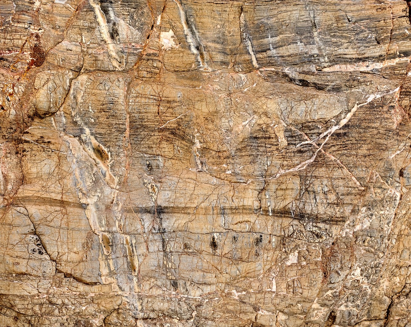
Titus Canyon, Death Valley, California
The geologic complexity of the Grapevine Mountains along the California/Nevada border was first described in 1875 by geomorphologist G.K. Gilbert, who noted, "the strata are greatly disturbed and dislocated… " Cutting across the strike of the mountain range, Titus Canyon is an anomaly in an extraordinarily dry desert; the mightiest force in carving this canyon is the desert's rarest commodity, water. In the deepest reaches of the canyon where this photograph was taken, the rapid runoff of flash floods cut the stream channel down (rather than widening it), racing along a narrow path, smoothing its vertical walls almost to a polish.
The walls are limestone and dolomite born of algae, silt, and mud deposited in warm shallow water, savannahs, and forests 500 million years ago, not long after complex life forms first appeared on our planet. The fossils and remnants of chert and other rocks, slices of which are embedded in these walls, reflect the geologic strangeness of that time. The tortured evolution of this wall is represented by its chaotic veining, intrusions, fractures, and a web of hairline cracks that speak to the multifarious movements of the earth's crust at play. This wall has been so wholly upended that it has been folded on top of itself and is, in places, resting upside down as though tectonic forces were laminating its layers like pastry dough.
more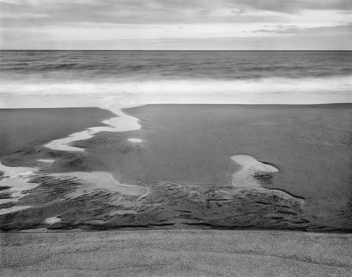
Low Tide, Coast Guard Beach, Cape Cod, Massachusetts
Cradled in the dunes behind Coast Guard Beach once sat Henry Beston's cabin where he wrote his 1928 classic "The Outermost House," a poetic diary of a year lived on Cape Cod's eastern shore. This evening, the intertidal flats, fed by water draining into the ocean from the beach face, filled small depressions. Sand ripples, formed by the continuous rhythmic motion of the waves, were rounded on their crests by the ebbing water, with each tide cycle staging a new rendering of this shore. Beston called this remote beach "Solitary and elemental, unsullied, and remote, visited and possessed by the outer sea; these sands might be the end or the beginning of a world."
Much has changed since Beston wrote those words. Glacial deposits that began accumulating 18,000 years ago shaped Cape Cod of unconsolidated sand and till hundreds of feet deep. The shoreline loses an average of three feet annually and is exceptionally high along the cape's exposed forearm where Beston's house once stood. It was moved a couple of times back away from the eroding beach and, in 1978, was destroyed by "Nor'easter" storm tides and – along with the high dunes around where it sat – was washed out to sea.
This photograph captures the beach in one moment of its history. Coast Guard Beach served as the initial landing site of the Mayflower on November 9, 1620. Henry David Thoreau began his 28-mile walk from here to Provincetown at the north end of the cape and wrote about that experience in his book "Cape Cod" in the mid-19th century. Beston's classic also memorialized what has become an ever-changing shore now fixed in memory.
more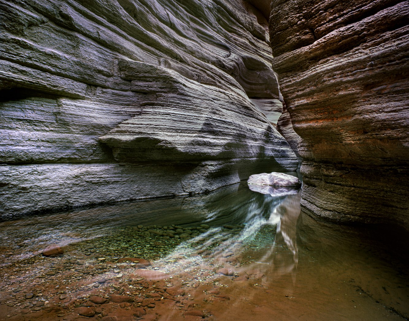
Chockstone and Pool, National Canyon, near Colorado River, Arizona
Wading through a pool shaded by National Canyon’s deep recesses near its confluence with the Colorado River, I hoisted myself and helped my hiking companions up over the chockstone shown in this photograph. We scrambled past it only to find deeper water and more chockstones in a narrow passage between the steep limestone walls. It was useless; this was as far as we could travel without climbing gear, which we did not bring along – or imagine using – on our river rafting trip through northern Arizona's Grand Canyon.
If we had climbed higher, we would have discovered ancient habitation sites, abandoned granaries that once stored corn, and metates – flat sandstone rocks with shallow indentions formed by grinding maize with granite river stones. The lower canyon lies within the Hualapai Reservation on the southern side of the Grand Canyon's western extension. They, along with the closely related Havasupai tribe that lives just to their east, have inhabited this high desert for the past 1500 years. Historically, the tribal members moved with the seasons, gathering plants and returning to their villages to tend gardens and hunt game.
National Canyon has a wide catch basin, and intense monsoon showers periodically scour its channel. A massive flood in 2013 ripped out trees and carried away boulders, eliminating the flats at the canyon's mouth where we had camped on this trip years before. However, on this morning, everything was calm. The sounds of May’s runoff trickling as it meandered through the ravine blended with the melancholy notes of a lone canyon wren whose song echoes within the wild heart of the Grand Canyon.
more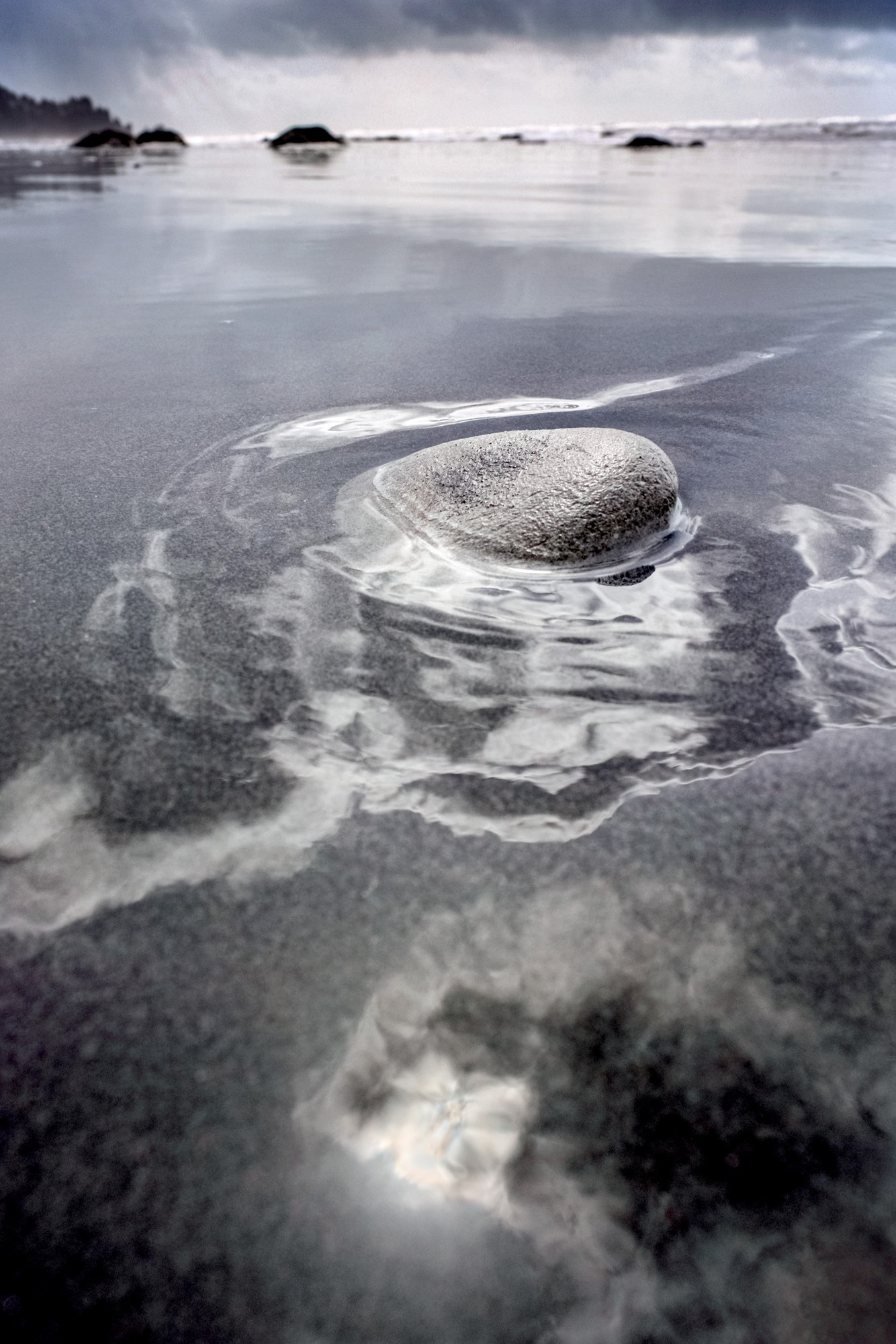
Retreating Tide, Approaching Storm, Second Beach, Olympic Peninsula, Washington
Second Beach, along the central Pacific coast of Washington State, is a popular destination for Olympic National Park visitors. Even when busy, it is so long and wide that beachcombers may feel a sense of solitude, especially when the tide is out and one can roam the enormous expanse of untrampled tan, red, and black sand between the forest and the waves.
Geologically, Second Beach is built of mélange rocks, a mixture of sand, gravel, and stones churned up along the borderline between converging tectonic plates that parallel the coast. The beach is protected from the worst of winter's mid-latitude cyclones by an offshore maritime bench where storm waves break and dissipate.
Two landowners share the beach: the Quileute Indian Tribe, which owns an ancient, pristine forest through which a trail leads to the ocean, and the National Park Service, which manages the beach, where day hikes and wilderness camping are allowed. A land swap ensured continued beach access when the Park Service provided a tract of high ground to the Quileute so that the tribe could move their homes out of a low-lying floodplain prone to increasingly dangerous king tides' and the threat of tsunamis.
more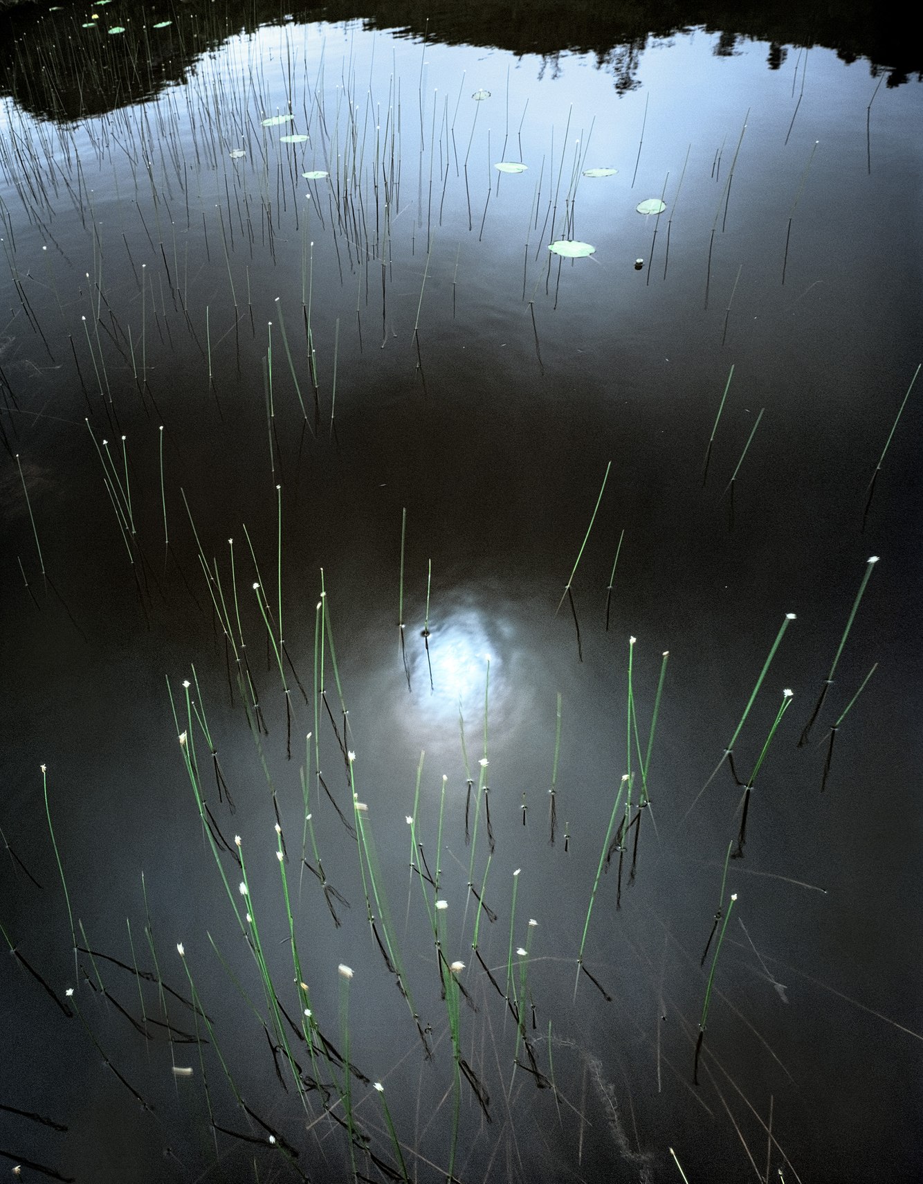
Reeds, Pond below Barachois Falls, near Rose Blanche, Newfoundland, Canada
On a hike to Barachois Falls near the fishing port of Rose Blanche on Newfoundland's rugged south coast, I felt the sun occasionally break through, warming the open country as it vied with cold, moist winds. Rising off the nearby Atlantic Ocean, the fog spread across the rolling barrens. The broader vista darkened and obscured; I focused on the details of the landscape, stopping at a pond where swaying sedges caught my attention, their tips budding with glowing cotton tufts.
Headlands rise abruptly from the sea along this coastal wilderness, and its rivers are short and turbulent. The landscape encompasses outcroppings of granite, boreal forests, heaths of sphagnum moss, and peat bogs interspersed with ponds and marshes. Once densely covered by balsam fir, European settlers clear-cut the island's south coast beginning 300 years ago. In the late 19th century, the land was subjected to frequent fires brought on by embers spread from the coal-fired locomotives running along the newly constructed narrow-gauge railroad crossing Newfoundland, delaying the forests' return for generations.
During the short summers, bogs fill with winter's runoff, blossoming with lily pads, reeds, and sedges. In this image, a blackwater pond mirrors solitary stands of spruce and larch, and scudding clouds filter the skylight. As a natural polarizer, the dark water intensified the sun's rich opalesque reflection.
more
Lightning Struck Cottonwoods, Dugout Ranch, Utah
The lightning strike shattered bark, exploded wood, and the cottonwood grove caught fire. A day later, on my first evening visiting southeastern Utah’s Dugout Ranch, I slept outside, and was often awakened by the sounds and light of the burning trees. I arose before dawn to record the spectacle as flaming branches loudly fell onto the ashened ground. Posing no threat to spring's rain-soaked pasturelands, the smoldering trees were left to burn. Decades later, driving past the Ranch on my way to The Needles District of Canyonlands National Park, I glimpsed those blackened trunks silhouetted against the backdrop of red rock buttes, reminding me of this breathtaking scene.
Encompassing privately owned winter pastures and government-leased highland meadows, the Ranch was named for the excavated shelters 19th-century settlers built to take refuge from heat and snow. In 1990, during that first visit, I met Heidi Redd, who had recently bought out the cattle from her ex-husband and took over ranching operations. She also began to host artist retreats (my reason for visiting). In subsequent years, my love for the Ranch was shared with my wife, Laura, and our children, Luke and Grace. For a time, it became our annual Easter trip, where we spent long weekends with Heidi and her other invited friends.
more
Vernal Falls, Merced River Valley, Yosemite National Park, California
A once-lofty conifer, the tree trunk shown in the foreground of this photograph, had most of its canopy snapped off a century ago. Photographers Carleton Watkins and Ansel Adams photographed the falls in 1861 and 1948, respectively, when the enormous tree was still alive. Long since bare of needles, it stands erect in death, overlooking Vernal Falls like an ancient sentinel.
Though named Vernal Falls in 1851, it was originally called Yan-o-pah – or "little cloud" in the language of the Ahwahnechee. These people inhabited Yosemite Valley for several millennia, nestled within three-thousand-foot canyons on the western front of California's Sierra Nevada Range. Vernal Falls and, upstream, Nevada Falls comprise the steepest stretch of the Merced River. Glaciers excavated loose, fractured rock a million years ago, clearing it down to its hardened granite bedrock.
In the mid-19th century, entrepreneurs carved hundreds of steps into the rock and charged a fee to hike from the valley floor to the top of Vernal Falls. Today, tourists no longer pay to climb The Mist Trail through the spray and rainbows generated by the thundering falls. Usually wide and roaring, the Merced River slowed to only a trickle during the season's extraordinarily low river flow, and Vernal Falls was almost silent. The plunging river's breadth typically veiled the entire background of this photograph. On this day, a dry spell revealed the usually hidden wall exquisitely painted with colorful streaks.
more
White River, Emmons Glacier, Mount Rainier, Washington
In south-central Washington State, 14,411-foot Mt. Rainier's commanding presence captivates observers up to 300 miles away. That is, when it is cloud-free. Moisture from the Pacific Ocean condenses on the persistently cloud-covered flanks of this volcano. As a result, the mountain is "out" only one day in four and is one of the snowiest places on the planet.
Taken from the Emmons Glacier Overlook on a rare cloudless morning, this photograph captures 10,000 feet of vertical gain from the White River to Rainier's peak. Fifty-eight hundred years ago, weakened by underground fissures expelling heated and erosive gases, the mountain's northeast side slowly fractured and crumbled. Most likely triggered by a slide of weakened rock from the mountain's summit, the Osceola Mudflow moved a cubic mile of liquified rock down through the White River Valley. Splashing up its walls as high as this overlook, it rapidly drained clay, rocks, and debris into the Pacific Ocean. Rubble-encrusted Emmons Glacier formed in the newly excavated cirque, expanding and contracting over the five millennia since the mudflow, feeding the White River and carving a valley that became carpeted by Pacific Silver Firs after the last ice age.
more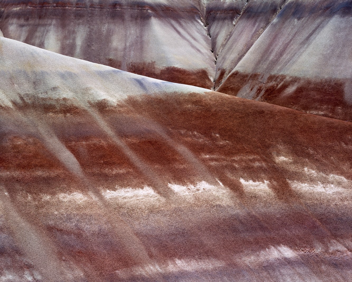
Morrison Formation, near Caineville, Utah
In December 1960, writer Wallace Stegner wrote to a friend what has since been called his “Wilderness Letter.” In the letter, he describes the southeastern Utah desert as a place that “can be a means of reassuring ourselves of our sanity as creatures, a part of the geography of hope.” He references the desert country around Caineville as “a lovely and terrible wilderness, such a wilderness as Christ and the prophets went out into; harshly and beautifully colored, broken and worn until its bones are exposed…” which led to his observation that preserving wilderness areas invites us to “take pleasure in the fact that such a timeless and uncontrolled part of earth is still there.”
In 1877, geologists first identified the Morrison Formation in an outcrop of a soft sedimentary rock near Morrison, Colorado, outside Denver. However, its most capacious expression is further west in Utah. Here, a deep layer of alluvial deposits containing volcanic ash, soil, sand, and decayed plants and animals accumulated one hundred and fifty million years ago when the region was a floodplain. Conifers as imposing as today’s giant redwoods dominated a savannah landscape. Dinosaurs lived along riparian drainages where rivers moved volcanic ash from explosions in the Sierra Nevadas. Compressed into soft mudstones, this once low-lying region lifted into the elevated and exotically weathered terrain we call red rock country. Among the wild hills encircling Caineville, eroding mudstones turned to enchanting clays, such as in this photograph, creating a slope ranging from red to green-gray and maroon-purple.
more
Skylight Cave, Cascade Mountains, Oregon
NASA researchers once tested space suits in Skylight Cave – a central Oregon lava tube – as it was thought to be representative of “extraterrestrial” caves on the Moon, Mars, and other planets. This earthly cave once offered shelter to indigenous peoples, and every winter, it hosts hibernating Townsend's long-eared bats. On the June morning this scene was captured, I was greeted by other unexpected visitors: a couple having wedding pictures made; the bride lit by a light beam that descended through an opening in the cave's ceiling, her raised hand silhouetted by a sunray.
Three shafts of sunlight illuminate this cave during late mornings from May to September. The light enters through hornitos ("little ovens" in Spanish), where lava once erupted out of the cave’s ceiling. Several thousand years ago, this cave served as a subterranean conduit for fast-moving molten basalt. The outer surface of this molten rock cooled to a solid crust while its hotter, insulated lava continued flooding downstream.
After the flow ceased, it left a long, hollow channel, its appearance today unchanged. Entering the 40-degree Fahrenheit cave, the narrow walls, low ceiling, and precarious footing compelled me to crouch as I cautiously walked through the dark, headlight in hand. Finally, ahead, an inviting glow appeared that revealed the outline of the floor, walls, and ceiling as I entered a large hall. The subterrestrial met the celestial as the sun reached into the dusty cave, revealing a chamber etched by cracking walls and littered with fallen rocks. By happenstance, the nearest shaft cast a heart-shaped glow on its floor.
more
Spring Storm, Dante's View, Death Valley, California
Dante's View is a mountain terrace a mile above Death Valley near California's eastern border with Nevada. Below lies Badwater Basin, the lowest point in North America and the site of the world's hottest recorded temperature (130 degrees Fahrenheit). On a cloudless day, one can see the 11,000-foot Panamint Range across the basin and, on exceptionally clear days, glimpse the peak of 14,505-foot Mount Whitney, the highest point in the contiguous 48 states.
This viewpoint is named for Dante Alighieri, who, in the 14th century, wrote “The Divine Comedy,” describing his poetic vision of the nine circles of torment within the earth, the nine spheres of Paradise above, and, in between, the seven terraces of Purgatory. We can envisage these realms from this high bench through the lens of his poem's allegorical cosmology. Dante's View can be thought of as residing near the summit of the steep mountain of Purgatory, in sight of heaven, symbolized by the sky and its sunrays, and of the underworld, signified by the fiery basin below.
Ten thousand years ago, this dun-colored playa was filled with water. Today, its arid landscape displays remarkable interlocking patterns formed by salt deposits. This photograph was taken in spring when a wet weather system moved inland from the Pacific Ocean and crossed California's mountains. Clouds rose over the Panamint Mountains as rain and snow dampened its crest. The atmosphere had been wrung dry by the time the storm reached Badwater Basin.
more
John's Canyon, San Juan River, Utah
On this quiet morning, the mudflats where John's Canyon meets the San Juan River displayed a fresh layer of sediment as a flood from the previous day abated. A radiant stone and stippled boulder – having long ago tumbled out of the canyon's mouth – rested in an elliptical pool. Its tranquil water luminously mirrored the pre-dawn light reflecting off an 800-foot-tall cliff. The scene struck me as a dreamlike set piece.
Southeastern Utah is almost entirely comprised of sedimentary rock formed from ancestral mountain ranges that eroded into the bottom of an ancient sea and hardened into sandstone. Later, when the Intermountain West uplifted thousands of feet to form the Colorado Plateau, the San Juan River transported enormous amounts of silt and sand as colorful, soft layers of the surrounding mesas wore away.
Moisture streaming from Mexico and the Pacific Ocean feeds monsoonal thunderstorms into the desert southwest from mid-summer to early fall. These storms tend to be short and spotty, with intense, local downpours drenching one canyon and missing others. Floods deposit layers of mud – red, tan, grey, or black – and send them downstream. They originate from an extensive network of side canyons that, on a map, resemble branches of a tree that converge into its trunk, the San Juan River. Examining the clay deposited here, experienced geologists and long-time river guides familiar with these branched canyons can easily identify the flood's origins by its signature colors.
more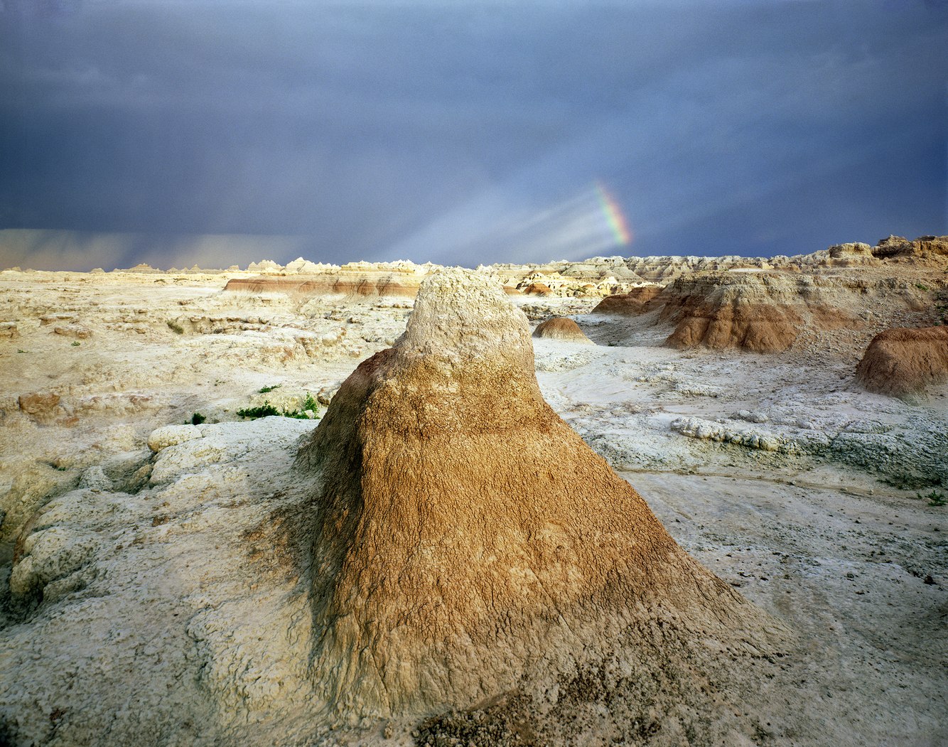
Badlands National Park, near Interior, South Dakota
When I first drove into the badlands, I left behind the Midwest's verdant plains to unexpectedly arrive in a haunting land of crumbling clay. As I explored, I began to realize its extraordinary and surreal barrenness was changing my way of perceiving it. That afternoon, a thunderstorm had formed over the Black Hills and moved east across this desolate country. The horizon was notched by pinnacles and buttes upon ground broken by ravines and escarpments. Above spun a cinematic firmament filled with flashes of lightning, fleeting shards of light, storm clouds with trailing sheets of rain, and a splintered rainbow.
Labeled "bad lands" by the Lakota people, 18th-century trappers and 19th-century wagon trains avoided crossing this part of western South Dakota. This rugged geography marks a break between the low-lying Prairie Plains that begin west of the Mississippi River and the elevated High Plains that skirt the eastern perimeter of the Black Hills and the Rockies.
Seventy-five million years ago, these mountains began forming as the western part of North America rose. Buried layers of lithified mud were uplifted from a sea that divided the continent. The soft mudstone crumbled and turned to clay, forming the badlands' "Yellow Mounds" in this photograph. Later, remnants of tropical forests, savannah grasslands, wildlife, and volcanic ash from distant eruptions added their sedimentary layers. Today, the terrain's relief looks like a three-dimensional geologic map illustrating a history that, 500,000 years from now, will be entirely washed away.
more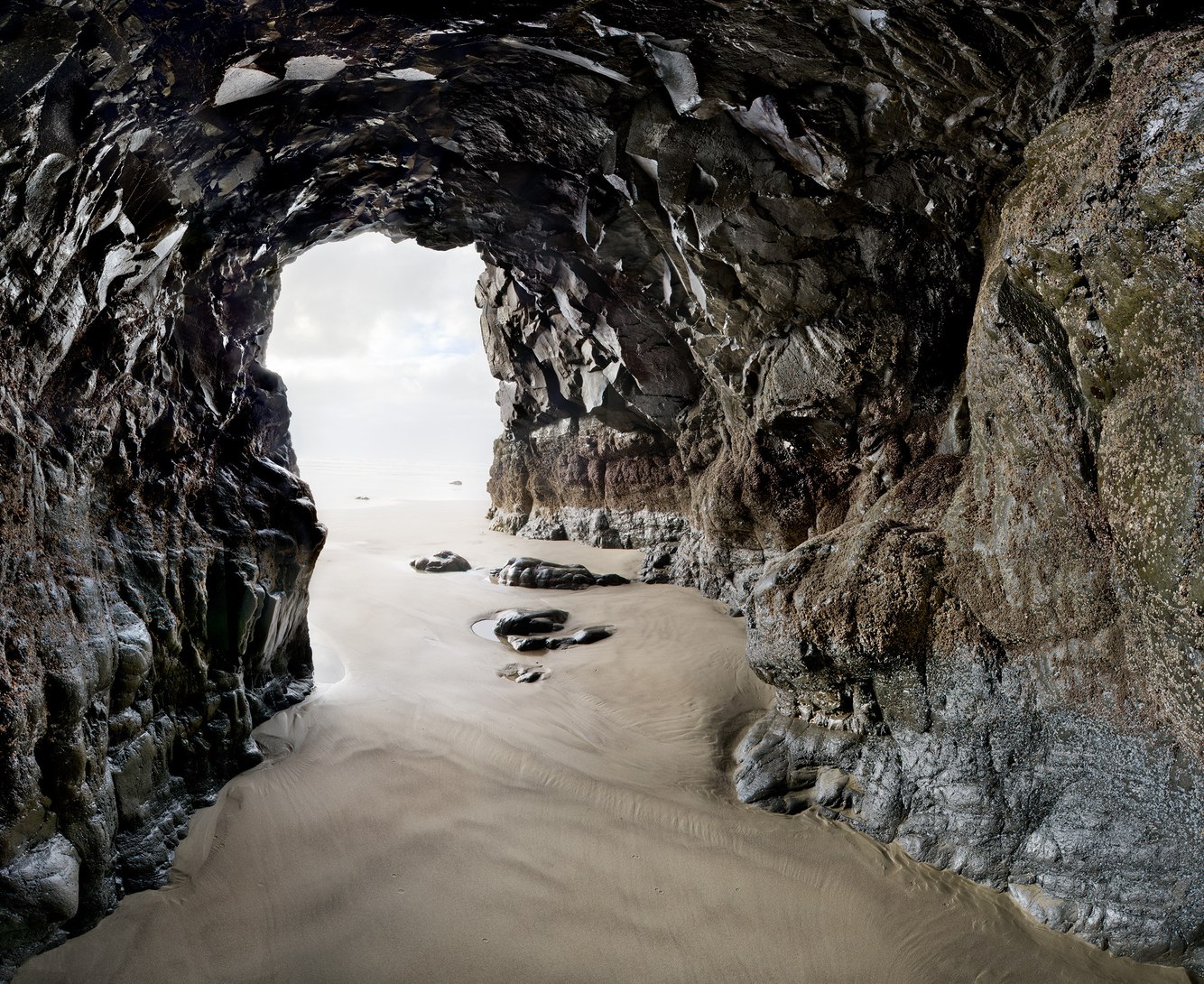
Sea Cave, Cape Lookout Beach, Oregon
Where the sea meets the beach, waves funneled into this cave. During the brief lull between waves, I entered to understand what a sea cave looks and feels like when the ocean rushes into it. A surging swell raised the water level; waves rinsed the layer of barnacles attached to the lava walls. Through the cacophony of countless air bubbles bursting, the waves gave voice to their journey's end. As the tide retreated, my footprints were erased, leaving faint, mottled patterns painted with sandstone, shale, and volcanic sediment. Then, I took this photograph as the ocean's reverberations abated, and the cave became silent.
Along this part of the upper Oregon coast, another type of flow – one that flowed from the east 16 million years ago – delivered sheets of inviscid lava across 200 miles. The lava overran an earlier layer of sedimentary bedrock to create 800-foot-high Cape Lookout, one of the most striking headlands on the Pacific Coast. Its erosion-resistant basalt eventually succumbs to surf that propels sand and gravel against its foundation. Exploding air pockets from breakers add to the sea's corrosive force, fragmenting rock, undercutting its cliff face, and creating sea caves.
more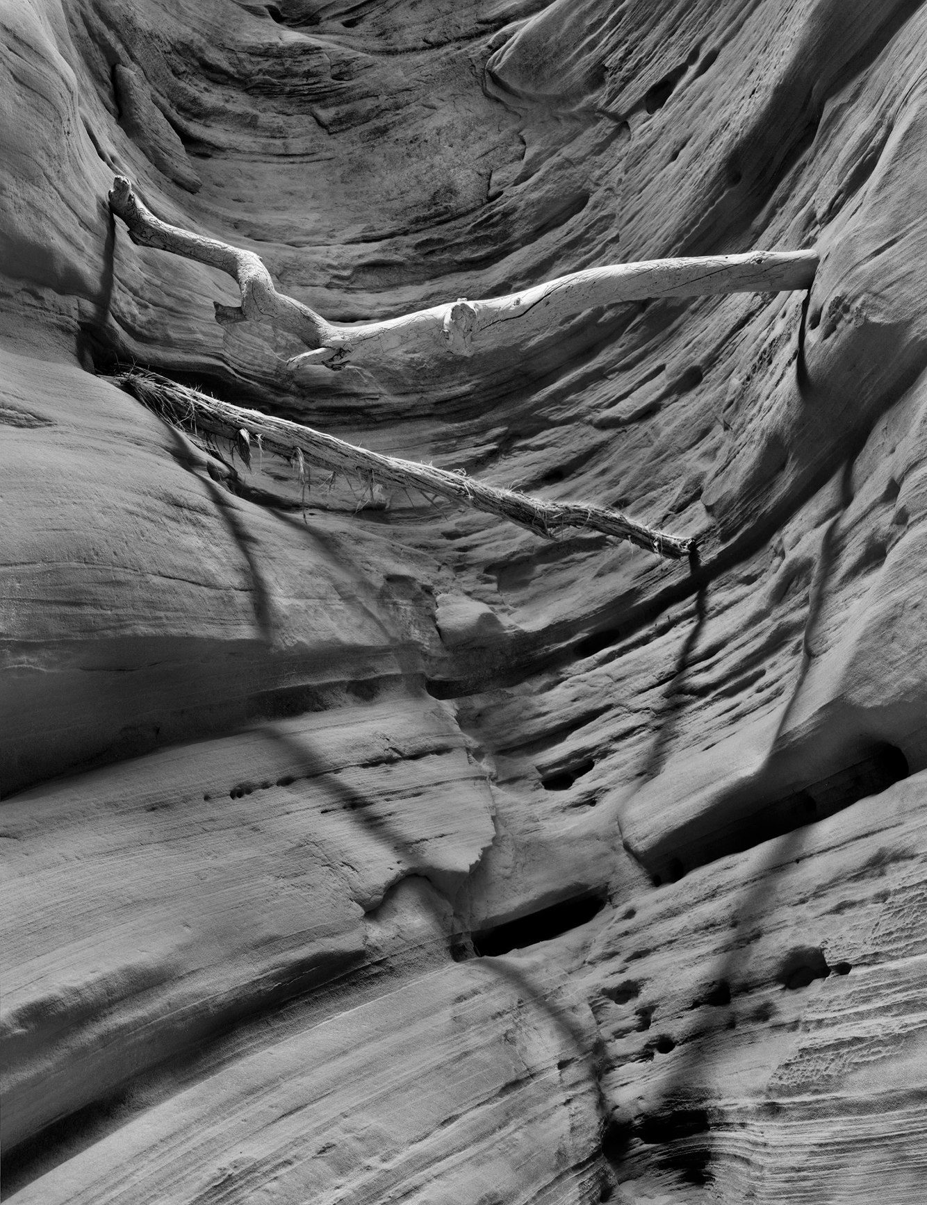
Branches from Flash Flood, Buckskin Gulch, Arizona
Buckskin Gulch is a classic slot canyon: long, narrow, deep, visually stunning, and unnervingly claustrophobic. It traverses the rugged desert country bordering Utah and Arizona, part of a broader region of uplifted red rock called the Colorado Plateau. The upraised sandstone fractured, forming joints that periodic flash floods carved to create extraordinarily narrow chasms.
I made this photograph near the beginning of the gulch, where it contracts from an open drainage into a corridor hundreds of feet deep. Along its 12-mile stretch, hikers can extend their arms and touch both walls. Flooding can occur at any time of the year, from rapid spring snowmelts to summer thunderstorms. Though rare, the water can rise to a hundred feet deep, carrying a slurry of mud, rocks, logs, and sticks.
It can be dangerous to hike, with few places to escape if a 'flood wall' suddenly appears, advancing at speeds as slow as a walking pace up to twenty miles per hour. Though deaths are rare, a few did occur in 2023. One survivor, overtaken by a flood, said being caught in the flow was like jumping onto a waterpark slide "but with more rocks and more danger. There's nothing you can do. Once you're on, you're on. You ride it to the end."
more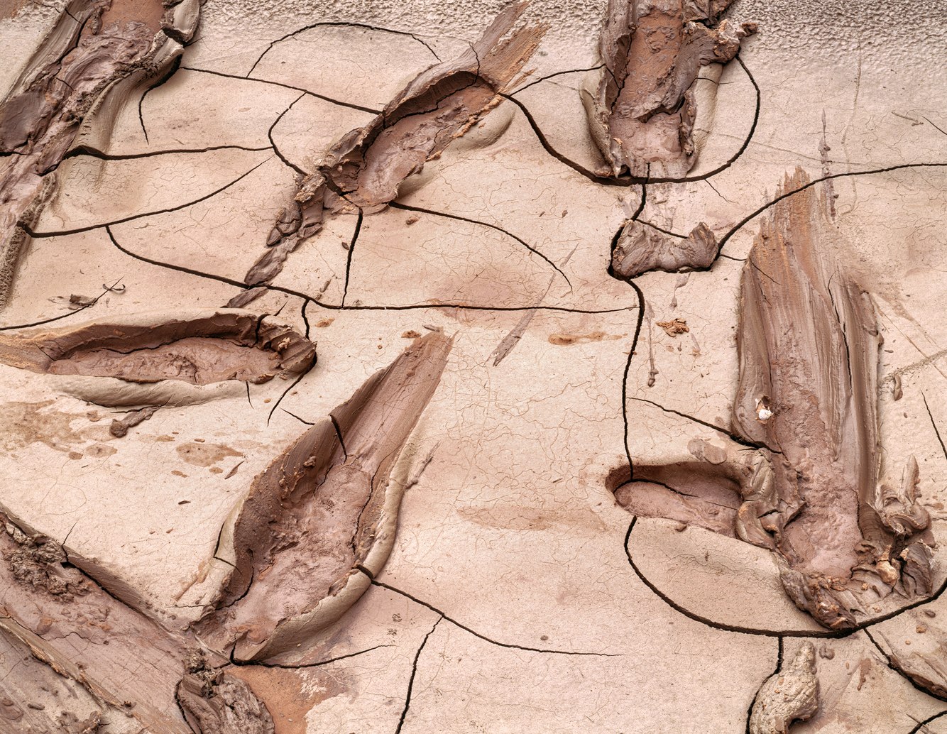
Tracks, Drying Mud, San Juan River, Utah
As we rafted down southern Utah's San Juan River, we saw that a flash flood had raced down the river ahead of us, originating from one of its side canyons after a late summer storm. Once the river receded and the silty flow settled out along the riverbanks at the entrance to Oljeto Canyon, the desert air began hardening the fresh blanket of mud.
As we exited the river boats, mud stuck to our sandals and squirted around our feet, creating a ridge of slurry that cupped our tracks. Some of us skid along after a running start, others slipped while gingerly navigating the slick scrim, and a few carefully and deliberately placed each foot straight down and lifted straight up. As the tracks dried, cracks formed. Other creatures left their marks. Small birds stamped claw prints. Worms' underbodies created small, squiggly trails and left engravings that mapped out circuitous and seemingly arbitrary routes.
As I absorbed the tableau, it reminded me of Roy Lichtenstein's brushstroke paintings, which parodied art theory concepts of the 1950s and 60s by caricaturing the painter's primary mark - the brushstroke. Aided by fluidity and gravity, these footprints, claw marks, and worm paths were unselfconscious gestures. Their canvas was mud, and they felt – like Lichtenstein's brushstroke paintings – instinctive, spontaneous, energetic, and slyly humorous.
more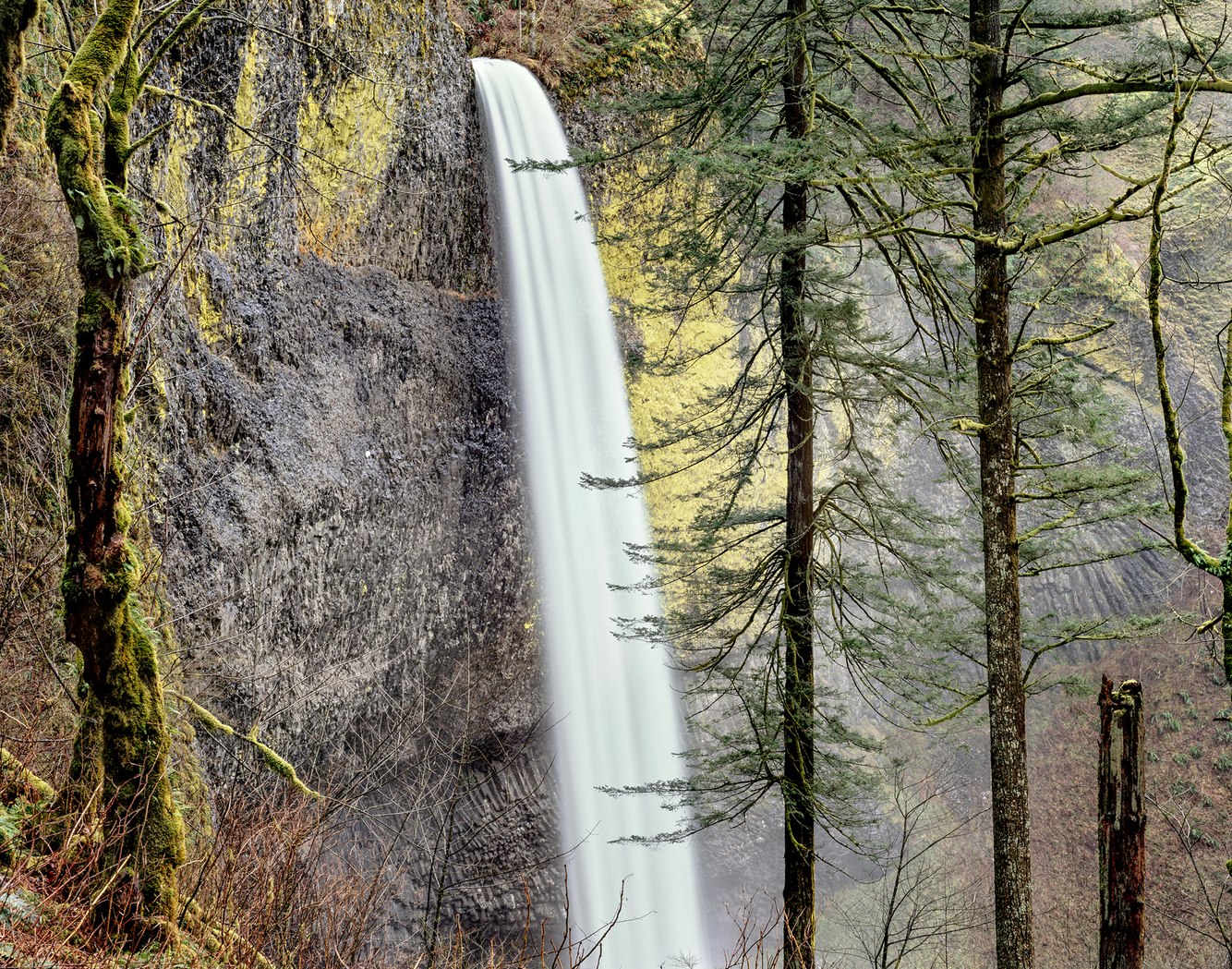
Latourell Falls, Upper View, Columbia River Gorge, Oregon
The Columbia River Gorge marks the boundary between western Washington State and Oregon. A fjord-like 80-mile stretch of river is inhabited by 90 waterfalls. Almost all of them are on the Oregon side, where the topography favors their formation. Over millions of years, hundreds of lava flows built layers of basalt rock that tilted away from the river to form the sheer cliffs, over which the water descended.
Latourell Falls is the westernmost of the gorge’s major waterfalls, plunging an unbroken 224 feet from the lip of a volcanic bluff to the base of the mist-filled valley of deciduous and conifer trees below. The viscous lava flow that formed this falls, originated nearby. The upper wall behind the falls is rough, where the basalt cooled rapidly. Further down the wall, lava was insulated by the crusty upper part of the flow and cooled more slowly so that the crystalline structure organized itself into symmetrical basalt columns.
In more recent geologic time, following the last ice age, a series of cataclysmic ice and water torrents raged through here – some of the most voluminous in world history – carrying gravels and boulders widening the Columbia River basin that scoured and undercut this basalt cliff. Its rougher upper surface has since become tinted by eye-catching patches of luminous golden-green lichens.
more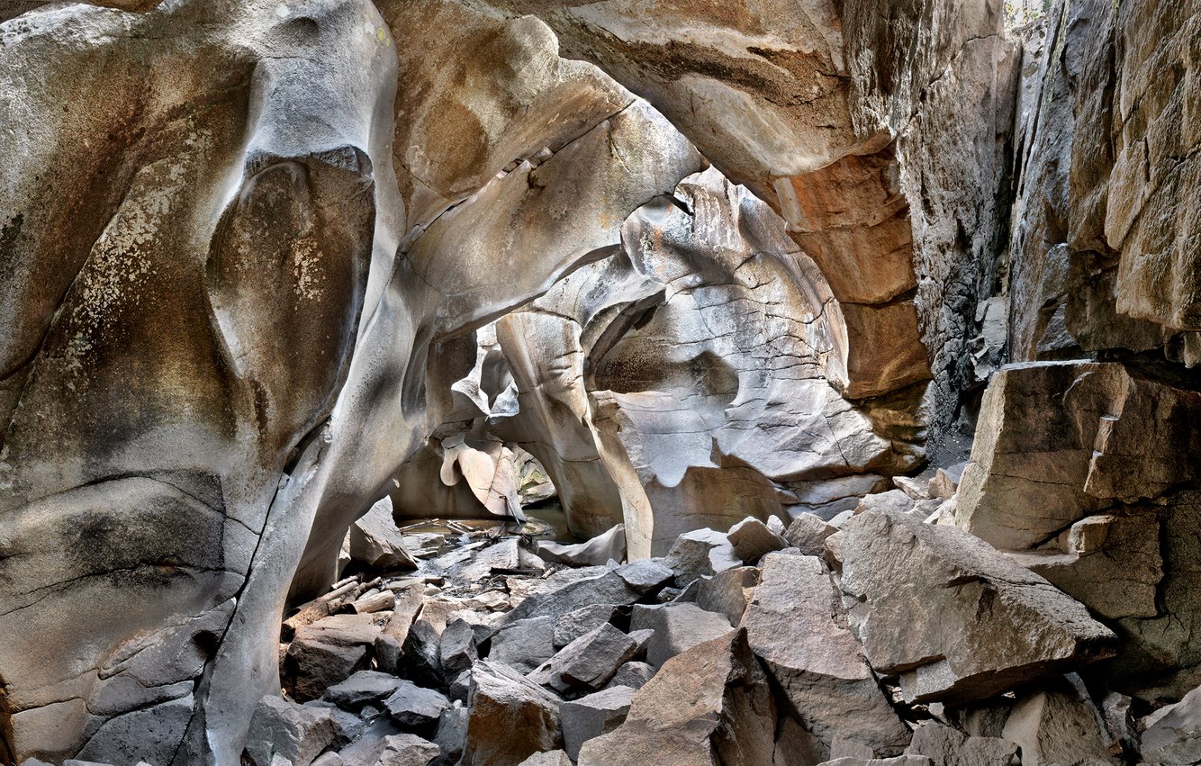
Grottos Cave, near Aspen, Colorado
Grotto is a term often used to describe a natural cave or cavern, though the word derives from something human-made. A richly decorated structure built by the Roman Emperor Nero soon after the burning of Rome in 64 A.D. had, over time, sunk underground only to be rediscovered in the 15th century. Upon viewing, it was considered very strange; something uncovered from the “underworld” and was called a grottesca – literally “of a cave.” This led to the French adjective grotesque – a word that suggested something strange, mysterious, and even disgusting.
The Grottos were built not by human hands but by the erosive powers of the swollen Roaring Fork River, which once flooded through this cavern at the end of the last ice age. Hidden from view beneath a trail, one enters a disorienting and otherworldly or, in this case, literally an “underworldly” and beautifully strange geological phenomenon.
I first entered the cave in winter when it was filled with ice, which entirely melted halfway through the following summer. The ice once served as refrigerated food storage for Ute people, including Chief Colorow and his family, who were hunting in the Roaring Fork Valley in the late 19th century using the Grottos when it was still part of ancestral Ute land.
more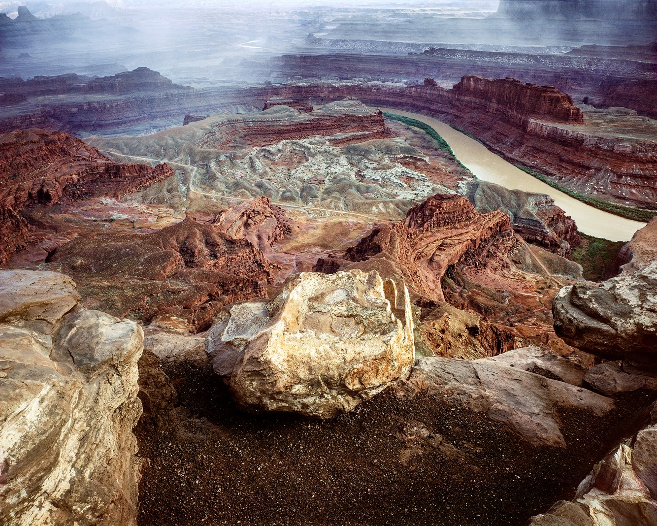
Colorado River Overlook, Dead Horse Point, Utah
Standing at the edge of eastern Utah's Dead Horse Point, I survey a 270-degree view east, south, and west across the grand expanse of red rock country and down 2000 feet through geologic time, and the lithified layers of mud and sand from an ancient era, when the North American continent was located near the equator.
Over eons, these sedimentary stratums were deposited in oceans, windblown deserts, freshwater lakes, streams, and floodplains. Plate tectonics moved the continent north and lifted the terrain in this part of the Intermountain West, creating a high plateau. Hardened into rock and cut through by the Colorado River, today they've become rust-colored pages of a geologic book, the text block and fore-edge of each page, seen from the plateau's rim down to the river.
In the late 1800s, the narrow neck of this point was fenced off and used to corral wild mustangs that were then shipped to Kansas City to serve as workhorses for midwestern farmers. After grading and culling the herds, the less desirable horses were left behind on the point, the cowboys leaving the gate open, allowing the horses to roam free. However, sometime later, the gate was discovered closed, having left the trapped horses peering helplessly into the crevasse with its river below, eventually dying of dehydration.
more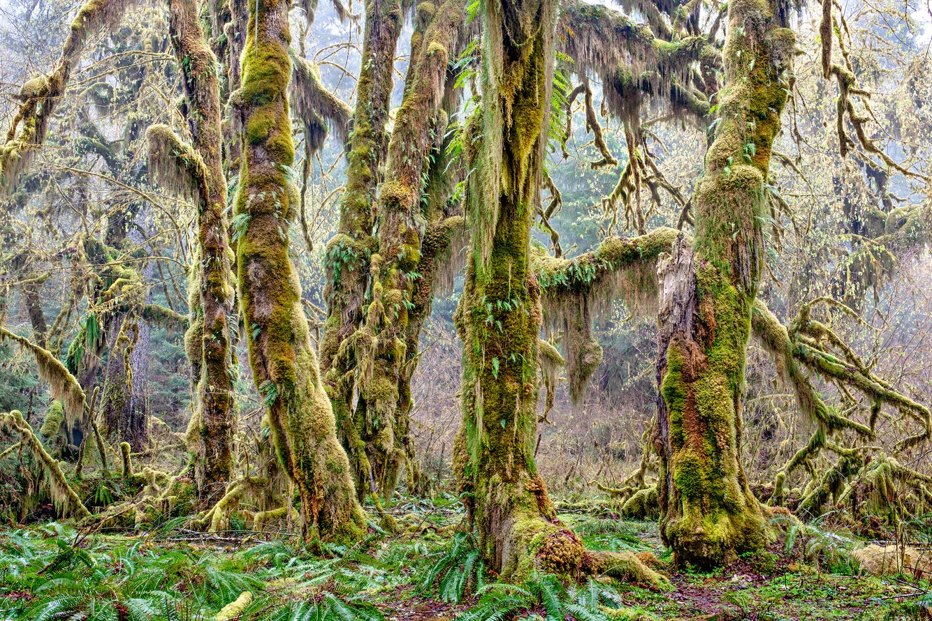
Hall of Mosses, Hoh Rainforest, Olympic Peninsula, Washington
Amid Washington State's Olympic Mountain Range, the Hoh Rainforest shelters ancient stands of coniferous and deciduous trees, most notably along its Hall of Mosses Trail. One of the best-preserved temperate rainforests in the world, its stable ecosystem is maintained by a steady flow of moist air off the Pacific Ocean. It delivers abundant rainfall of twelve feet annually in the cooler seasons and ample sunshine in the drier summer.
It is both a lush and very quiet place. Sound engineers have identified a spot in this forest where you will hear the least human-produced sounds in the United States. While exploring this area, I've only ever heard the occasional group of hikers conversing on the trail, as well as the rare but intrusive Navy fighter planes passing overhead. Otherwise, the ambient sounds characteristic of this forest are the 'morning chorus' of birds in the summer and winter's falling rain.
The best time to walk the Hall of Mosses Trail is during the wet seasons between November and April when its colors are most vibrant. The open, light-filled grove provided by the taller, well-spaced conifers and the fertile soil harbors a mature stand of large, big-leaf maple trees. The trail is named after this celebrated grove with its trunks and branches clothed in mosses – especially clubmoss and slender mouse-tail moss – and the ground carpeted with sword ferns. The stances of the tree trunks and expressive gestures of their limbs in this congregation of maples conjure a sense of their sentience.
more
Horseshoe Falls, Niagara River, Ontario
Horseshoe Falls is the largest of the three waterfalls forming Niagara Falls along the Canada–United States border. Ninety percent of the Niagara River, or an average of 3000 tons of water per second, flows over the 167-foot height and the half-mile-long arc of Horseshoe Falls.
Niagara Falls was created when the Niagara Escarpment was exposed after the retreat of glaciers at the end of the last ice age. The escarpment is a cliff face that crosses the Niagara River between New York State and Ontario, Canada. It is capped by dolomite that is harder than the underlying rock and forms the leading edge of the falls, which erodes upstream about three feet yearly.
Horseshoe Falls has been a subject for artists for at least the past two centuries. Painters Thomas Cole, Albert Bierstadt, and Fredrik Edwin Church stood at the edge of the same overlook from which I made this photograph. In Bierstadt's preliminary sketch, he wrote notes about the quality of the water, its spray, color, and shades. He described the same scene I saw 120 years later when this picture was taken, "Niagara morning, the great body of the fall in light, Horseshoe fall."
At its edge, a stone wall holds back those who are drawn to the river as it tumbles into the misty void. Dozens have accidentally fallen into, dived over, or crated themselves inside barrels to brave the vertical descent. A surprising number survived, while several did not. One feels the pull of the raging water and the almost gravitational attraction that the enormous downward movement of water has upon one's perception and body. Philosopher Søren Kierkegaard observed, "He whose eye happens to look down the yawning abyss becomes dizzy."
more
Sandstone Tafoni Formation, Pebble Beach, California
Walking the shoreline of Pebble Beach gave me the opportunity to loiter along the intersection of three states of matter, with the calm Pacific Ocean to my left, the ragged wall of colorful sandstone to my right, and the vaporous sky above. Ambling the shoreline invited a close examination of this extraordinary environment where water, earth, and air converge to craft the landscape’s contours and details, inspiring a state of wonder that left me conjecturing about their creation.
Tafoni is one such puzzling geologic detail. Its honeycomb pattern can be formed on granite, limestone, or sandstone and is most often created in salt-rich environments such as Pebble Beach. Here, multicolored sedimentary layers were uplifted, steeply tilted and exposed to water and air at the boundary of the converging Pacific and North American tectonic plates.
The salt left behind from ocean mist, wind-blown spray, rising and ebbing tides, and splashing waves coats the sandstone's surface and indentations. The resulting filigree is birthed by a complex combination of factors, such as the cementing of the sandstone's crust, the rock's texture and porosity, and the cyclical tides' wetting and drying. This allows crystallized salt to permeate the rock's sub-surface, which then expands when re-wetted and finally erodes its interior to create small, smooth-edged openings, widening into delightful and mysterious latticework patterns.
more
Above the Queen's Garden Trail, Bryce Canyon, Utah
Bryce Canyon is renowned for its colorful, awe-inspiring formations. Their creation began with ancient floods periodically depositing massive amounts of fine-grained sediment over millions of years. Under the weight of its layers, the sediment lithified into rock. The earth's mantle moved and uplifted much of the intermountain west to high plateaus before eroding this part of southwestern Utah to reveal an otherworldly dreamscape.
The canyon was, and continues to be, carved by ice forming in cracks and forcing rocks to split apart. Ice wedging is continuously sculpting this fragile topography. These limestone columns break, first into walls, then windows, and finally into rock spires before disintegrating altogether. It is one of the few places I've visited where I have observed the evolution of this landform over time. For instance, reaching the capstone ledge on which I made this photograph is no longer possible as the path has completely eroded.
This ledge and the tops of these "hoodoos" surrounding it are capped with white dolomite, which is harder and more rigid than the underlying red limestone. Because it fractures and erodes more slowly, it shields the layers below to help maintain their height and structure. In fact, like a tabletop, the caprock that I stood on to make this image overhangs the 200-foot-tall column that supports it and appears to levitate above the valley floor.
more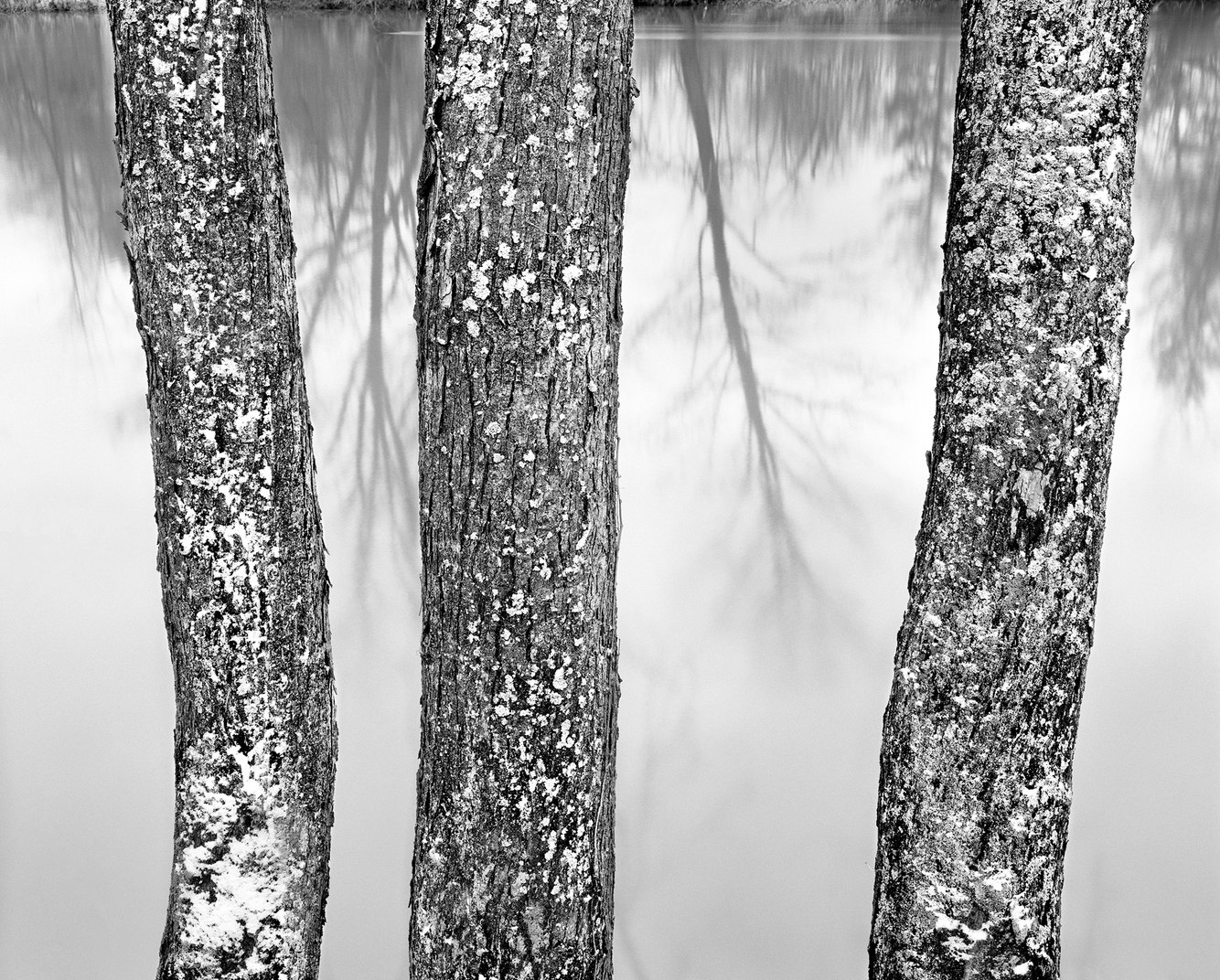
French Creek, near Venango, Pennsylvania
In 1753, George Washington passed by this location, traveling along the Venango Path, an ancient portage trail carved by the Seneca, Onondaga, and Cayuga People and migrating herds of bison. French Creek, named by Washington, marked the western edge of early French and English expansion. In the 19th century, as homesteaders journeyed to the far west, they detoured around this heavily forested region of northwestern Pennsylvania, which remained a sparsely settled wilderness between Lake Erie to the north and the creek's confluence with the Allegheny River to the south.
Today, with its rich and well-preserved ecological resources, French Creek has the highest biodiversity of any watershed in the northeastern United States. Over time, though, this once-clear river has turned milky and opaque. Mining, development, and agriculture have diminished its historically pristine water quality.
Along this peaceful stretch stand three lichen-covered trees. Their trunks are etched in icy relief by the northerly winds of a November storm and the onset of a long winter characteristic of this upland snowbelt. The river's rich riparian loam is ideal for growing these northern hardwood trees – middle-aged with their fissured bark – that naturally flourish along the riverbank's wetlands. Their trunks and limbs are pasted with snow intermingled with lichens, a fertile partnership of fungus and algae, attracted by dampness, anchored by the bark's crevices, and fed by the sunlight the trees' open structure provides.
more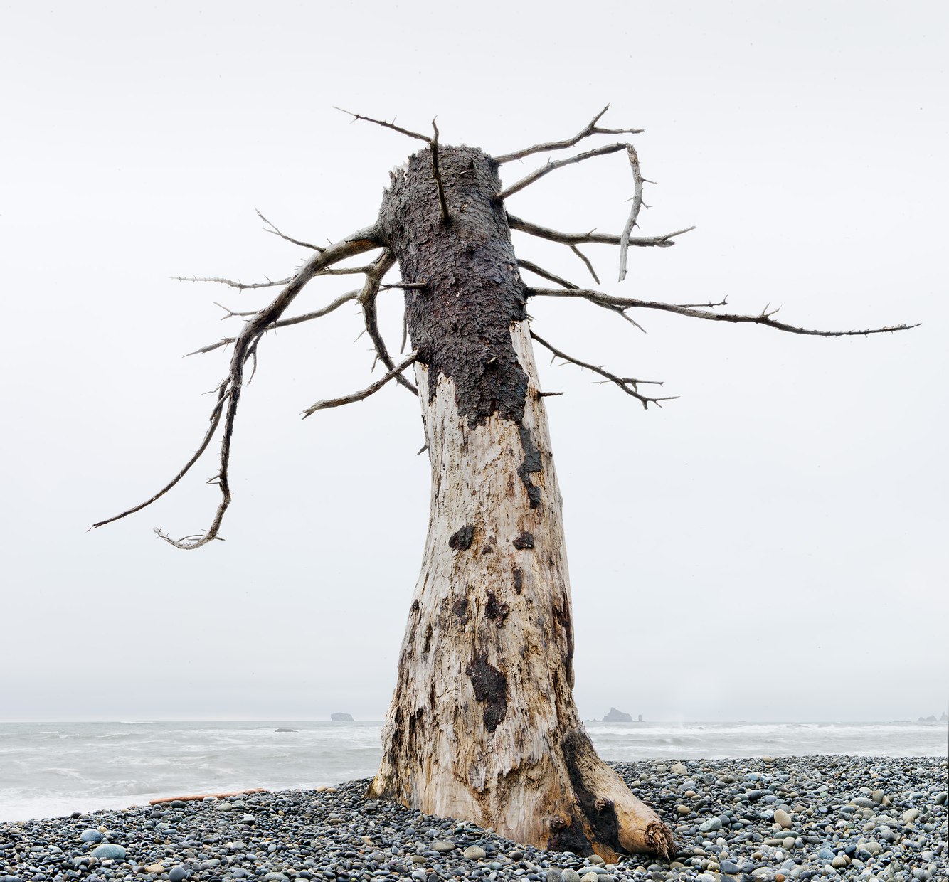
Sitka Tree Snag, Rialto Beach, Olympic Peninsula, Washington
Located along Washington State’s Pacific coast, Rialto Beach is covered by cobblestones and sand relentlessly assaulted by encroaching and sometimes ferocious ocean erosion. Here, a lone Sitka spruce leans into the onshore winds and waves, which have scrapped away at its lower trunk, leaving bark only on the upper part of its leeward side.
Sitka trees grow along a narrow coastal strip from northern California to southern Alaska. Following the last retreat of the Cordilleran Ice Sheet 14,500 years ago, they were a pioneer species that quickly re-established themselves as the ice receded. This coast’s mild climate and wet seasons help these trees thrive, and frequent fog tempers the sun’s heat during the summer.
Its expressive, pendulous limbs invite anthropomorphic interpretations; even in death, the appearance of life persists. Native peoples migrated from Asia to this coast after the ice sheet melted and arrived not long after these trees began to flourish. These First Americans used its pitch for glue, caulking, and varnish; its roots, bark, and branch tips for medicinal purposes; and its inner bark and young shoots for emergency food. They believed Sitka trees held healing and magical powers; during winter ceremonies, they used its boughs to protect dancers while they conjured spirits.
more
Spouting Rock, Glenwood Canyon, Colorado
Gushing out the cliff's recess, Spouting Rock's unusual waterfall emerges from the sedimentary limestone that underlies this region of central Colorado. The stream then flows into Hanging Lake, situated just below the falls, and, from there, feeds into the nearby Colorado River. The sound of the falls blends the low, rumbling echo of the stream flowing through the crevice's opening and the high-pitched splash of water striking its rocky stream bed.
Enclosed by 700-foot cliffs, the waterfall flows from a spring deep within the earth. Its source and path are unknown, though underground streams often issue from limestone formations – especially in steep terrain such as Glenwood Canyon – following a course through eroded tunnels and caves and along fractures and impermeable subterranean ledges. The water flowing out of these falls is rich with dissolved calcium carbonate leached from limestone. The mineral-rich water produces the iridescently blue color of Hanging Lake.
This lively waterfall is active year-round. In a semi-arid climate, the spray-filled air feeds the microhabitat of native mosses and plants that embroider the cliff wall. I've walked behind the waterfall where the limestone has been undercut, forming a (relatively) dry cave, and reveled in the sight of American black swifts agilely catching insects and nesting in the crevices encircling the cave.
more
Chinle Formation, Jasper Forest, Petrified Forest National Park, Arizona
Two hundred million years ago, the supercontinent of Pangaea contained the earth's entire landmass. An early variety of pine trees grew along waterways in the region of Pangaea that is now Arizona, where flooding, wind, and death felled whole forests of these 200-foot-tall trees.
'Chinle' means "flowing through." The Navajo Tribe uses this word to describe soils washed down from Arizona's fertile highlands into its otherwise arid canyons and valleys. It also describes the sediment and organic materials that flowed into Pangaea's floodplains, including the remains of animals, trees, and other plants. Overtime, the accumulation of these deposits compressed into sedimentary rock that makes up the Chinle Formation of eastern Arizona's Petrified Forest National Park.
Exquisitely preserved within the formation's colorful layers, the quickly buried conifers, lacking oxygen, did not decay. Instead, they absorbed minerals dissolved in groundwater, replacing their wood over millions of years to become "petrified," a word derived from Ancient Greek (πέτρα) meaning "wood transformed into stone." These rock boles are colorful versions of quartz, stained by iron oxide and including purple amethyst and yellow citrine.
more
Full Moon, Orion, Lincoln City Beach, Oregon
Orion, the renowned hunter of Greek mythology, was first written about in the 8th century B.C. Though mortal, Orion was reputedly the son of the sea god Poseidon. A fateful story tells of his affection for Artemis, daughter of Zeus and Goddess of the Moon. However, Artemis' jealous twin brother Apollo tricked her into killing Orion. Apollo challenged Artemis – an expert archer – to aim for a head bobbing far out to sea, claiming the swimmer was evil. Her silver arrow split his head, but as the body washed ashore, she discovered it was, in fact, Orion. In grief and as a tribute, she lifted his body into the sky on her moon chariot to become a constellation.
By chance, this photograph combines the elements present in this myth: the shore, sea, moon, and the Orion constellation. Its configuration is visible in the western sky during autumn's twilight before sunrise. During this usually rainy season in Oregon, the air is remarkably clear; even the radiant moon does not dim the constellation's stars, with bright Sirius, representing Orion's dog trailing after him as he pursues the Seven Sisters, mythological nymphs symbolized by the star cluster Pleiades.
The constellation's alignment to the celestial equator and the shifting of its observed position due to the seasonal tilt of the earth's axis accounts for its prominence in both hemispheres. In the northern hemisphere, Orion comes into view near the horizon before daybreak beginning in September, then, during midwinter, appears overhead. Seasonally, the same is true for the southern hemisphere; as their winter corresponds to the northern hemisphere's summer months, Orion reaches its apex in the night sky south of the equator during June and July.
more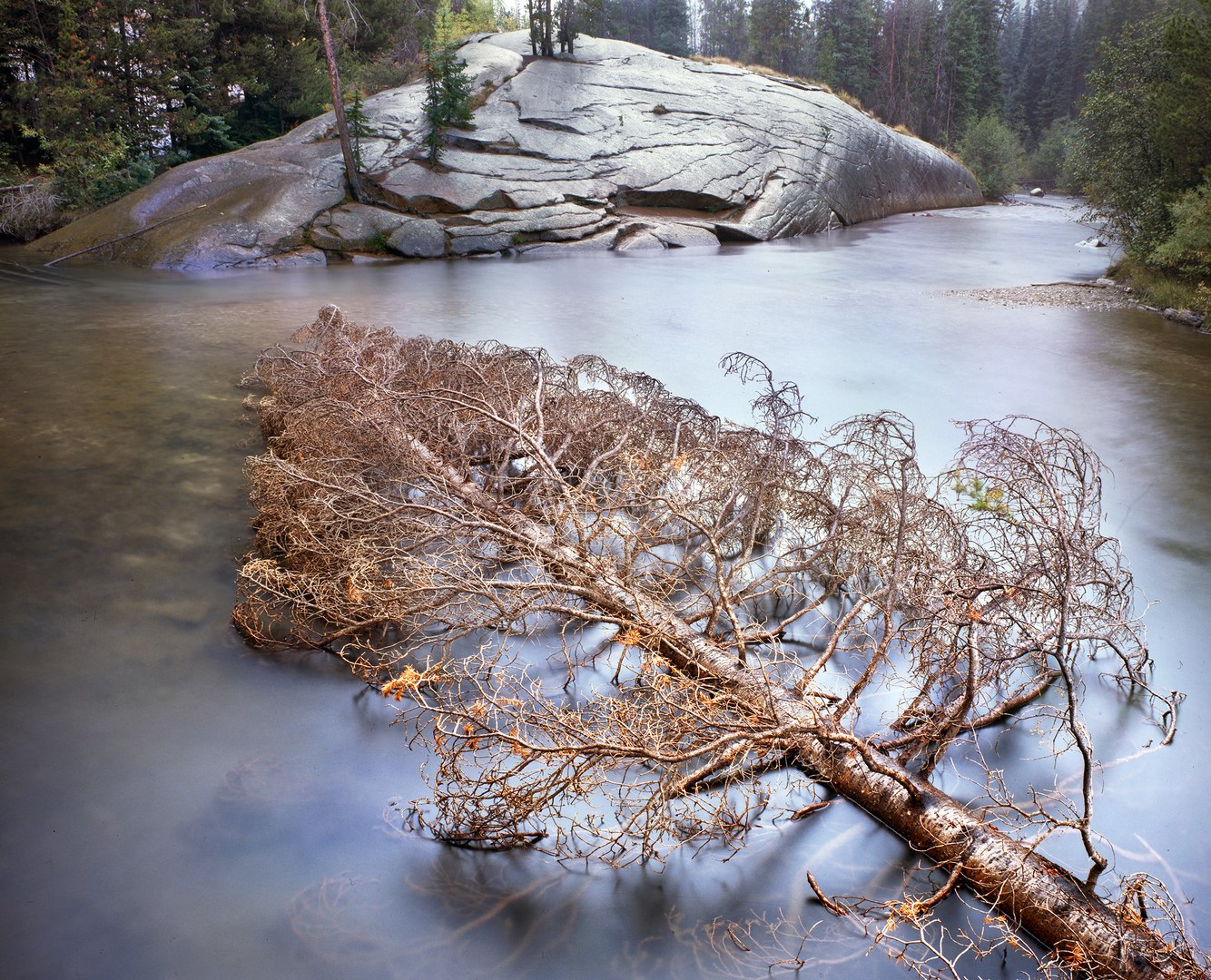
Floating Spruce, Roaring Fork River, Colorado
A young spruce tree falls from the riverbank into a crook in the Roaring Fork River, still green with needles. Over time, I’ve watched its needles brown and thin. Eventually, bark and branches will fall off or be stripped by weather and current. Its trunk will finally settle onto the channel’s stony floor slowly, possibly over many years.
This river originates beneath the nearby crest of the Sawatch Range of central Colorado’s Rocky Mountains. Eighteen thousand years ago, glaciers swept down from the surrounding mountains, widening and deepening the river valley and polishing the bedrock. Today, its path carves through billion-year-old Precambrian granite, beginning at the outflow of Independence Lake and coursing 70 miles northwest to the mile-high town of Glenwood Springs.
During the winter, the river and downed spruce become encased in ice beneath deep layers of snow. During the spring, snowmelt swells the river and hastens its course through this otherwise slow, level stretch. The stream subsides during the summer and fall until its movement becomes barely perceptible. The tree’s fibers dissolve and eventually disintegrate through the annual cycle of seasons, its nutrients feeding life within the river.
more
Ceiling, Snow Cave, near Verlot, Washington
Accumulations of deep snow coating Four Mountain – located in western Washington State – cascade down its steep slopes, amassing on a slanted plain at the Mountain's base. This buildup formed a permanent snowfield under which meltwater streams have carved icy, banquet hall-sized caves.
The hike to the caves traverses a terrain littered with the remains of winter's avalanche-downed Pacific Silver Firs (usually found at higher elevations but growing here due to their proximity to the perpetually chilly snow fields). The trail presents hazards throughout the year, with boulders and stones flying down the mountainside to a large and active scree slope surrounding the snowfield.
The wet variegated ceilings of these caves continuously drip in the warmer months. This photograph reveals a brown streak of dense sediment, likely marking the dividing line between winters or possibly the ash residue of a wildfire. This luminous ceiling is also characterized by spots and indentations of captured debris and sediment-stained ice glowing yellow, blue-grey, and cyan. Each passing year adds and subtracts colors to the ceiling's palette.
The Forest Service has restricted entrance to the caves, but despite their warning signs, this underground world has tempted many to inspect its wonders. Lying down to view this ceiling's panorama would be a serene and mesmerizing experience if not for the frigid air and dripping melt. There is also the constant danger of ice falls, which have taken the lives of at least four adventurers, especially during summers when visitation is frequent and the cave's ceiling is most unstable.
more
Black Dragon Wash, San Rafael Reef, Utah
Black Dragon Wash takes its name from a nearby pictograph that, as once outlined in chalk, resembled a dragon. Later, it became apparent upon closer inspection that some passersby carelessly encircled what initially appeared to be a dragon but was, in fact, several figures painted in the ancient style of hunter-gatherer tribes from two thousand years ago. Nevertheless, the misnomer became the adopted name of this wilderness canyon within central Utah's San Rafael Swell.
The Swell is an anticline of sedimentary sandstone uplifted by the action of the earth's outer shell that floats on a fluid inner mantle, fragments of which collided, compressed, and rose. Later erosion and floods created Black Dragon Wash and the other canyons that cut through the steep eastern face of the Swell.
The matte black color of this sandstone wall resulted from infrequent torrential rain pouring off the slick rock and staining the canyon’s cliff walls, depositing clay with traces of manganese and zinc. Upon this gessoed surface, a montage was created of a bright stripe of red rock flanked by talc-like marks resembling streaks, a cross, and an oval blemish. For me, these contrasting elements come together as a composition that conjures meaning and defies interpretation.
more
Glacial Erratic, Deer Isle, Maine
A lichen-freckled granite boulder held the evening's fading light. Deposited on a granite bench that rims the shoreline of Deer Isle on Maine's midcoast, it rests uncertainly, transported here by an ancient glacier. When the climate warmed and the weighty ice retreated, the land bulged, fracturing its bedrock. Seeps sprung from cracks in this terrace, leaching minerals, staining its surface, and breaking the bedrock into thin, irregular sheets.
Though the rock terrace and the boulder are both granites, it is apparent that this boulder is a visitor due to its shape and appearance. It arrived via the most recent advance of the Laurentide Ice Sheet, which initially encompassed much of Canada and the northeastern quadrant of the United States almost 100,000 years ago. The glaciers invading present-day New England were thick enough to bury its mountains and push out into the Gulf of Maine until they began to recede 12,000 years ago.
The Latin word for erratic – errare – means "to wander." From where did this itinerant rock originate? Geologists can sometimes identify the home of an erratic by analyzing its mineral makeup and tracking back along the direction of an ice field's movement to the outcrop or bedrock from which it was lifted. This boulder could have traveled as little as a couple of miles or – evidenced by its rounded shape and worn edges – from hundreds of miles away.
more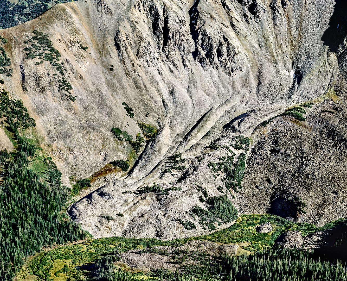
Rock Glacier, Cathedral Lake Trail, near Aspen, Colorado
When I first saw this rock glacier from the valley floor, it looked like a scree slope, flat and stationary. Further up the trail, as I photographed this scene from above, I realized its appearance was much different, exhibiting the same shape and sense of movement as an ice glacier. However, unlike the smooth exterior of ice glaciers, its furrowed surface resembled pale, desiccated skin.
Rock glaciers form in a manner similar to ice glaciers; both result from gravity carrying ice – or, in this case, rocks intermingled with ice – down from mountain peaks and ridges. Sometimes, rock glaciers form from the path of a melted ice glacier, later covered by stones and boulders. Almost always, their ribbed and wrinkled surface is the product of rocks that have become 'glued' to one another by ice moving downhill together.
Fed by rockfalls off the cliffs along its upper reaches, this mile-long formation in central Colorado's Elk Mountain Range is composed of granodiorite that advances a few inches to two feet per year. Though conifers growing on its lower arms helped stabilize part of this glacier, as I hiked its edge, I quickly understood it was too treacherous to traverse, its sharp, angular rocks precariously perched in place.
more
Sunlight, Morning Mist, Sitka Grove, Cape Lookout Beach, Oregon
Sitka spruce inhabited glacial moraines left from the last ice age along the Pacific coast from California to Alaska. They thrive on frequent morning fog and are unfazed by clouds of salty wave spray from onshore winds. This species welcomes the fury of late fall's blustery storms and winter's ample rains. Though the low sun of December's solstice does not penetrate the thick stands easily, the trees continuously grow from year-round photosynthesis and can live up to 800 years.
This morning, the sun broke above the foothills' high horizon that backdrops this portion of Oregon's west coast and shone down on a fog-bound beach through a dense Sitka forest. Under their deep shade, lower branches have lost their needles and broken into sharp spears that cut the light. Filtered rays added depth and dimension to the woods; the brighter, sharper shafts foregrounded the nearest trees against the softly lit inner grove.
The beauty and spectacle of sunbeams sifted through steamy layers of tree trunks, branches, and leaves has lent itself to various interpretations. In Japan, the word 'komorebi' is often used to describe the feeling of sunlight filtering through the branches of trees. Among many cultures, sun rays illuminating the primeval dark of the forest, mark the approach or presence of a celestial being.
more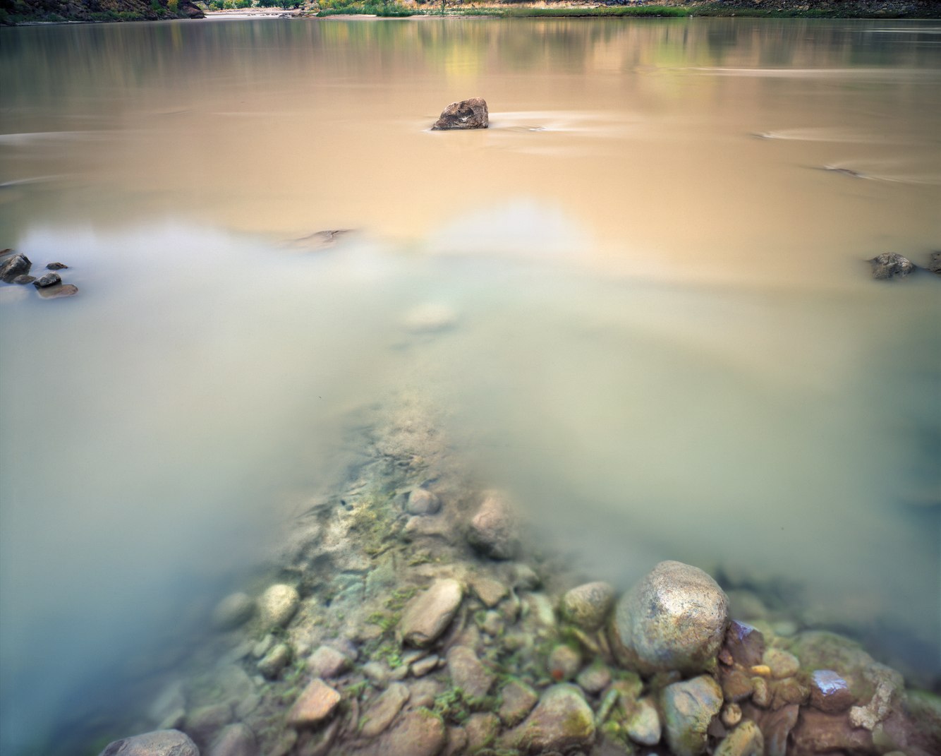
Confluence, Rock Creek and Green River, Desolation Canyon, Utah
Carved deep within the cavernous fold of a plateau bordering both sides of the Green River is a remote canyon that traverses eastern Utah’s desert. “We pass through a region of the wildest desolation,” wrote John Wesley Powell, thus naming the canyon during a historic 1869 river expedition that eventually carried him and his crew through the Grand Canyon.
Rock Creek begins at the 9800-foot crest of the Roan Cliffs, cascading down to the Green River 5,300 feet below through Ute tribal lands and past ancient rock art sites. In an otherwise arid climate, this stream provided fresh water to Rock Creek Ranch, where the Seamount family planted fruit trees and irrigated cattle pastures from 1914 until personal tragedies and poor economics forced them to abandon the farmstead a decade later. Today, the site could be mistaken for the set of an old Western.
On this October evening, clear Rock Creek dissolves into the Green River, “a river surcharged with sand and silt, seldom green,” wrote Edward Abbey. Willows and cottonwoods border it, now turned autumnal yellow. Waterfowl nest here, and deer and elk have begun to winter in the protected canyon. Desert sage and bunch grass backdrop the riparian riverbanks; further above, snow has covered the steep, rocky slopes. Camping here reminded me of a passage from Ann Zwinger’s book Run, River Run, “There is a beautiful solitude to this canyon. Now, in the dusk, the river muses, as if to itself… I fall asleep listening to moonlight and the old cottonwoods...”
more
Morning Frost, Great Sand Dunes National Park, Colorado
“Their appearance was exactly that of the sea in a storm, except as to color, not the least sign of vegetation existing thereon,” wrote U.S. Army Lieutenant Zebulon Pike about the Great Sand Dunes on an 1807 expedition he led through the Rocky Mountains.
Dune fields often form where the earth’s tectonic plates move apart, creating depressions in the earth’s contours known as rift valleys, such as southern Colorado’s San Luis Valley. Over at least 12,000 years, fine grains of volcanic rock traveled via rivers and wind from the San Juan Mountains to settle in this valley, along with coarser grains washed down from the nearby Sangre de Cristo Mountains.
On an early December morning, the combination of rapid night-time cooling and air saturated with moisture stored from within the dunes created a thick coating of frost on their surface, so thick that it resembled snow. As the sun climbed, it quickly melted away, leaving a trace in the shadow of this 700-foot dune that reflected the cyan-blue sky.
Though the morning air was still, wind blowing across the dunes from the previous day created ripples like fingerprints, sorting large grains on the ripples’ crests and smaller grains in their troughs. When seen from the air, the dune field also reveals a granular flow, the ever-changing shape of the dunes resulting from the wind’s energy.
more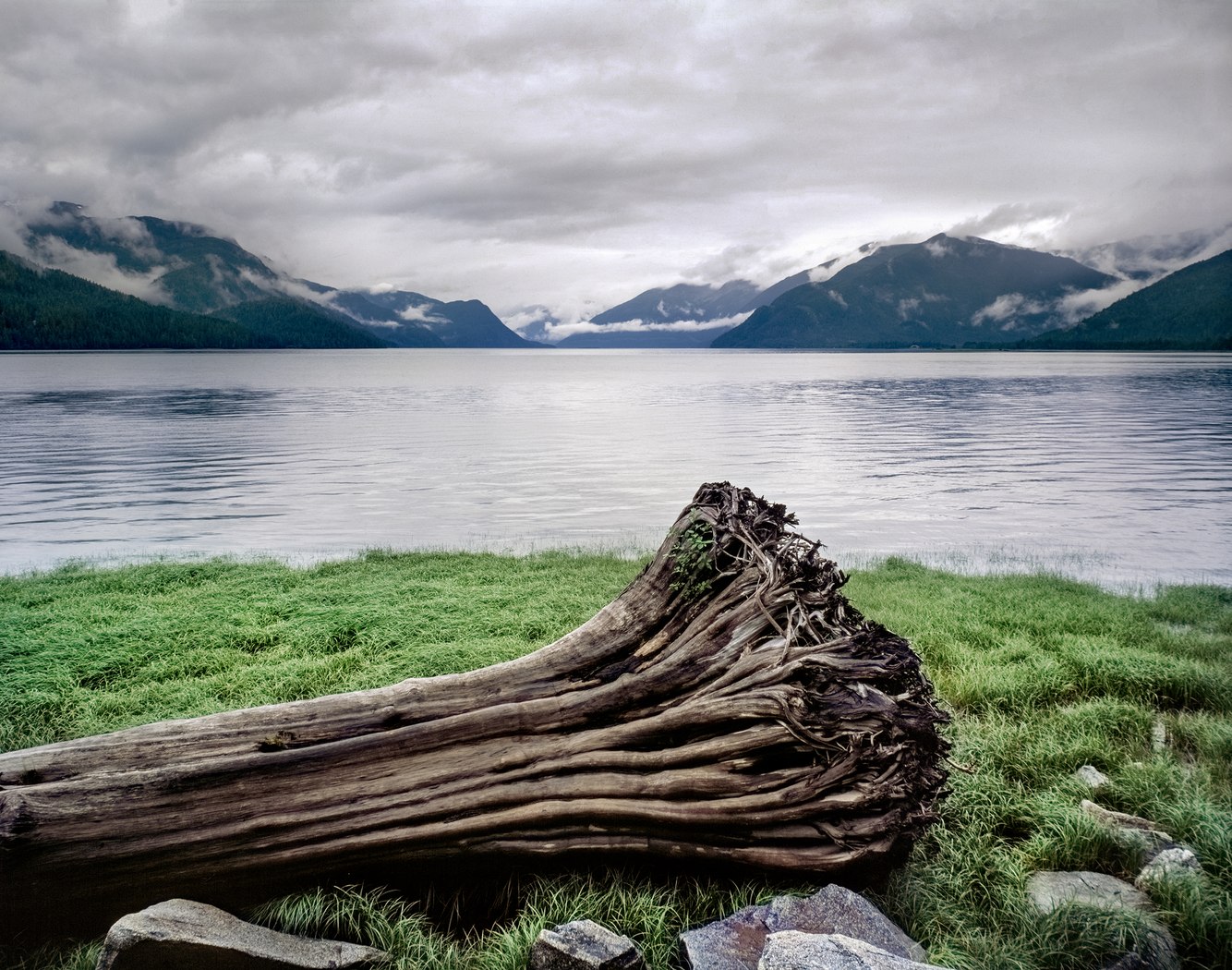
Drift Log, Skeena River, British Columbia, Canada
The Skeena River is one of North America's largest free-flowing (undammed) rivers. Its course runs from the interior of northern British Columbia to its coast, passing through the world's largest intact temperate rainforest, the Great Bear Rainforest.
To the native nations that share this region, "the word 'Skeena' means "water from cloud," a place of abundant rainfall and persistent cloud cover. Geographically, they rely on a mild climate for growing food and depend upon and honor salmon and mammals such as deer and bears, especially Spirit Bears. Tradition holds that Spirit Bears – a rare local breed of black bears with white/cream-colored fur—signify thanks for the bountiful land.
Along the river's course, it passes through massive Sitka Spruce and Western Red Cedar stands. When the river runs high, and the Pacific Ocean's large tides flood the Skeena's estuary and lower reaches, shoreline trees caught by the high rushing water become drift logs caught in the current, entangled in the shallows, and stranded on its banks. Driftwood, stripped of bark and branches, sometimes serves as material for artists, including indigenous artists Alex and Michelle Storey, who planned community-built sculptures along the riverbanks. (link to article)
more
Nankoweap Granaries, Colorado River, Grand Canyon, Arizona
Granaries are storehouses for safely preserving seeds, beans, and grains away from animals, insects, disease, and floods. Typically built from timber, stone, and clay, evidence of their construction goes back over 11,000 years, and they continue to be used worldwide today.
The Nankoweap Granaries were built around 1100 AD by members of the Ancestral Puebloan culture who cultivated food in a significantly different environment. Today, cold, blue water flows into the Grand Canyon from Lake Powell, resulting from the 1964 Glen Canyon Dam construction 68 miles upstream from this site. When the Puebloans made these granaries, the free-flowing Colorado River was warmer and red from carrying sediment. The Puebloans benefited from the nutrient-rich soil deposited along the riverbanks to grow crops. They stored corn and pumpkin seeds for periods of drought when food was scarce.
Constructed by stacking sandstone mortared with mud and straw, the shallow cave’s bedrock formed the floor, ceiling, and back wall, and flat sandstone slabs once sealed the front openings. A steep trail protected the granaries from enemies and floods 700 feet above the river. It is a half-mile hike from the broad and once-fertile delta of Nankoweap Creek (upstream from this location), where as many as 900 people cultivated the arable land. Looking downstream from the granaries at the river and the plateau’s rim above, this view has remained essentially unchanged in the past 900 years.
more
Granite Bedrock, Atlantic Ocean, Schoodic Point, Maine
Extending far seaward from Maine’s eastern coast, shifting tectonic plates and ancient erosion exposed Schoodic Point's bedrock. Granite fractured into irregular blocks, broken seams filled by molten flows that cooled into black basaltic veins.
After the last ice-age glaciers retreated, the rock shelves again rose and stabilized. Today, granite benches flank the ocean, its flat-topped terraces tilting down to the North Atlantic's edge. Attached to their walls in between the high and low tides, white acorn barnacles cleanse the water and provide food for other organisms.
The sea blackens the rock with its ceaseless ebbs and swells. This long film exposure overlayed hundreds of breaking waves, deceptively rendered as a diffuse glow. However, the experience of being there can be quite different. Geyser-like spray rinses the granite as waves break directly against the rock face. Gales and high surf have (though rarely) swept unsuspecting sightseers into the tumultuous ocean.
Historically, Schoodic Point has attracted painters to interpret its desolate beauty. In 1940, renowned modernist Marsden Hartley painted storm waves ruthlessly assaulting its headland. In an article by Carl Little (January 4, 2022), Janice Anthony said her acrylics reveal "the eternal presence of the underlying rock, defiant against the ocean waves, sheer cliffs standing unperturbed…" and oil painter Joel Babb described the promontory as "the end of the world [where] the order and structure of the earth ends at the edge of something great and different and disorderly."
more
Spirit Falls, near Oakridge, Oregon
Cradled in a lava bowl, Alex Creek flows over a 40-foot moss-covered outcrop, draping it like a luminous veil as spring-fed water spills into a shallow pool. Echoing off its basaltic walls, one can hear the waterfall before it comes into view, hidden in the cleft of an old-growth forest of Douglas-fir, western hemlock, and big-leaf maple.
Spirit Falls is a dreamlike refuge between the crest of the Cascade Range and the Willamette Valley in the low, wet mountains of southern Oregon. Fed by snowmelt and groundwater, the creek thunders through the rock wall's gap in the spring. On this mid-October day, the fall's ebbing flow is lit by a break in the forest canopy.
In 1978, when a forest service employee first came across the falls, he named it after his wife, calling it Andrea Falls. A few years later, a Boy Scout troop, in an enterprising project, built the half-mile trail to the falls. Afterward, the troop approached the Oregon Board of Geographic Names to officially designate it Spirit Falls in tribute to the "Scout Spirit" of "doing good," though, over time, its name has come to describe its ethereal and contemplative nature.
- James Baker
more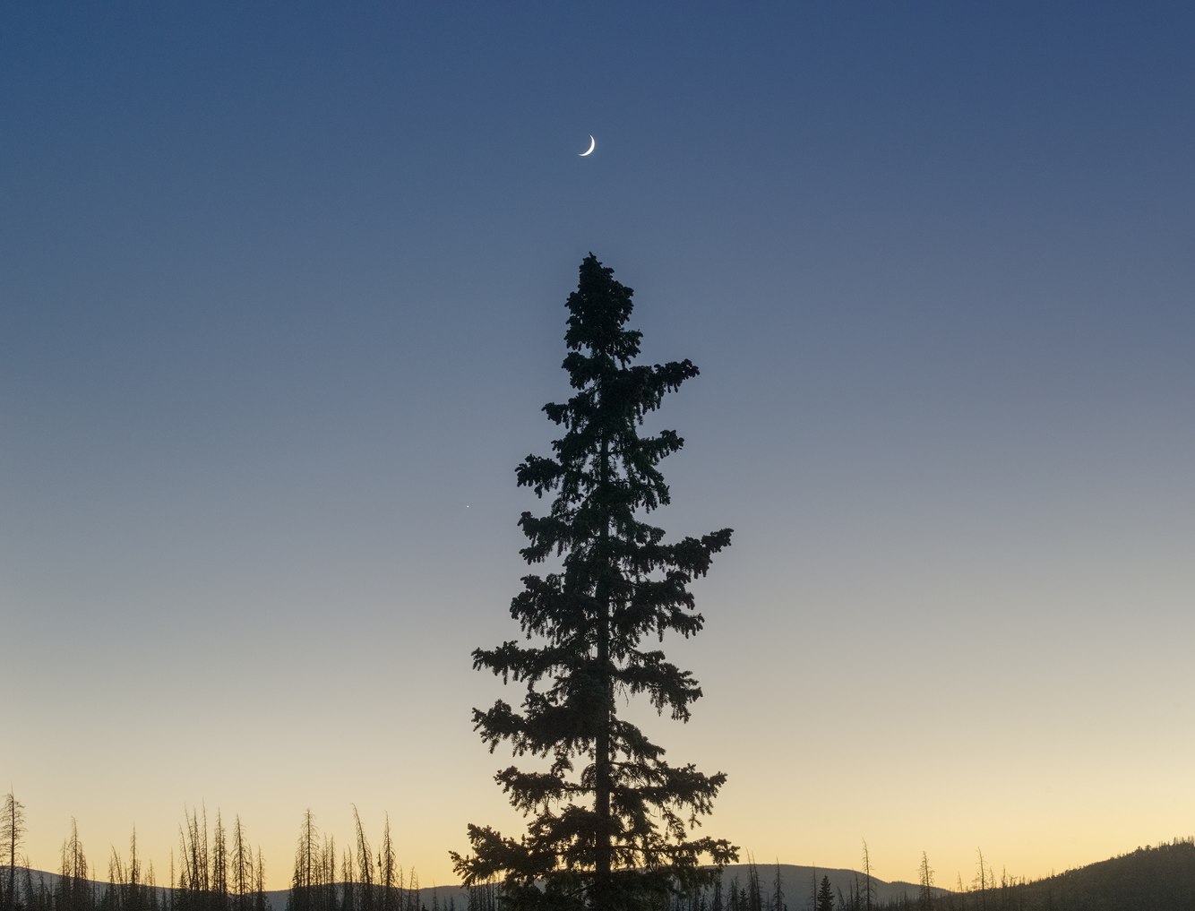
Young Engelmann Spruce, Spruce Beetle Epidemic, Hanson's Mill, near Creede, Colorado
Above the historic silver mining town of Creede, Colorado, an 11,000-foot plateau skirts the San Juan Mountains of southern Colorado. One summer day in the 1980s, I hiked from an abandoned sawmill through ancient groves of blue-green spruce. The La Garita Wilderness I entered appeared to float above the world. La Garita is Spanish for "lookout," aptly describing a wondrous panorama of snowmelt creeks deeply incised through the gentle terrain and jagged summits that etched the horizon. Bands of sheep driven by Basque sheepherders on horseback followed the "stock driveway" trail to mesas above the treeline, feeding on thick grass fields watered by the monsoon season’s afternoon showers.
Thirty years later, the landscape dramatically changed. The Spruce Beetle Epidemic killed vast stands of Engelmann spruce due to an old forest structure already stressed by disease that spread to otherwise healthy trees weakened by extended drought and a warmer climate. Today, though the epidemic has slowed – killing almost all the trees susceptible to the outbreak – it continues in isolated pockets.
Younger trees were unaffected by the beetle invasion. Standing alone, bordered by the gray skeletons of dead spruce, this fledgling tree thrives. Within the once dark and dense stands, sunlight reaches the forest floor, ground vegetation flourishes, creating healthy habitats for wildlife, seedlings become saplings, and the forest regenerates.
more
Moonlight, The Pyramid, Pyramid Lake, Nevada
The moon arched across the night sky, and from its sweeping light, this six-hour film exposure rendered a soft glow to the island and lake. The Northern Paiute call the island "Wono" – the name for their woven cone-shaped baskets. In 1843, government expedition leader John Fremont gave the island and the lake their current names when he wrote in his diary, "We encamped on the shore, opposite a very remarkable rock in the lake … from the point we viewed it, presented a pretty exact outline of the great [Egyptian] pyramid of Cheops." This photograph was taken from the same beach 150 years later.
Western Nevada's deeply folded topography collects rainfall and mountain runoff in basins to soak into its clay or evaporate. Over millennia, this once moist, cool basin and range country became a vast desert of saltpans and remnant bodies of water such as Pyramid Lake that, unable to empty into the ocean, have become increasingly saline.
Though the form of the island is like an Egyptian pyramid and a Paiute basket, a closer analogy might be to a volcanic cone. While molten lava created volcanoes, a freshwater hot spring beneath the lake formed this cone. Twelve thousand years ago, its surging flow chemically interacted with the salty, alkaline lake water to build a tufa mound. The top of The Pyramid corresponds to the former lake's highest elevation, and in today's drier, warmer climate, it has emerged as a 300-foot-high island.
more
Salmon Cove, Rose Blanche, Newfoundland, Canada
Newfoundland’s rugged and exposed south coast contains numerous fjords, bays, and harbors supporting small and widely separated villages. These “outports,” only accessible by fishing boats and coastal steamers, date back to the 1500s and earlier.
Historically rich in fishing grounds, over-harvesting during the latter half of the 20th century collapsed the industry in 1992. One effect was the emigration of inhabitants from smaller communities to larger towns and the abandonment of the most isolated stretches of the coast.
Across the Bay Le Moine in southwestern Newfoundland is the village of Petites – barely visible in this photograph in a sheltered cove along the horizon’s stony reach of coastline. Now deserted of its year-round population, the remnants of a few decaying houses and a steepled church evoke its history.
This timeless landscape is one of mossy granite shelves bordering the tides. Lichens shade the faces of these blackened cliffs. As bedrock contracts and swells through seasons of cold and heat, it slowly wears away, fractured, smoothed, and rounded by unremitting wind, waves, rain, and ice.
- James Baker
more
Plant Wrapped in Spider Web, Discovery Park, Seattle, Washington
Summers in western Washington State challenge the usual perception of the Pacific Northwest as a perpetually cool, wet place. The weather is warm and dry from Independence Day to Labor Day. Perfect for building spider webs so that by the end of August, they abound everywhere in the forests, including this park near Seattle.
Some plants become enveloped by cobwebs. And very different types of spiders can produce them, the smallest being a spider mite. Others, such as the Sierra Dome Spider, craft tent-shaped nets like the kind shown here. That said, with over 50,000 spider species and innumerable types of web architecture, there is a wide range of styles of arachnid weaving.
This plant provided a framework around which the spider built three or four layers of netting, extruding silk-like threads to create a complex structure known as a tangle-web design. Though this cobweb managed to snare dead leaves and debris, ultimately, it aimed to feed and protect the spider and its eggs from predators.
- James Baker
more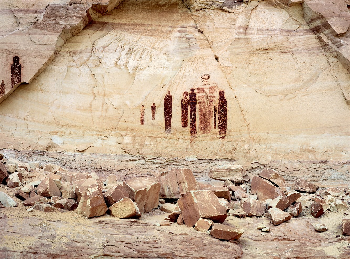
Pictographs, Holy Ghost Panel, Horseshoe Canyon, Utah
Horseshoe Canyon shelters one of North America's most significant rock art sites. Beginning around 8000 BC, hunter-gatherers from the Desert Archaic Period seasonally visited this canyon and created pictographs (paintings on rock walls) between 1000 BC and 1000 AD. Using a mixture of blood, vegetable, and mineral compounds, they depicted hundreds of figures as tall as eight feet and as small as six inches along a 200-foot wall within this secluded gulch of eastern Utah's desert. The people who painted these figures left few other traces of their culture, though their pictographs and petroglyphs (rock carvings) resemble some Aztec and Puebloan iconography.
The Holy Ghost Panel in this photograph portrays ghostly anthropomorphs that suggest a spiritual meaning and are prominently displayed within the canyon. Specifically, those who painted these shamanic-like figures responded to the character of the surface upon which they were rendered. Enclosed by the proscenium arch of the cliff's overhang, the wall was exposed through a rockfall, revealing a smooth, almost luminescent stage-like façade. Anthropologist James Farmer posits that it served as something like a "spiritual membrane or portal through which supernatural entities move between earthly and supernatural realms."
more
Redfish Lake, Sawtooth Mountains, Idaho
Redfish Lake is the headwater of central Idaho’s Salmon River, which flows into the Snake River and continues to the Columbia River and Pacific Ocean. Up until the late 1800s, 4,000 sockeye salmon annually returned to the lake — their birthplace, 900 miles from the ocean — to bear the next generation of sockeye. It is the longest such pilgrimage in North America.
During their run, splashing sockeye used to keep ranchers awake at night. The lake shimmered with their radiant color, transformed from silvery-blue to brilliant red during mating season. And there were so many of them, apocryphal stories recounted walking across the lake on their backs. With no energy remaining after spawning, the sockeye died providing nutrients to the lake, and its forests and animals.
Commercial fishing, mining, logging, and ranching decreased their population, though the biggest impediment to their migration was hydroelectric and irrigation dams. By 1992, around the time this photograph was made, only one salmon – nicknamed “Lonesome Larry” – completed passage. Today, through mitigation efforts, the returning number of these endangered sockeye has begun to increase.
Once wild and colorful with breeding and birthing salmon, on this August morning the lake was mirror-still as fog lifted and dissipated.
more
Grazing Sheep, Green Point, near Rocky Harbour, Newfoundland, Canada
Upon a wind-swept knoll above the fishing outpost of Green Point on Newfoundland’s west coast, graze a hardy strain of sheep first introduced to the island province in the 16th century. Derived from the Border Cheviot breed common to the Scottish and English borderlands, this local stock is shorn and set out to pasture in the spring and their lambs sent to market in November as the blustery winter sets in.
The field of summer forage sits atop a half-billion-year-old, fossil-bearing ledge uplifted from an ancient sea during a time when the European and North American continents began to break apart. Today, Europe has drifted far to the east and Newfoundland and North America’s mainland are now separated by the Gulf of St. Lawrence.
This is at once a solitary and lively place; a lonely corner of the world far from the mass of humanity surrounded by the voices and movements of the relentless wind, sonorous waves, cracking ice and, on this otherwise quiet evening, bleating sheep.
- James Baker
more
Luke, Wainiha Ridge, Kaua'i, Hawaii
Four thousand feet above the Pacific Ocean on the northwestern side of Kaua'i lies a deeply furrowed plateau, the remains of a caldera rimmed by Wainiha Ridge. Lava flows and accumulations of sediment have eroded since Kaua'i’s volcanic origins millions of years ago. In truth, this ridge is nearly 20,000 feet above the ocean floor. A relic of an ancient seamount — the oldest in the Hawaiian island chain — these highlands are covered by a rainforest dense with unique plant species in one of the wettest places on the planet.
On this afternoon, the view looking down onto the pleated cliffs of the verdant Kalalau Valley became increasingly obscured by rising warm, damp air that condensed into a floor of cloud just below the ridge. The ocean’s rich blue bled through the clouds. The sun, filtered by mist, created a nebulous glow tinted by a “glory,” an atmospheric phenomenon much like a rainbow in which water droplets both focus and reflect a spectrum of colorful light.
- James Baker
more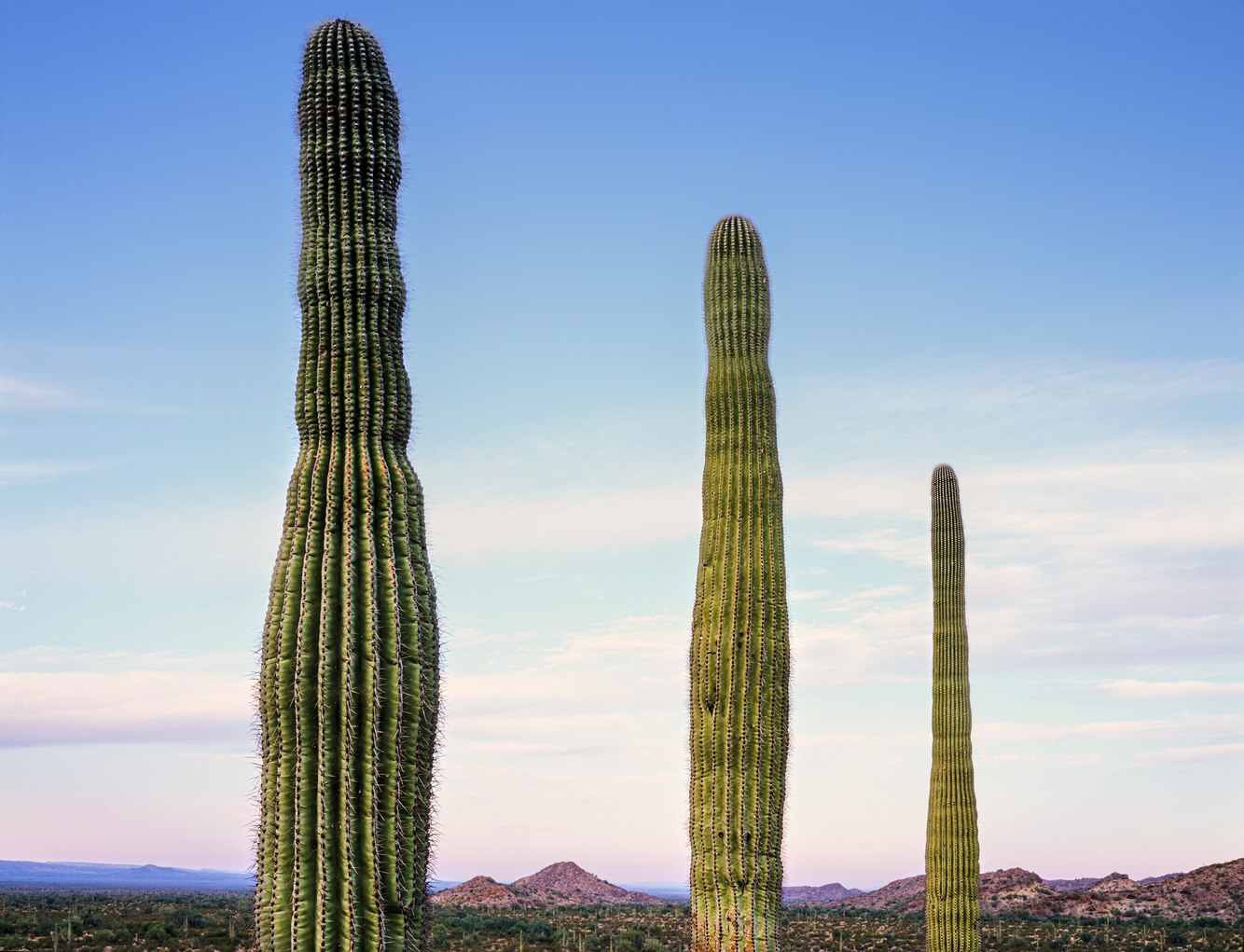
Saguaros, Crater Range, Arizona
Few other plants are so readily identified by place as the saguaro in Arizona’s Sonoran Desert. Though it looks like a tree, it is in fact a cactus. The tallest plant in this desert and largest cactus in the United States, it typically grows to 45 feet and weighs 4000 pounds. Saguaros take a century to mature and after that may live as long as another century.
The cactus’ imposing size, its arms gesturing to the sky, and the fact that it ‘breathes’ water into its accordion-pleated trunk after a downpour, lend it a sentient presence. Saguaros began to populate the Sonoran 8,000 years ago, at a time when the Tohono O’odham People were already settled in this region. Saguaros (Ha:sañ in O’odham) are part of their cultural cosmology, they consider them human, and treat them with the same respect.
Though well-adapted to their habitat, saguaros appear to go through population cycles and may now be near the end of a three-decade period of flourishing. Botanical studies record fewer young saguaros germinating and attribute this to loss of territory due to development, introduction of invasive plants such as the fire-prone buffelgrass and extended droughts accompanied by exceedingly high temperatures.
more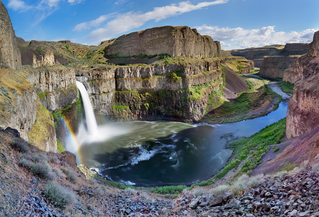
Palouse Falls, Washington
Fifteen thousand years ago, what is now western Montana, lay beneath a 2000-foot-deep lake formed from meltwaters that became impounded after exiting an ice sheet that covered large parts of North America. Twice a century for two millennia, an ice dam formed and then, under building pressure from rising water, periodically ruptured sending cataclysmic floods across parts of Idaho and Washington State into the Columbia River Gorge. Driving across southeastern Washington, I was surprised by an abrupt break in the landscape, verdant grasslands giving way to deeply eroded ‘scablands’ scoured by these ancient floods that washed away soil, created deep-walled canyons and carved a new course for the Palouse River.
The reverberations of crashing water reflect off hardened layers of volcanic rock encircling the falls as it dives into a deep pool. The river then courses through a winding chasm to its confluence with the Snake River. In 2009, Tyler Bradt set a world record for the longest plummet in a kayak. He followed a smooth “tongue” over the fall’s edge, dropped 189 feet into its plunge pool and emerged seconds later suffering only a sore wrist and a snapped oar.
- James Baker
more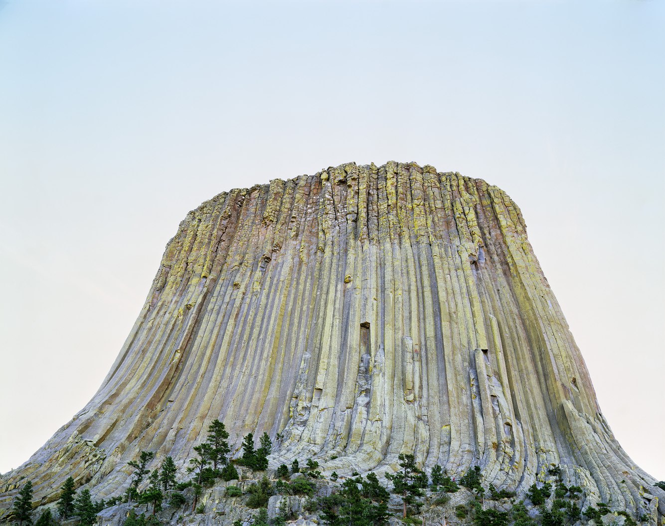
Devils Tower, above the Belle Fourche River, Wyoming
On this early dawn around summer solstice, the sun rose behind the western face of Devils Tower. The architecture of this 1300-foot structure was first formed underground from molten volcanic rock that slowly cooled from liquid into hardened polygonal columns made of rare and exceptionally durable phonolite porphyry. Long buried beneath layers of sedimentary rock, the erosion of the softer sandstone, shale and gypsum around the structure, in time, opened this ancient laccolith to the elements. Exposure to sun and rain fed the growth of lichen, especially the vibrant yellow-green crustose lichen prominently coating its south-facing columns.
Several indigenous tribes honor this place as the setting for creation stories. The Lakota People that lived in this part of eastern Wyoming named the butte ‘Mato Tipila’ (Bear Lodge) and visited here for vision quests, as well as to spend overnight trips, as evidenced by remains of shelters around its base.
More recently it had become part of contemporary mythology serving as the imposing backdrop for Steven Spielberg’s 1977 film “Close Encounters of the Third Kind” and the fictional landing site of, and first contact with extraterrestrials.
more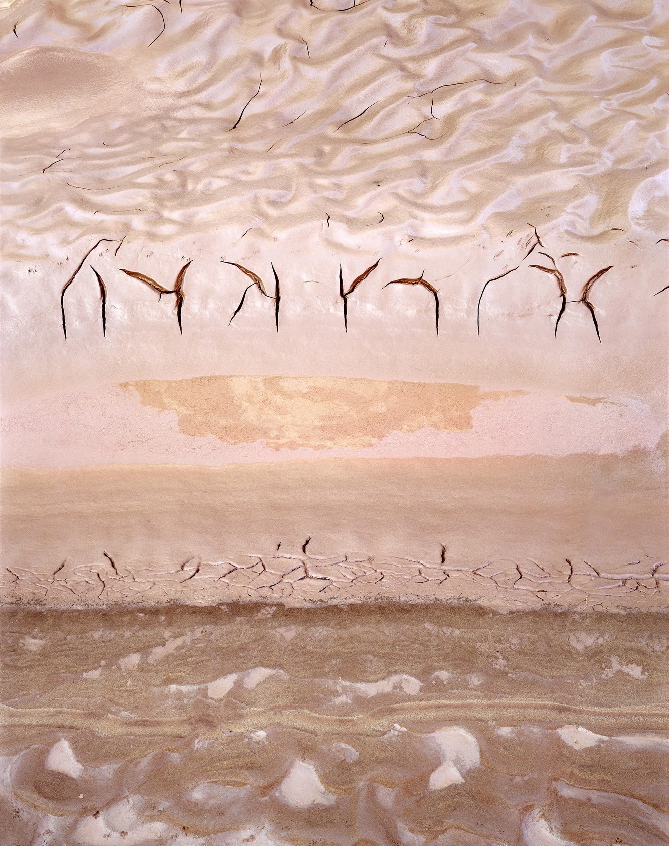
Moonlight Wash, San Juan River, Utah
A couple of days prior to making this photograph, the San Juan River that traverses southern Utah suddenly surged. Its color turned from grey-green to red. The flood’s origin was from northeastern Arizona’s reddish-brown sandstone formations. Beginning as a cloudburst, a dense muddy torrent raced down Chinle Wash entering the San Juan River at its confluence. Later, downstream in the quiet backwater of Moonlight Wash, rippling patterns of mud accumulated beneath the receding swell.
On the morning after the flow subsided, the clay began to contract. The exposed surfaces formed V-shaped cracks that connected to other cracks, assuming shapes that read like incised cryptic letters. In Old English, one meaning for the word ‘runes’ is “secret conversation.” Like runes carved in wood, these cracks cut against the grain — in this case, at a right angle to the river’s course — and strung together an indecipherable message. Dried by the rising sun, later the clay would harden, cracks expand, edges curl and, inevitably, these embossed ‘letters’ would be swept away by the next monsoonal flood.
- James Baker
more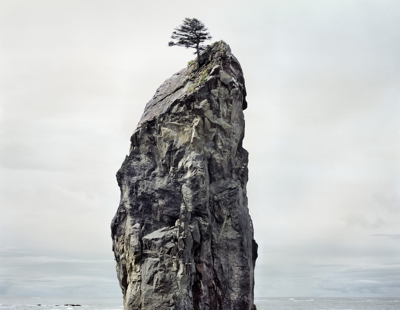
Sitka Spruce, Sea Stack, Rialto Beach, Olympic Peninsula, Washington
A lone Sitka spruce grew atop this sea stack, protected on its windward side by the crest of a 50-foot pillar that is the eroded remains of land uplifted by the movement of tectonic plates. On this spring day along Washington’s northwest shoreline, the earth was quiet and the seas calm; a 314-year reprieve from the most recent of violent earthquakes and tsunamis that shaped this region, and a seasonal break from winter’s heavy surf that annually erodes, and then rebuilds, this stony and driftwood mantled beach.
During the 2015-16 winter – a couple of years after this photograph was made – this coast endured a series of unusually intense storms fueled by a strong El Nino climate pattern. On March 13, 2016, an extratropical cyclone made landfall near Rialto Beach accompanied by 80-mile-per-hour gusts and 20-foot swells. Soon afterward, this ancient column was found toppled. An Olympic National Park physical scientist observed, “The coast is a constantly changing landscape. In contrast, the sea stacks are some of the few static features that don’t really change. This is the first time I’ve ever seen one entirely collapse.”
- James Baker
more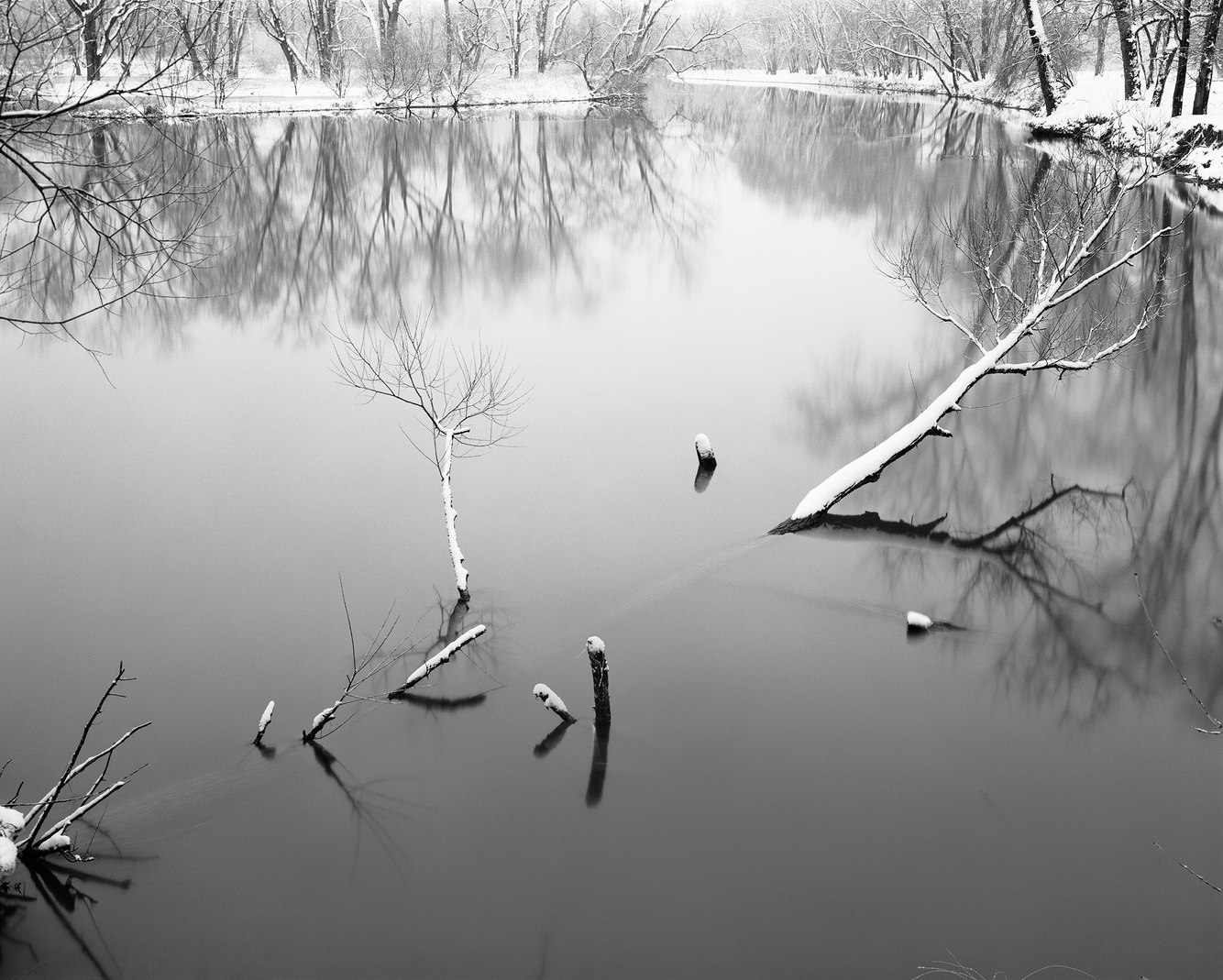
French Creek, near Cambridge Springs, Pennsylvania
Prior to the last ice age, French Creek flowed north to Lake Erie and then to the Atlantic Ocean. Later, retreating glaciers deposited a thick layer of rock debris in the northwestern corner of Pennsylvania. Its terminal moraine blocked the creek and forced it to reverse course and flow south joining the Allegheny River, which runs into the Ohio and then Mississippi River, eventually draining into the Gulf of Mexico. The creek remains one of the most ecologically healthy and biologically diverse waterways in the United States.
Named by George Washington in 1753 in recognition of early French voyageurs who canoed the river for the fur trade, French Creek meandered past the village of Deadwater. Aptly titled on maps for the creek’s slow current through this section of its course, the settlement was later renamed Cambridge Springs as it transformed into a destination for those attracted to the supposed curative powers of its mineral rich spring waters. Adjacent to the ruins of the last remaining resort, the riverbend caused a back eddy that ensnared the trunk of a fallen tree under its cut bank.
- James Baker
more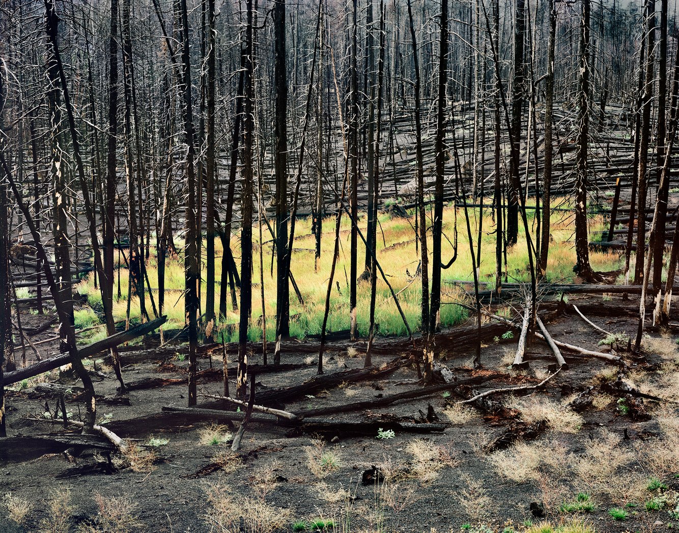
Two Years after The Fire, Yellowstone National Park, Wyoming
In 1988, a wet spring was followed by a drought that led to the driest summer in the history of Yellowstone National Park. Fueled by dry tinder, lighting, strong winds, and, to a lesser extent, the activities of outfitters and woodcutters, over 50 separate fires merged to create an out-of-control conflagration that burned 800,000 acres of the northwestern corner of Wyoming.
Dozens of elk and other animals were consumed by fire, as was the mature-growth stands of 200-year-old lodgepole pine. Ultimately, few other plants species were affected, their tops burned, but not their roots, so that throughout most of the park regeneration occurred quickly.
The North Fork fire was the largest, located in the western part of the park where this photograph was made two years later. The oval of new-grown grass — changing its seasonal hue in September 1990 – looks as though the ground is still ablaze. Beyond this circle — and judging by the paucity of plant life -- most of the barren ground must have been deeply seared by the fire’s intensity, killing the organic material necessary to quickly support new plant life.
more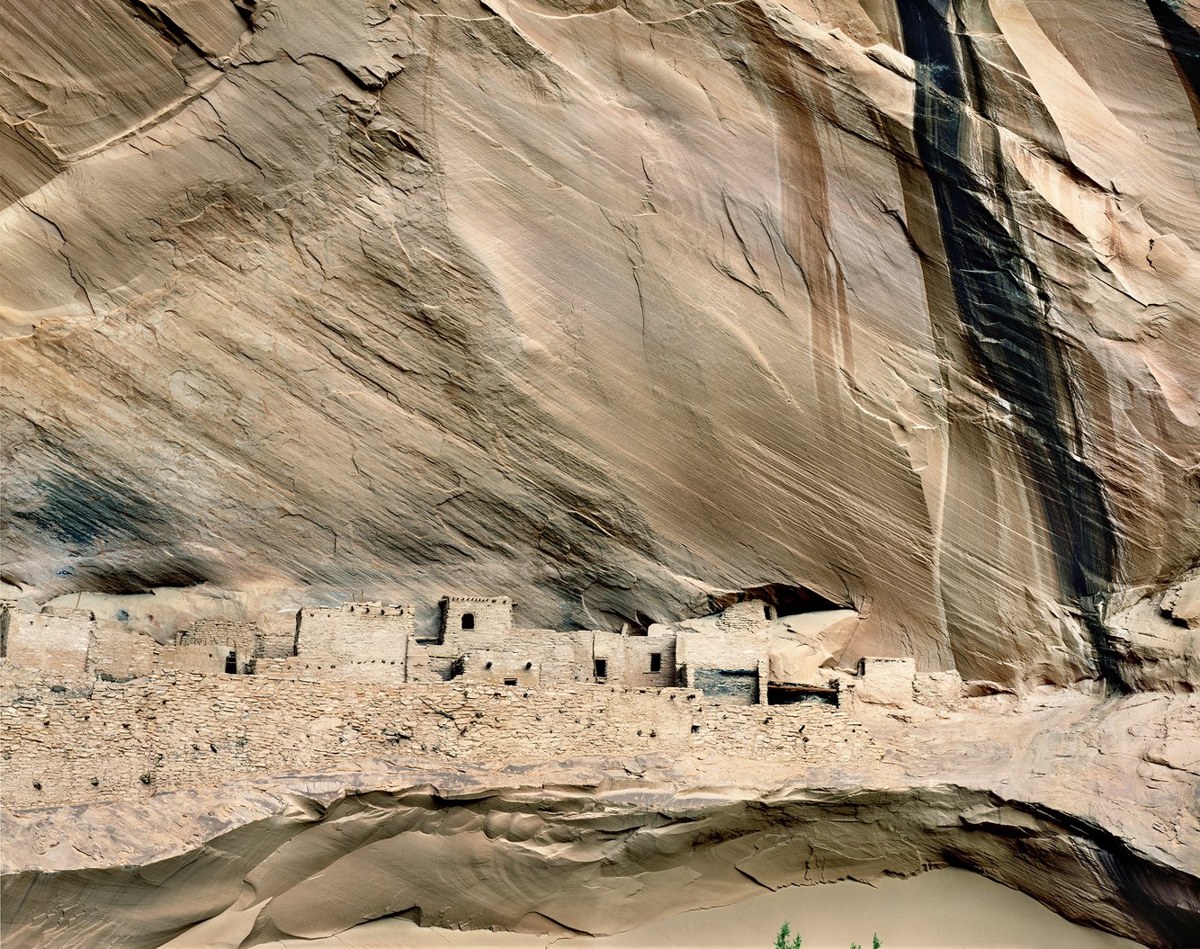
Kiet Siel, Tsegi Canyon, Arizona
Concealed deep within the canyons of northern Arizona are the remains of well-preserved dwellings sheltered beneath an overhanging cliff of Navajo Sandstone. Over the period it was inhabited, 150 living spaces and granaries were built on a ledge high above the canyon floor, securing the community from enemies and inclement weather. At first glance, it’s difficult to distinguish the village from the alcove within which it sits; its well-disguised structures assembled from the same rock.
The Navajo called it Kiet Siel, which translates into “broken pottery scattered around.” The Hopi named it Kawestima; a sacred shrine for prayer offerings made for the spiritual world beyond. First occupied around 1250, over time it appears different groups of inhabitants occupied the cave’s site, as it contains more variation in room design and construction and more kivas than most U.S. southwestern cliff dwellings. Eventually, overcrowding, drought, and depletion of the soil from growing maize may have contributed to the departure of the Ancestral Puebloans. By 1320, the site was abandoned and today it remains a haunting and beautiful place.
- James Baker
more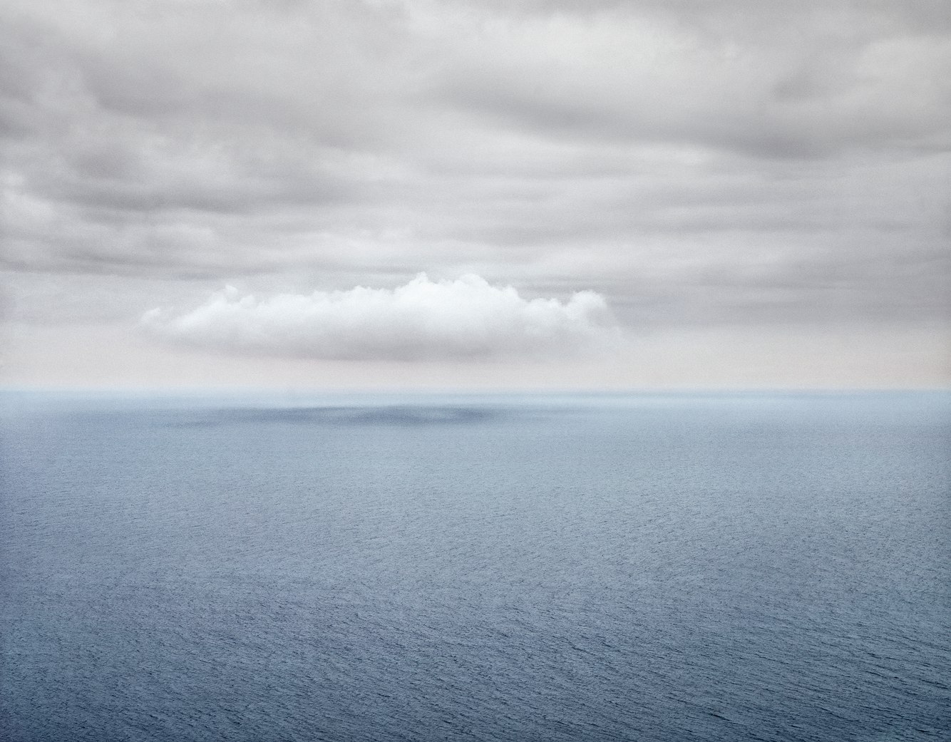
Gulf of St Lawrence from Cap Rouge, Cape Breton Island, Canada
Along Nova Scotia’s northwest coast, the steep slopes of Cap-Rouge’s French Mountain meet the southern shore of the Gulf of St. Lawrence. An extension of the Appalachian Mountain chain; Cape Breton’s tablelands are built upon the most ancient known rocks in Canada’s Maritime Provinces.
Skirting its coastline, in 1932 the once rocky Cabot Trail was replaced by a paved scenic highway encircling the cape. Beginning in the early 19th century the “old road” had connected Acadian fishing villages whose families, by 1940, had their homes expropriated with the development of Cape Breton Highlands National Park. This view, from the highway’s ‘look-off’ above ruins of the former settlement, surveys a vast seascape, absent of once numerous inshore fishing dories harvesting cod.
As the outlet for North America’s Great Lakes, the gulf is an estuary of the St. Lawrence River feeding into the Atlantic Ocean. This enclosed sea is less turbulent and, during the summer, milder than the open ocean into which it flows. Every so often, on balmy afternoons, stratocumulus clouds form and drift along the remote coast casting shadows on the sea’s tapestried surface.
- James Baker
more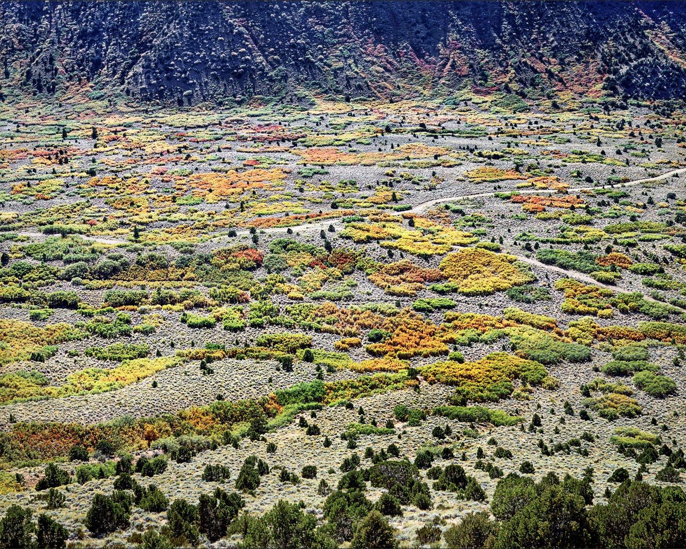
Scrub Oak and Piñon, Castle Valley, Utah
During late September, as nights lengthen and scrub oaks lose their chlorophyll, their leaves turn to rich hues of yellow, red and brown lending a surreal aspect to this austere desert. Cradled within the northern slopes of Utah’s rugged La Sal Mountains, Castle Valley is an unexpectedly level basin. Three hundred million years ago, this place was along a shoreline that built up thick layers of salt later buried beneath heavy deposits of sediment. Subsequently, the region rose, becoming a mountainous plateau. Under pressure, the subterranean salt layers flowed and dissolved collapsing the overlying strata into this flat, tilted valley.
Until the late 19th century, the Ute peoples migrated with the seasons through this valley living off its plants and animals. As settlers turned this wilderness into ranch land, the inability of the Utes to freely migrate culminated in the Pinhook Draw Fight on June 15, 1881. The landscape shown in this photograph was the battleground upon which dozens died. At the end of that day, a survivor recalled the setting sun as “a lurid red… and beneath that gory pall, lay the forms of our friends [that] held the soul in a thralldom of solemnity."
- James Baker
more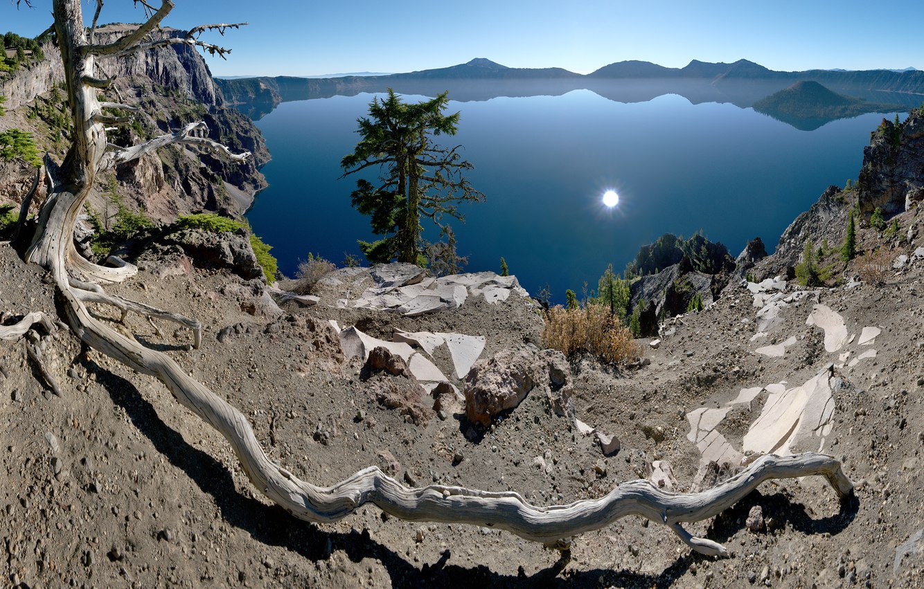
Whitebark Pine Root, Merriam Point, Crater Lake, Oregon
Seven thousand, seven hundred years ago, southwestern Oregon’s 11,000-foot Mt. Mazama erupted. Legends from the Klamath people carry first-hand accounts of the collapse of the mountain, laying waste to much of the surrounding area, depositing a deep layer of volcanic ash and, in its aftermath, creating within its volcanic caldera a 2000-foot-deep lake of pristine clarity. In this early morning of late fall, the low morning sun reflects off the clear, calm lake. Sitting on the crater’s rim a thousand feet above the lake, a dead Whitebark Pine rests precariously atop a volcanic rock ledge with its extended and exposed root providing balance. This endangered species formerly thrived at high altitudes such as the sub-arctic climate of Crater Lake’s 7,000-foot elevation, and in fact is the highest altitude pine of the Cascade Mountain Range. Though, like other victims of its species, through invasive attacks by pine bark beetles, circulation of nutrients was disrupted, and the insects’ boreholes introduced a deadly pathogenic fungus to this tree leaving only its skeleton.
- James Baker
more