
Tectonic forces beneath the Earth's crust shaped the corrugated topography of the Intermountain West from Mexico to Oregon. Uplift and subsidence folded the land, fracturing the crust and creating alternating mountain ranges and basins, including Nevada's Black Rock Desert.
This basin contains silts and clays deposited by Lake Lahontan, which once covered much of Nevada. The lake reached its largest extent 12,700 years ago near the end of the last Ice Age, with its shoreline standing five hundred feet above the current surface of the desert. Over time, it gradually vanished as a warming climate reduced its size. Eventually, the lake evaporated into a flat plain. Bone dry most of the year, during winter and spring, rain and snowfall sometimes coat its surface with a thin layer of water teeming with fairy shrimp, providing habitat for migratory birds and making it impossible to cross on foot or by vehicle.
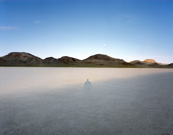
I took this photograph in a small playa separated from the surrounding desert by the Black Rock Range. As the late-day shadow lengthened from the elevated rim on the western edge of this one-square-mile desert bed, it stretched until it intersected with my spectral shadow. Surprised, I marked the spot, recorded the time, returned the following evening, set up my camera, and exposed the film when our shadows overlapped again. Two meditative figures wandering along the far edge of the playa below the rising moon offset the scene's symmetry. In the early evening, everything seemed to move slowly – the air, the sun, the moon, the drifting people; all except the shadows, which raced across the silent desert floor.