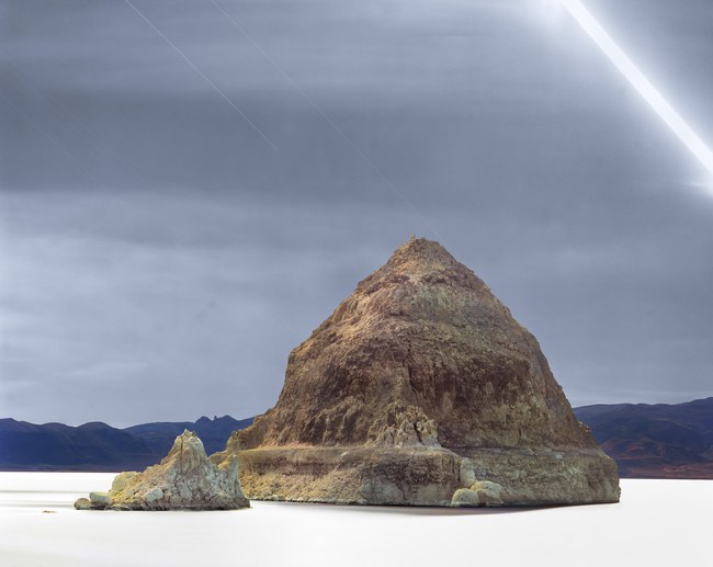
The moon arched across the night sky, and from its sweeping light, this six-hour film exposure rendered a soft glow to the island and lake. The Northern Paiute call the island "Wono" – the name for their woven cone-shaped baskets. In 1843, government expedition leader John Fremont gave the island and the lake their current names when he wrote in his diary, "We encamped on the shore, opposite a very remarkable rock in the lake … from the point we viewed it, presented a pretty exact outline of the great [Egyptian] pyramid of Cheops." This photograph was taken from the same beach 150 years later.
Western Nevada's deeply folded topography collects rainfall and mountain runoff in basins to soak into its clay or evaporate. Over millennia, this once moist, cool basin and range country became a vast desert of saltpans and remnant bodies of water such as Pyramid Lake that, unable to empty into the ocean, have become increasingly saline.
Though the form of the island is like an Egyptian pyramid and a Paiute basket, a closer analogy might be to a volcanic cone. While molten lava created volcanoes, a freshwater hot spring beneath the lake formed this cone. Twelve thousand years ago, its surging flow chemically interacted with the salty, alkaline lake water to build a tufa mound. The top of The Pyramid corresponds to the former lake's highest elevation, and in today's drier, warmer climate, it has emerged as a 300-foot-high island.
- James Baker

