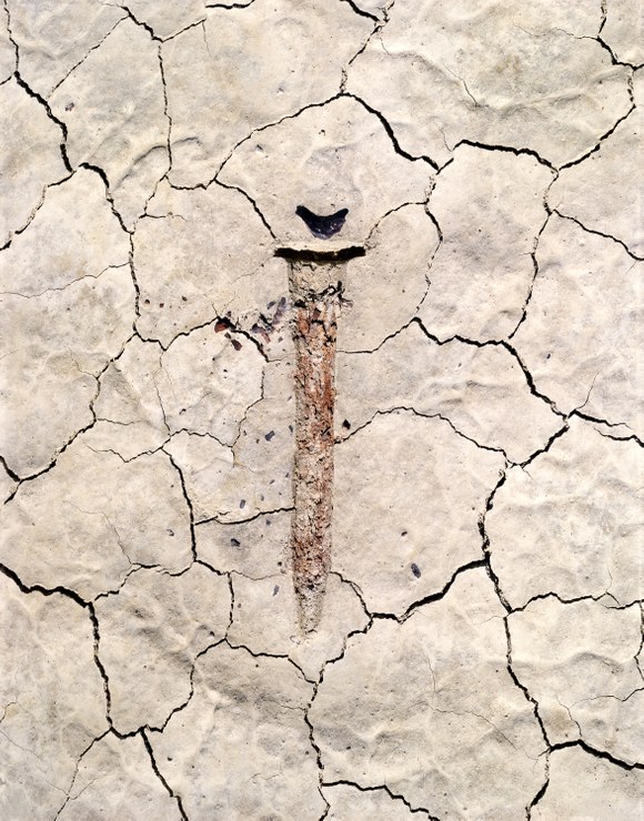
In Nevada's Basin and Range country, rain does not flow into rivers that eventually empty into the sea. Instead, it collects and evaporates at the bottom of desert basins, like the Black Rock Desert, a vast playa encompassing the state's northwest corner. After winter's snow and rain, the desert plain's clay surface expands; then, as it dries, it contracts, forming V-shaped polygonal mud cracks.
Driving across the playa, I entered a hallucinogenic landscape charged by a lakebed so radiant that it made me squint in the desert's brilliant sunlight. The cream-colored, cracked ground contrasted with the flat, blank, and richly blue sky. Intersecting the sky and ground, dust devils shimmied and lurked along the rim of the expansive, ancient lakebed.
On numerous occasions, this surface was so flat that I took time to close my eyes and walk, not worried about stumbling over any obstacles. I listened to the muted sound of flowing air, felt the soft clay under my feet, and smelled the faint scent of a nearby sulfurous hot spring. When I opened my eyes and examined the ground, I found relics half-buried in the flaking earth: leftover pieces of a Scrabble game, an abandoned bicycle, a rusted stake.
Lifting the latter, a survey boundary marker, from the playa floor, I photographed the embossed form it left in the dried and hardened ground. The marker had likely been transported by a seasonal stream and had come to rest not far from where it marked the proposed boundary of a wilderness study area. Above the removed spike's imprint sat a small, dark stone that, together with its shadow, suggested the shape of a perched bird.
Location research and commentary by James Baker.

