Hundreds of millions of years ago, sediment collected in an alluvial plain formed along the seam between the North American and African continents, which cemented into sandstone and shale. Later, the region rose to become the Appalachian Mountains. As the range uplifted, the rock cracked, creating a break – the Delaware Water Gap – through which the Delaware River carved its course to the ocean.
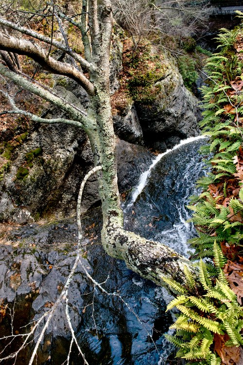
This photograph was taken at the top of the 130-foot-high Dingman Falls, where a small birch straddles the lip over which the river tumbles down the eastern escarpment of the Appalachians. Dingmans Creek was once flooded by cascading meltwater from ice-age glaciers, leaving steep, shaded slopes and a moist, sheltered valley shielded from summer’s direct sun. Today, this low-light, high-humidity microclimate supports a variety of unusual plant life, including 140 species of native wildflowers.
The area was first settled by the Lenape Indians, and the creek and falls derived their names from Andrew Dingman, a Dutchman who settled here in 1735. Soon afterward, several gristmills and sawmills sprang up along Dingmans Creek. Eventually, treaties crafted by the debt-ridden sons of William Penn (after whom the state was named) took the land from the Lenape. After a period of violence, they were driven from the area to settle in Oklahoma and Ontario, Canada. Today, the land – reestablished as a wilderness – is preserved as part of a National Park Recreation Area. Its proximity to the most populated parts of the U.S. eastern seaboard makes this a place of unexpected tranquility and solitude.
Location research and commentary by James Baker.

