
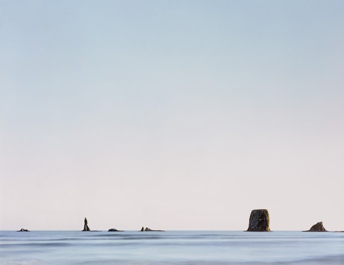
The Pacific Northwest coast is fringed by reefs, shoals, and small islands or rock columns that run parallel to its shores, from the tide line of its sandy beaches and promontories, to miles offshore. Known as "sea stacks," they are the remains of headlands formed by the continued uplift of the coastline due to the collision of the Pacific and North American tectonic plates.
Following the last ice age, as sea levels rose faster than the land, tides and waves eroded the coast, pushing the shoreline east by several miles and leaving behind these remnants. A line of sea stacks, seen half a mile offshore from Second Beach on Washington’s mid-coast, rests on a marine terrace just below the high-tide level, which skirts and connects the bases of these stacks.
On my first hike down to this beach 40 years ago, I looked out across a summertime sea, quiet in this season of calm waters. The gentle pulse of the waves reminded me that we’ve inherited the name of this body of water from explorer Ferdinand Magellan, whose ships entered Mar Pacifico (peaceful seas) in 1519 as they rounded the southern tip of South America, leaving behind the stormy Atlantic Ocean.
Around these sea stacks, waves crash, and currents swirl sea foam into lacy tracery. Among their cliffs and atop their capstones, birds nest, drawn by their isolation and safety, where the stacks serve as a way station on their migrations. To the left in this photograph is a narrow, pointed column — a “needle” — from which these stacks derive their name. The Quileute people know the largest islet on the left as Dhuo-Yuat-Zach-Tah, meaning “Bird Rock.”